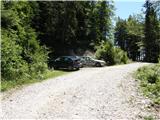
Starting point: Urbas (1280 m)
Starting point Lat/Lon: 46.4344°N 14.134°E 
Time of walking: 3 h 15 min
Difficulty: easy unmarked way
Difficulty of skiing: no data
Altitude difference: 956 m
Altitude difference (by path): 1000 m
Map: Karavanke - osrednji del 1:50.000
Access to starting point:
From highway Ljubljana - Jesenice we go to the exit Lesce and follow the road ahead in the direction of Žirovnica and Jesenice. After few km of driving, we will get to a crossroad, where the road in Žirovnica and Moste branches off to the right (from the direction of Jesenice left). Only few meters ahead in the next crossroad, we turn left in Moste (right Žirovnica). Further, we drive past a monument to fallen soldiers, where the road starts ascending on a hill below the railway track. On top of the slope, we turn right (at the sign Vila Karin), and then drive towards the lake Završniško jezero and Valvasorjev dom. The road then flattens and it brings us to a crossroad, where the road to Valvasorjeve dom branches off to the left. We go on the mentioned road (straight mountain hut Koča pri izviru Završnice), that starts at first gently, and then steeper and steeper ascending on an occasionally quite rough road (the most steep parts are paved with asphalt). Higher, the road brings us to a little bigger crossroad, where we continue left in the direction of Potoška planina (right Doslovška planina). The road then flattens and a little further brings us to the next crossing, where a road towards the mountain hut Valvasorjev dom branches off to the right, and we continue on the left bottom road which then for quite some time continues without large changes in altitude. The road then leads us past a turn-off of the path on Ajdna and then starts ascending steeper on an occasionally quite rough road. The road then again flattens and past the mountain pasture Potoška planina brings us to a well Urbas, near of which is few smaller parking spots.
From Moste to the starting point, there is approximately 10 km of driving.
Path description:
From the parking lot, we at first walk to a well Urbas, and here we notice a mountain sign for mountain pasture Belščica, which points us on at first a little harder to follow footpath. First 15 minutes of walking, the path only gently, and then it starts to ascend steeply through the forest. Higher the forest is becoming thinner and slowly passes into a lane of dwarf pines, and the path starts turning more and more towards the west. After a good hour of walking, we step on grassy slopes and the path after few additional strides, it brings us to bivouac on Belščica (emergency bivouac).
From the bivouac, we continue forward towards the north and already after few steps we notice a little poorly visible footpath which goes sharply right (direction east). Further, we are ascending on the mentioned footpath which is ascending diagonally over occasionally little steeper slopes. The path which crosses two more distinct gullies higher brings us on a marked path, which we follow to the right. Already after few steps of walking on a marked path, the path to Vajnež branches off to the left (20 minutes), and we continue straight on the path which slightly turns to the right and after few steps of descent brings us in a small valley between Vajnež and Potoški Stol (near the saddle Vajneževo sedlo). The path mentioned small valley only crosses and then steeply ascends towards the ridge of Potoški Stol. On a wide grassy ridge we continue left and for some time we are slightly ascending on it. The path then brings us to a cross below Potoški Stol.
Here we at first descend a little and then we cross steep slopes on the south side of the ridge. We still cross a slope towards the east and the path brings us to a crossing in front of a valley between Mali and Veliki Stol. We continue slightly left and start ascending through the mentioned valley upwards all the way to a crossing on the saddle between the both peaks. On the saddle, we continue left (right mountain hut Prešernova koča 5 minutes) in the direction of Stol which we reach after 10 minutes of additional walking.
Pictures:
 1
1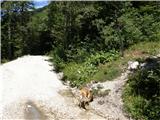 2
2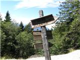 3
3 4
4 5
5 6
6 7
7 8
8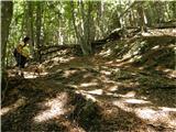 9
9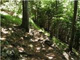 10
10 11
11 12
12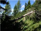 13
13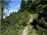 14
14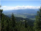 15
15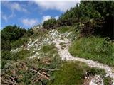 16
16 17
17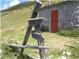 18
18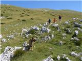 19
19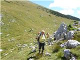 20
20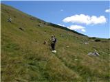 21
21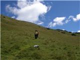 22
22 23
23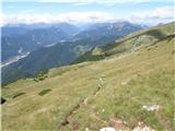 24
24 25
25 26
26 27
27 28
28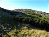 29
29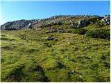 30
30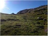 31
31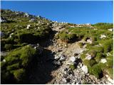 32
32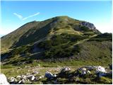 33
33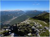 34
34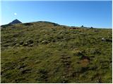 35
35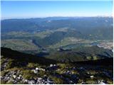 36
36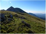 37
37 38
38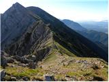 39
39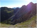 40
40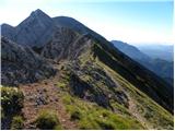 41
41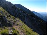 42
42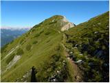 43
43 44
44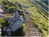 45
45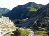 46
46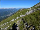 47
47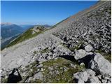 48
48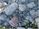 49
49 50
50 51
51 52
52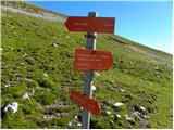 53
53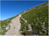 54
54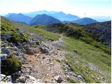 55
55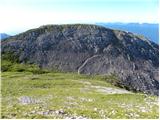 56
56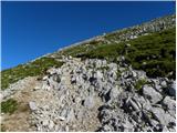 57
57 58
58 59
59