Uskovnica (Lom) - Tosc (via planina Spodnji Tosc)
Starting point: Uskovnica (Lom) (1076 m)
Starting point Lat/Lon: 46.3133°N 13.9054°E 
Path name: via planina Spodnji Tosc
Time of walking: 4 h 20 min
Difficulty: difficult marked way, easy unmarked way
Difficulty of skiing: no data
Altitude difference: 1199 m
Altitude difference (by path): 1340 m
Map:
Access to starting point:
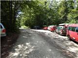
From highway Ljubljana - Jesenice we go to the exit Lesce and follow the road towards Bled and forward towards Bohinjska Bistrica. Only a little before Bohinjska Bistrica, at settlement Bitnje, we continue sharply right in the direction of Pokljuka. After a short ascent the road flattens and it quickly brings us into a valley Zgornja Bohinjska dolina. Here at the crossroad we continue left (right Pokljuka) and follow a road ahead to Srednja vas. Here in the second part of the village we notice signs for Uskovnica (7 km), which point us to the right on narrower, at first still asphalt road. The road that is most of the time ascending, we then follow to a parking lot "Lom", where there is a sign which is prohibiting further driving (further driving is allowed only to landowners).
Path description:
From the parking lot, we continue in the direction of the mountain hut Koča na Uskovnici, on the road, on which we quickly come out of the forest, where we notice signs for cheese, milk and homemade products. Some 10 meters ahead from the road short path which leads to the near cheese cottage pr Ulčnek branches off to the left, where we can in grazing season buy previously mentioned products, otherwise we continue straight to few steps distant marked crossing, where we continue right in the direction of Koča na Uskovnici. The path ahead at first leads past a religious symbol (cross), and then continues among pastures. When on the right side pastures ends, from the right marked path from Srednja vas joins (path "Za Ribnico").
We continue straight, and then past a holiday cottages we get to trough with a water and few steps ahead to the spot, where signs for already known mountain hut point us to the left on a cart track. Next follows a short ascent on a cart track and the path brings us to the mountain hut Koča na Uskovnici.
From the mountain hut, we continue in the direction of Tosc, Draški vrh, Viševnik, Vodnikov dom, Rudno polje and Praprotnica on the path which at first crosses a grazing fence, and then it quickly joins the macadam road which we follow to the right. The road then leads us between mogul meadows, and then after the crossing of the next fence we quickly get to a crossroad at the chapel of Mary Queen of Peace on Uskovnica.
Behind the chapel, we continue left (straight mountain pasture Konjščica, right Rudno polje) on a gentle road which leads us through a large meadows of Uskovnica, and then the path brings us to the edge of the forest, where it starts changing to at first a wide cart track. Cart track, which further starts moderately ascending has some crossings, we follow it in the direction of Vodnikov dom and Triglav. Higher the cart track which in the most part run through the forest changes into a footpath, and which quickly brings us to a pleasant well. At the well we continue straight (right hunting cottage) and we continue the ascent on a gently sloping path, that a little further brings us on steep slopes. Soon after we got to the steep slopes at the crossing through a steep gully we have fixed safety gear for help. The path ahead continues on a relatively steep and mainly in wet for slipping dangerous slopes. During the crossing of the steep slopes, the path several times for a short time steeply ascends and then descends again. In the last part of the crossing we stride across some very steep gullies, through which leads in parts entirely wrecked path (great risk of slipping). Crossing ends at bigger torrent (usually a well) after which we step on a softer grassy terrain.
Few minutes of easy walking follows and the path brings us to an abandoned mountain pasture Spodnji Tosc. The path ahead starts moderately ascending and it soon brings us to a smaller crossing, where we continue sharply right (straight old, partly abandoned path) on easy to follow path. The path ahead starts ascending steeper and steeper and it quickly brings us from a lane of thin forest into dwarf pines, where it starts turning more and more to the left. The path soon flattens and from dwarf pines brings us on grassy slopes, through which in few minutes of additional walking, we ascend to the path Pokljuka - Triglav.
We follow the mentioned path to the right and only after few steps it brings us to the spot where the path on Tosc branches off to the left. We continue in the direction of Tosc (turn-off is marked) on unmarked, but easy to follow path which starts ascending steeper and steeper over grassy slopes of Tosc. Increasingly steep path is slowly turning a little towards the right, and then turns sharply to the left and almost entirely flattens. Next follows traversing of short steep slope, and then the path brings us on less steep slopes, where it starts gradually vanishing. A poorly visible footpath then turns slightly to the right and starts ascending a little steeper. After few minutes of the ascent, we step on an indistinct Mali Tosc, from which a view opens up on Tosc. Next follows a short descent and the path past a bigger sinkhole, which we bypass on the right side brings us by the upper foot of Tosc. The path ahead moderately ascends over a pleasant grassy slope and after few minutes of additional walking brings us to the summit of Tosc.
Orientation in fog is difficult in the last part.
Pictures:
 1
1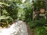 2
2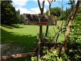 3
3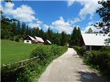 4
4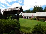 5
5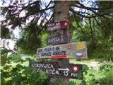 6
6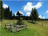 7
7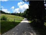 8
8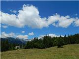 9
9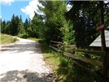 10
10 11
11 12
12 13
13 14
14 15
15 16
16 17
17 18
18 19
19 20
20 21
21 22
22 23
23 24
24 25
25 26
26 27
27 28
28 29
29 30
30 31
31 32
32 33
33 34
34 35
35 36
36 37
37 38
38 39
39 40
40 41
41 42
42 43
43 44
44 45
45 46
46 47
47 48
48 49
49 50
50 51
51 52
52 53
53 54
54 55
55 56
56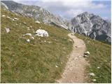 57
57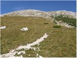 58
58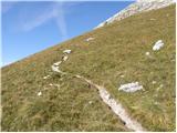 59
59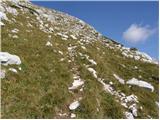 60
60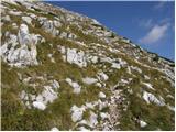 61
61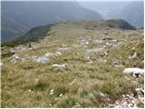 62
62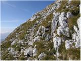 63
63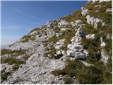 64
64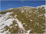 65
65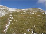 66
66 67
67 68
68 69
69 70
70 71
71 72
72 73
73 74
74 75
75 76
76 77
77 78
78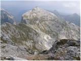 79
79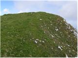 80
80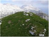 81
81