Uskovnica (Razpotje) - Planina Konjščica
Starting point: Uskovnica (Razpotje) (1215 m)
Starting point Lat/Lon: 46.3267°N 13.9107°E 
Time of walking: 1 h 5 min
Difficulty: easy marked way
Difficulty of skiing: no data
Altitude difference: 223 m
Altitude difference (by path): 275 m
Map: TNP 1:50.000
Access to starting point:
From highway Ljubljana - Jesenice we go to the exit Lesce and follow the road ahead towards Bled. In Bled at the traffic lights, the signs for Pokljuka point us to the right. Ahead we drive through Gorje and past the abandoned ski slope Zatrnik to Rudno polje on Pokljuka (large parking lot, barracks and shooting range). From here we continue straight on a macadam road which a little further brings us to a crossroad, where we continue left in the direction of Uskovnica (right mountain pasture Konjščica). From here we drive a good 500 meters to a parking lot above Uskovnica. This area is called Razpotje.
Path description:
From the parking lot by the crossroad, we continue on for public traffic closed macadam road in the direction of Uskovnica. The road immediately starts quite steep descending and it quickly brings us to a bridge over Ribnica (Ribnica is a stream, which separates Uskovnica from Pokljuka). Behind the bridge road turns sharply left and then in a gentle descent crosses the slopes above the right bank of Ribnica. Some 10 meters further we get to a smaller crossroad, where we continue sharply right in the direction of the mountain pasture Planina Konjščica. (straight Uskovnica). The path ahead at first moderately ascends by the pasture, after that for few minutes it entirely flattens. When the worse road again starts ascending, from the left joins the path from the chapel on Uskovnica (crossing isn't specifically marked), and we continue right.
A little further a nice view opens up towards Viševnik, and the cart track is then for some time ascending diagonally, mostly through the forest. Higher, we cross a grazing fence and the path brings us on the southwest edge of the mountain pasture Planina Konjščica.. Here the path which was occasionally again a little steeper entirely flattens and leads us diagonally through mountain pasture. During the crossing we stride across some smaller streams, after that behind a smaller cross we also cross a little bigger stream and behind it in few steps we reach cheese cottage on the mountain pasture Konjščica, where in grazing season it is possible to buy some milk products.
Trip can be extended to: Planina pod Mišelj vrhom
,
Velo polje
,
Vodnikov dom
,
Studorski preval
,
Ablanca
,
Jezerski Stog
,
Viševnik
,
Prevalski Stog
,
Mali Draški vrh
,
Koča na Doliču
,
Vernar
,
Veliki Draški vrh
,
Tosc
,
Vrh Snežne konte
,
Šmarjetna glava
,
Dom Planika
,
Visoka Vrbanova špica
,
Begunjski vrh
,
Triglavski dom na Kredarici
,
Rjavina
,
Triglav
Pictures:
 1
1 2
2 3
3 4
4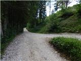 5
5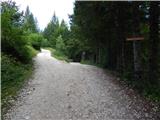 6
6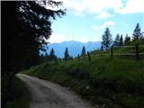 7
7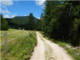 8
8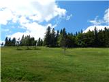 9
9 10
10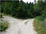 11
11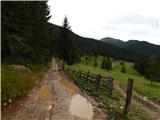 12
12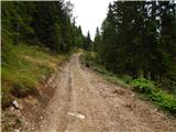 13
13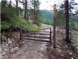 14
14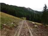 15
15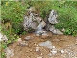 16
16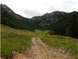 17
17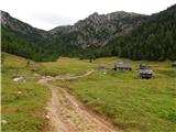 18
18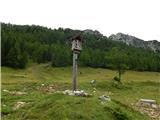 19
19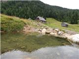 20
20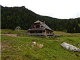 21
21