V Koncu - Dolgi hrbet (via Kokrsko sedlo)
Starting point: V Koncu (900 m)
Starting point Lat/Lon: 46.342°N 14.5682°E 
Path name: via Kokrsko sedlo
Time of walking: 5 h
Difficulty: very difficult marked way
Difficulty of skiing: very demanding
Altitude difference: 1573 m
Altitude difference (by path): 1700 m
Map: Kamniške in Savinjske Alpe 1:50.000
Access to starting point:
We drive to Kamnik and follow the road ahead towards the valley of Kamniška Bistrica. From the hut in Kamniška Bistrica we continue driving on the forest road which higher brings us to a crossroad, where we continue straight (right Jermanca, starting point for saddle Kamniško sedlo). The road then past the boulder Žagana peč brings us to the parking lot at the bottom cargo cableway station to a saddle Kokrsko sedlo.
Driving from the mountain hut in Kamniška Bistrica to the parking lot V Koncu is now forbidden (traffic sign), this extends the path for a little less than an hour.
Path description:
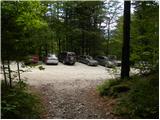
From the parking lot at the cargo cableway we go on a footpath in the direction of Kokrsko sedlo and Grintovec. The path which runs through the forest is at first only gently ascending, but this part of the path is short. Already after few minutes of walking, the path starts ascending steeply and a little higher we have fixed safety gear for help, which come in handy when the ground is wet and slippery (when dry undemanding). Well visible and still steep path higher starts turning a little towards the right. For a short time the ascent becomes less steep and the path brings us out of the forest on avalanche slopes below Kokrsko sedlo. Here the path becomes steep again and with increasingly beautiful views (those are most beautiful on peaks above the valley of Kamniška Bistrica) it is ascending by the foot of the walls of Kalška gora and Mali vrh. Easy to follow, but because of a lot of stones (slightly overgrown scree) strenuous path, after a good 2 hours of walking, it brings us to a saddle Kokrsko sedlo, where there stands a mountain hut Cojzova koča.
From the saddle, we continue right in the direction of Grintovec, Kočna and Skuta. The path immediately above the saddle steeply ascends and a little higher brings us to a crossing, where a path towards the bivouac Bivak pod Grintovcem and Skuta branches off to the right (straight Grintovec over Streha and Kočna). We go on this at first a little poorly visible footpath which in a moderate ascent brings us to scenic passage over Mala vratca. After the narrow passage Mala vratca, the path starts descending on a steep and occasionally slightly exposed slope. By the end of the descent, which takes approximately 100 altitude meters there are some iron spikes for help. Next follows crossing of the gully and then ascent on high mountain terrain to bivouac below Grintovec.
From the bivouac, we continue on a marked path, which quickly brings us to a crossing. We continue straight in the direction of Skuta and Grintovec (right saddle Kamniško sedlo, Rinke and Turska gora) on a relatively gently sloping path, which soon brings us to the next crossing. We again continue on the left path (right Skuta), which then leads us over karst terrain full of limestone pavements and abysses. Further, we carefully follow the blazes, which after a short ascent take us to a saddle Mlinarsko sedlo, where joins the path from Jezersko. Here we are at the crossing, where we go right in the direction of Dolgi hrbet and Skuta (left Grintovec). From here ahead we have to the top of Dolgi hrbet only good 30 minutes of a secured climbing path. At first the path leads us on the southern slopes of Dolgi hrbet, but with the help of numerous fixed safety gear the path quickly brings us on a ridge again. Next we walk on the ridge, in parts path runs above 1000 meter precipices. This path, which is in wet dangerous for slipping soon brings us to the summit of Dolgi hrbet.
V Koncu - Cojzova koča 2:15, Cojzova koča - Bivak pod Grintovcem 1:15, Bivak pod Grintovcem - Dolgi hrbet 1:30.
Pictures:
 1
1 2
2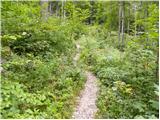 3
3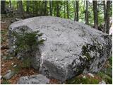 4
4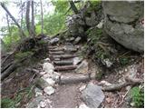 5
5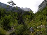 6
6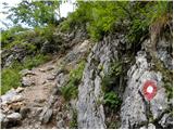 7
7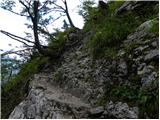 8
8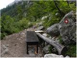 9
9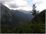 10
10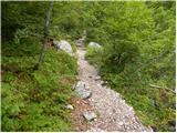 11
11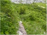 12
12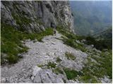 13
13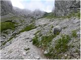 14
14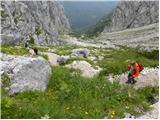 15
15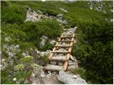 16
16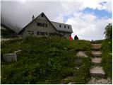 17
17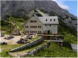 18
18 19
19 20
20 21
21 22
22 23
23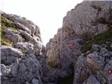 24
24 25
25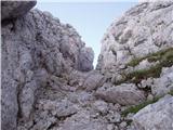 26
26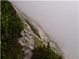 27
27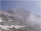 28
28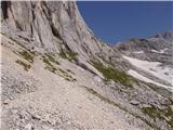 29
29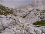 30
30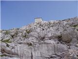 31
31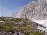 32
32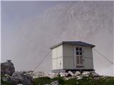 33
33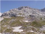 34
34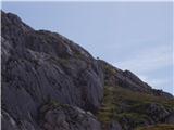 35
35 36
36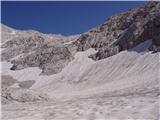 37
37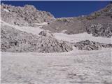 38
38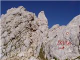 39
39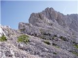 40
40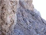 41
41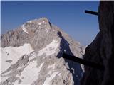 42
42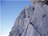 43
43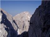 44
44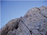 45
45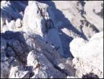 46
46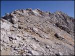 47
47 48
48