Val Aupa - Creta Grauzaria (via normale)
Starting point: Val Aupa (720 m)
Starting point Lat/Lon: 46.47643°N 13.18512°E 
Path name: via normale
Time of walking: 4 h 20 min
Difficulty: very difficult marked way
Difficulty of skiing: no data
Altitude difference: 1345 m
Altitude difference (by path): 1365 m
Map:
Access to starting point:
Drive to Tablja (it. Pontebba) in Italy.
From Via Macroni street turn right to Via Zardini street. Immediately after driving through the underpass, turn left. Afterwards keep left or straight. There are markings for Val Aupa and for the city limit of Pontebba. From this sign, drive 14.4 km to Val Aupa (you will pass Studena Alta, Cereschiatis pass, and the villages Saps and Bevorchians).
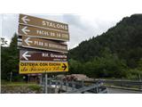
Soon afterwards, two roads branch off to the right, the first one before the bridge and the second one after the bridge. Turn right for the second one. To be sure, check the signs where you need to spot the sign "Rif. Grauzaria, sentiero n. 437" (the sign is in distinctive brown color). See a photo. Follow the paved road a few bends higher through a pine forest to the parking place.
Option 2: drive to Možac (it. Moggio Udinese) in Italy and turn for Val Aupa. After Dordolla two roads branch off to the left (with a bridge between them). See pictures. Follow the first road a few bends higher through a pine forest to the parking place.
Path description:
The ascent starts at the upper part of the parking lot, which ends with a steep right bend. Here go a few steps further up the asphalt road, then turn left onto the footpath following the markings. The footpath soon splits, but in the next few minutes follow right twice to a wider cart track, which you follow uphill. Soon our path 437 branches off to the right, an attentive hiker will notice the number 1 on a stone there. Follow path 437, soon a new junction where the path to the village Grauzaria (paese Grauzaria) and the bridge Dordolla (ponte Dordolla) branches off to the left. Here we continue right and ascend on the path that without major bends or serpentine runs westward. The pine forest is soon completely replaced by beech forest. Further on, cross a spring, but since it flows over muddy ground, water cannot be taken here. The ascent along the path through the forest leads to a junction, where continue right (left is again the path to the villages Dordolla and Grauzaria) and passing above the abandoned alpine pasture Flop (it.: Malga Flop).
Panoramic boards along the path, according to photos from 1941, show former life on this pasture, where now only ruined remains of walls of former buildings remain, the pastures are slowly shrinking and being overgrown by forest.
After the pasture, the path first continues through the forest, then at less visible markings for the hut (30 minutes remaining), the view opens. To the hiker appears the mighty wall and head of the mountain Cima della Sfinge (1847m) and right toward the west also Cima dai Gjai (1916m). Between these two mountains runs a steep but marked path to the Portonat saddle. Left immediately at the forest edge branches off the path to bivouac Feruglio, we continue on the easy path westward. To the hut, several torrent beds are crossed. In the last slope about 30 to 50 meters below the hut and along the last torrent bed, the path to Portonat saddle (1860m) branches off to the left. Hut Rifugio Grauzaria is open in summer, overnight stay possible. Next to the hut there is drinking water.
The path marked 444 to Portonat saddle starts along the torrent bed below the hut. The path gets lost at the beginning, so carefully follow the markings and ascend steeply without going too far to the east. The path is steep all the way, first through scrub, later on one short, slightly exposed and crumbly section helped by a few meters of rope. The terrain becomes steeper with altitude, occasionally some scrambling needed (up to partially difficult). In the last part in a narrower gully scree terrain, where also the branch to Cima dai Gjai (sentiero Alpinistico Piero Nobile). We follow the scree which leads to the false summit, from where the path slightly descends, then ascends to Portonat saddle at 1860 meters. From the hut to there 2 hours of walking (scree terrain).
From the saddle to Creta Grauzaria there are no fixed protections, passages or direction shown by red markings. The technically most demanding part is right at the start (difficulty UIAA II). In the first 30-50 meters there are two bolts for possible belay on descent. Further on crumbly terrain, locally exposed, but technically not exceeding UIAA I. Occasionally the terrain is also quite flat and there the direction is replaced by a well-visible path. In the last turn toward the summit a small cross surprises, then statue of Mary, just below the summit summit logbox and on the narrow summit another small cross. Stamp is in hut Rifugio Grauzaria. From saddle to summit 40 to 60 minutes.
Timing to: Rifugio Grauzaria (1h 20min); Portonat (3h 20); Creta Grauzaria (4h 20 min).
Description and photos from June 2019.
On the way: Malga Flop (980m), Rifugio Grauzaria (1250m), Portonat (1860m)
Pictures:
 1
1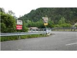 2
2 3
3 4
4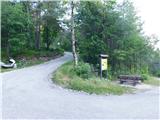 5
5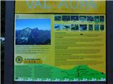 6
6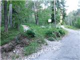 7
7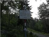 8
8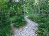 9
9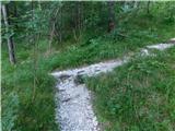 10
10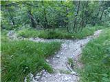 11
11 12
12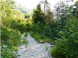 13
13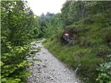 14
14 15
15 16
16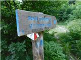 17
17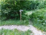 18
18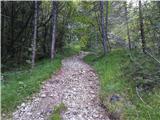 19
19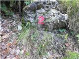 20
20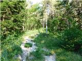 21
21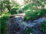 22
22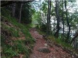 23
23 24
24 25
25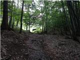 26
26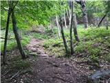 27
27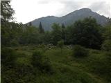 28
28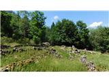 29
29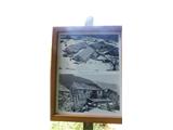 30
30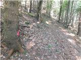 31
31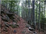 32
32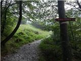 33
33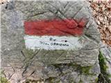 34
34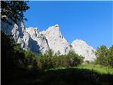 35
35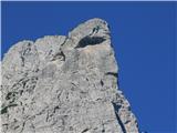 36
36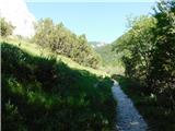 37
37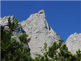 38
38 39
39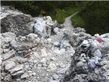 40
40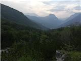 41
41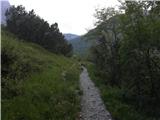 42
42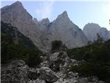 43
43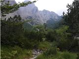 44
44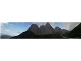 45
45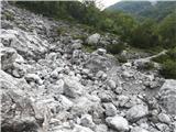 46
46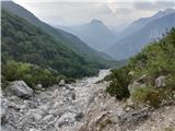 47
47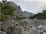 48
48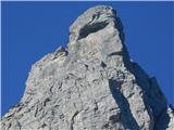 49
49 50
50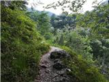 51
51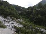 52
52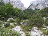 53
53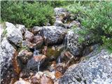 54
54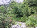 55
55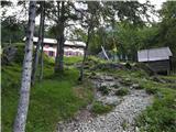 56
56 57
57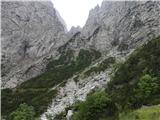 58
58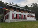 59
59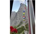 60
60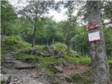 61
61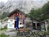 62
62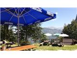 63
63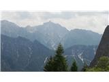 64
64 65
65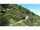 66
66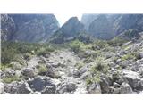 67
67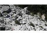 68
68 69
69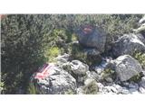 70
70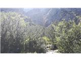 71
71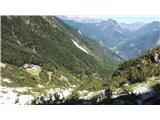 72
72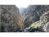 73
73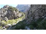 74
74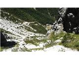 75
75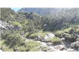 76
76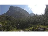 77
77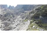 78
78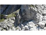 79
79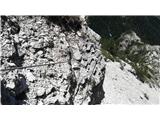 80
80 81
81 82
82 83
83 84
84 85
85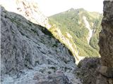 86
86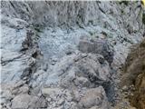 87
87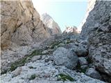 88
88 89
89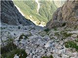 90
90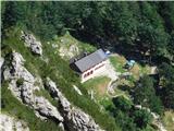 91
91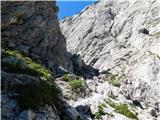 92
92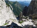 93
93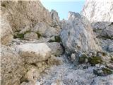 94
94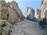 95
95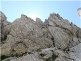 96
96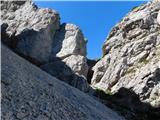 97
97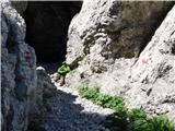 98
98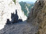 99
99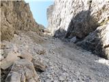 100
100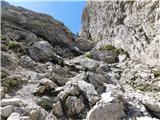 101
101 102
102 103
103 104
104 105
105 106
106 107
107 108
108 109
109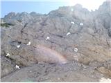 110
110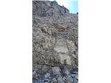 111
111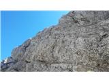 112
112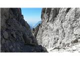 113
113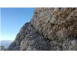 114
114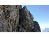 115
115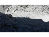 116
116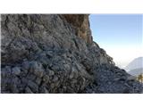 117
117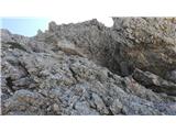 118
118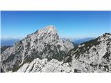 119
119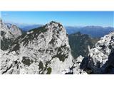 120
120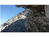 121
121 122
122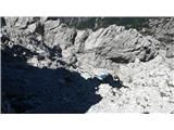 123
123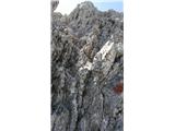 124
124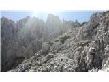 125
125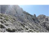 126
126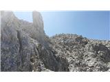 127
127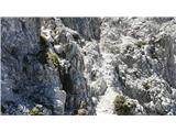 128
128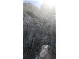 129
129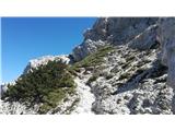 130
130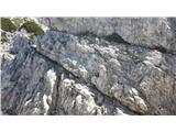 131
131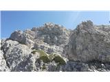 132
132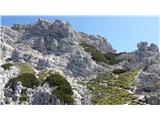 133
133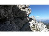 134
134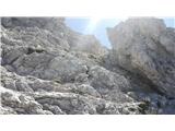 135
135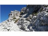 136
136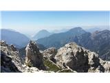 137
137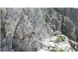 138
138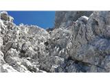 139
139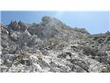 140
140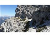 141
141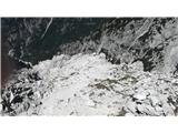 142
142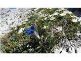 143
143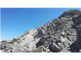 144
144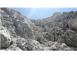 145
145 146
146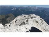 147
147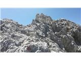 148
148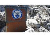 149
149 150
150 151
151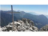 152
152