Starting point: Velike Lašče (540 m)
Starting point Lat/Lon: 45.83372°N 14.63634°E 
Time of walking: 1 h 15 min
Difficulty: easy marked way
Difficulty of skiing: no data
Altitude difference: 243 m
Altitude difference (by path): 243 m
Map: maPZS
Access to starting point:
Car:
Velike Lašče lie by the main road between Škofljica (connection with Ljubljana and the Dolenjska highway) and Kočevje. We drive on this road from any direction and park in an appropriate place. It will be most considerate if we do this in a larger organized parking lot by the cemetery on the northern edge of the settlement. During free days, we can also try the second parking lot slightly south by street Javorškova ulica, which during working hours is primarily intended for users of the nearby post office and health center.
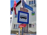
br] Bus:
In Velike Lašče, buses stop between Ljubljana and Kočevje. The bus stop, officially named "V. Lašče", is located right next to the starting point at square Levstikov trg.
br] Train:
Passenger trains between Grosuplje (possible connection with Ljubljana and Dolenjska) and Kočevje stop at the "Velike Lašče" station, which is located slightly outside the center of the settlement, reachable by about a one-and-a-half km walk along the road. "Unofficially," near the station, we can carefully cross the track, find a path in the forest, turn right onto the path that runs parallel to the track towards the south. At the end of the path, we turn left and thus join the described path.
Path description:
The first part of the path coincides with the route of the E7 path, which means that, in addition to the usual Knafelc red-white blazes, we will also be accompanied by round red-yellow blazes.
From square Levstikov trg in Velike Lašče, we set off along the asphalt road "Grič" past the church towards the east. The road initially descends gently. During the descent, we will notice a turnoff for the path "Kulturna pot" to the right onto street Jontezova ulica, but we follow the red signpost and continue straight. We continue straight at the next crossroad next to the chapel. The path leads us past the chapel; at the next fork, where we can already see a sign for the end of the settlement in the distance, a signpost directs us to the left. Behind the last house, the asphalt transitions into a macadam road, which leads us to the edge of the forest or the crossing "Pri Martinkovem kozolcu". Our path continues straight onto the forest road and into the forest. Immediately after the crossing, the main road turns left onto private land, but we continue straight to a new crossing at a smaller clearing, where we notice a sign prohibiting waste dumping. Here we turn left onto the path marked with a traffic sign for a dead-end street. We soon reach the railway track, and in front of it, signs prohibiting passage (even though we were walking on officially marked paths!!!). Therefore, we "ignore" the signs and very carefully cross the embankment and the track (which at this spot, due to the forest and curves, isn’t particularly visible!). Soon after the crossing, an "unofficial" path from the railway stop joins from the left.
Here, the previously "flat" path starts to ascend mildly. Quite soon, we cross a forest road. From a distance, we will notice a red arrow on a tree pointing left, but as we get closer, we find signposts that actually direct us straight. A little further, we reach another crossing, "Ta zmrznjeni", where the E7 path branches off to the left and downwards towards Videm, but the signposts direct us straight. We carefully follow the marked path, which from here on ascends more noticeably. As we gradually turn towards the southeast, we continue walking in the forest and notice a clearing on our right not far away. Now, a fairly steep ascent leads us to the saddle between Debeli hrib on our right and an unnamed peak on our left. After the saddle, we first descend about 30 altitude meters, then immediately "tackle" a new, fairly steep slope (about 60 altitude meters. ) onto a new "saddle", immediately after which "hides" the mountain hut on Kamen Vrh, where paths from several directions converge.
From the mountain hut awaits the steepest (in winter, crampons may be useful) but short ascent (about 20 vertical meters) towards the summit Kamen vrh. A little below the summit, we will find a box with a guestbook and a stamp, and at the very summit, next to the national flag, some benches from where views open up towards the east.
The description and pictures refer to the conditions in February 2023.
Pictures:
 1
1 2
2 3
3 4
4 5
5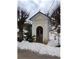 6
6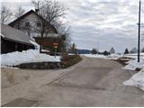 7
7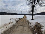 8
8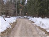 9
9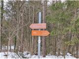 10
10 11
11 12
12 13
13 14
14 15
15 16
16 17
17 18
18 19
19 20
20 21
21 22
22 23
23 24
24 25
25 26
26 27
27 28
28 29
29 30
30 31
31 32
32 33
33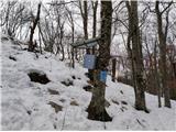 34
34 35
35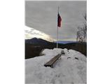 36
36 37
37