Veliko Trebeljevo - Kucelj
Starting point: Veliko Trebeljevo (620 m)
Starting point Lat/Lon: 46.0039°N 14.7395°E 
Time of walking: 45 min
Difficulty: easy marked way
Difficulty of skiing: no data
Altitude difference: 128 m
Altitude difference (by path): 145 m
Map: Ljubljana - okolica 1:50.000
Access to starting point:
A) From the Ljubljana eastern bypass, we head to the exit Ljubljana Bizovik or Sostro, and then continue driving towards Sostro. At the end of Sostro, the road starts ascending, and after a few kilometers it brings us to a smaller pass, where a steep road branches off to the right that leads to Javor. Here we continue straight and descend into the valley of the Besniški potok stream. When we descend into the mentioned valley, the road from Zalog also joins from the left, and we continue right and start ascending again. We drive along the main road to Veliko Trebeljevo, where at the intersection we continue right towards the center of the village (left on the main road to Šmartno pri Litiji). Through the village we drive past a renowned confectionery and past the church of the Holy Cross. Above the village, the road ascends more steeply, and then it brings us to an intersection, where we continue straight in the direction of Višnja Gora (right Mali Vrh). We park immediately after the intersection at a suitable place by the road.
B) First, we drive to Litija and from there continue driving towards Šmartno pri Litiji. From Šmartno pri Litiji we go right and continue driving towards Štangarske Poljane and Malo and Veliko Trebeljevo. At the beginning of the settlement Veliko Trebeljevo we come to an intersection, where the main road towards Zalog turns slightly to the right, and we continue straight towards the center of Veliko Trebeljevo. Through the village we drive past a renowned confectionery and past the church of the Holy Cross. Above the village, the road ascends more steeply, and then it brings us to an intersection, where we continue straight in the direction of Višnja Gora (right Mali Vrh). We park immediately after the intersection at a suitable place by the road.
C) From the Ljubljana - Novo mesto highway, we head to the exit Višnja Gora, and from there continue driving towards the settlement Vrh pri Višnji Gori, Leskovec and Veliko Trebeljevo. After approximately 3 km of driving from the village Leskovec we arrive at a smaller intersection, where to the left branches off the road towards Mali Vrh, and to the right continues the road towards Veliko Trebeljevo. We park at a suitable place a few meters before the intersection.
Path description:
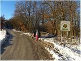
Near the sign with the inscription "Dobrodošli v deželi jagod (fruit road between Javor and Janče)", we will notice a cart track that immediately splits into three parts. It does not matter which one we take, as all three join after a few minutes, and the marked one is the far left one, next to which we notice a hiking direction sign for Janče pointing left downwards. We continue slightly to the right and first ascend moderately, then the path flattens and joins the previously mentioned cart track. We walk on the cart track for a few minutes, then the blazes direct us slightly to the right onto a marked footpath, which gently ascends along the slopes of the nearby Kopance (684 m). Later, the path flattens or even slightly descends temporarily, then it brings us to a smaller junction, where we continue slightly in the direction of the European footpath E6 (slightly left Obolno). A little further ahead, we join a road, then we emerge from the forest. The path ahead leads us past an intersection, where a road branches off sharply to the left leading to Obolno.
We continue straight and further on walk along the road leading towards the village Leskovec, which gently ascends. After a few minutes, the road flattens and brings us to an unmarked junction, where a wide cart track leading towards Kuclj branches off sharply to the right. A few steps further, we enter a narrow strip of forest, where we notice a blaze on a tree confirming that we are on the right path. The wide cart track ascends further along the edge of a grassy slope, slightly higher it turns left into the forest. Through the forest we walk for a few minutes, then we arrive at the summit grassy slope of Kuclj, where we turn right. We continue the gentle ascent along a less pronounced cart track, past a hunting observatory, and in a few minutes arrive at the panoramic summit, in the middle of which stands a geodetic tower.
Pictures:
 1
1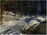 2
2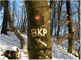 3
3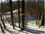 4
4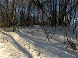 5
5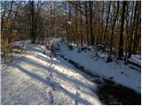 6
6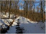 7
7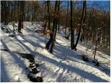 8
8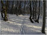 9
9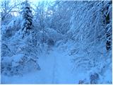 10
10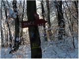 11
11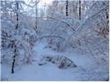 12
12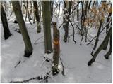 13
13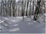 14
14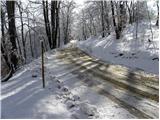 15
15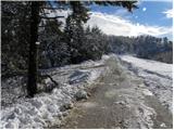 16
16 17
17 18
18 19
19 20
20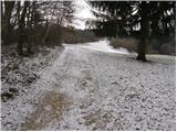 21
21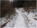 22
22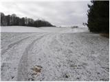 23
23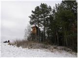 24
24 25
25 26
26 27
27