Vikrče - Šmarna gora (Pogačnik way)
Starting point: Vikrče (320 m)
Starting point Lat/Lon: 46.1285°N 14.4446°E 
Path name: Pogačnik way
Time of walking: 1 h 30 min
Difficulty: very difficult marked way
Difficulty of skiing: very demanding
Altitude difference: 349 m
Altitude difference (by path): 400 m
Map: Ljubljana - okolica 1:50.000
Access to starting point:
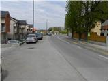
A) From the Ljubljana - Jesenice highway, take the Ljubljana - Šmartno exit, then continue driving towards Tacen. In Tacen, just before the road over the bridge crosses the Sava River, continue slightly right towards Pirniče. A little after Ljubljana ends, we arrive in Vikrče, and we follow the road to the inn Kovač, which is located right next to the bus stop. At the starting point, there are no appropriate parking spots.
B) From Šentvid, drive to Tacen; there, immediately after the bridge over the Sava River, turn left towards Pirniče. A little after Ljubljana ends, we arrive in Vikrče, and we follow the road to the inn Kovač, which is located right next to the bus stop. At the starting point, there are no appropriate parking spots.
C) From Medvode, drive to Zgornje and then to Spodnje Pirniče, and follow the road towards Tacen. When we arrive in Vikrče, join the road leading from Smlednik towards Tacen; here continue right and follow the road to the nearby inn Kovač, where the starting point of our path is. At the starting point, there are no appropriate parking spots.
D) The starting point can also be reached by LPP bus number 15.
Path description:
From the inn Kovač, first walk along the road leading towards Tacen; then, when the main road makes a slight right turn, continue slightly left onto the narrower local road (at the junction there is a no-driving sign, and near the sign an information board for the forest educational trail on the Šmarna gora Grmada). Along the narrower asphalt road walk to the private parking lot; there continue sharply left onto the poorer road, which gently ascends among piles of logs (straight: Grmada via Mazijeva steza and Šmarna gora over Zatrep).
Along the mentioned road, walk some 10 m, then arrive at the start of the climbing path to Grmada. The path to the start of the climbing path is poorly marked.
Here the signpost for Pogačnikova pot to Grmada (very demanding path) directs us right upwards. The well-secured path first leads through a narrow gorge relatively steeply upwards, then the path temporarily flattens somewhat and brings us to a traverse to the right. With the help of the fixed protections, we quickly manage the traverse, then arrive at the most demanding part of the path. The path ahead climbs vertically up the vertical wall; besides the pegs, a steel cable assists us, to which we can attach the self-belay kit. Once we climb the vertical pegs, the path becomes a grade harder, as it becomes slightly overhanging. When we climb the short overhanging wall, the path gradually enters the forest, and the steepness also begins to ease gradually. A little higher, Westrova pot joins from the left (we can descend via the mentioned path); we continue right and continue the ascent along the forest-covered western ridge of Grmada. We follow this path all the way to the mentioned summit, from which a nice view opens.
From the top of Grmada, continue along the marked path, which begins to descend through the forest. After approximately 15 minutes of descent, the path brings us to the saddle Sedlo between Grmada and Šmarna gora, where we join the path from Tacen and Šmartno pod Šmarno goro.
Continue along the road, from which a footpath to Šmarna gora soon branches off. From here, we have two options to the summit.
We can ascend to the summit along the forest road, which takes us past the wish bell and the children's playground, or along the steep footpath, which past the chapel brings us to the summit in a few minutes, where both paths join.
Pictures:
 1
1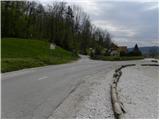 2
2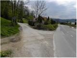 3
3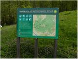 4
4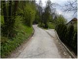 5
5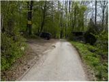 6
6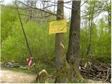 7
7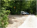 8
8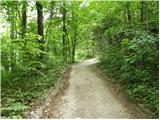 9
9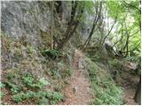 10
10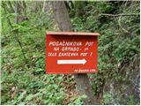 11
11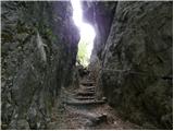 12
12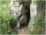 13
13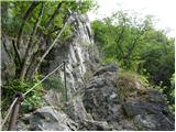 14
14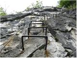 15
15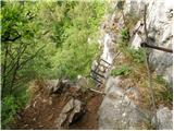 16
16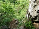 17
17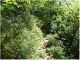 18
18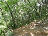 19
19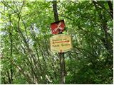 20
20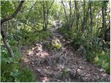 21
21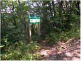 22
22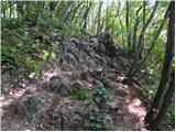 23
23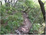 24
24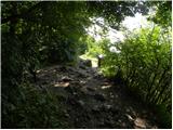 25
25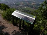 26
26 27
27 28
28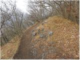 29
29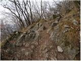 30
30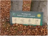 31
31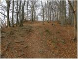 32
32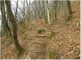 33
33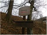 34
34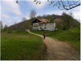 35
35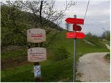 36
36 37
37 38
38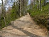 39
39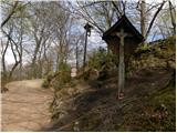 40
40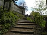 41
41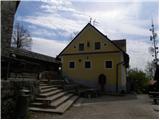 42
42 43
43