Volkzeinalm - Degenhornsee
Starting point: Volkzeinalm (1884 m)
Starting point Lat/Lon: 46.8676°N 12.4392°E 
Time of walking: 2 h 50 min
Difficulty: easy marked way
Difficulty of skiing: no data
Altitude difference: 830 m
Altitude difference (by path): 835 m
Map:
Access to starting point:
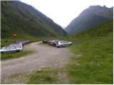
Through the Karawanks Tunnel, we drive to Austria, and then we continue driving towards Spittal and forward towards Lienz (a little after Spittal highway ends). Further, we drive on a relatively nice and wide road through Drau valley. In the center of Lienz, in main roundabout we continue »left« and we continue driving towards Italy (exit from the roundabout in the direction of village Leisach, Anras and Silian). In the village Heinfels (village is located right next to the village Silian) we will notice signs for valley Villgratental, which point us to the right on an ascending road. A little higher in the village Außervillgraten we continue right in the direction of village Winkeltal. The mentioned road which higher loses an asphalt covering we then follow to the parking lot at the end of the road (road continues only to the nearby mountain hut).
Path description:
From the parking lot, we go following the signs “Degenhorn” on a cart track which leads by the stream. After a short walk on a cart track we come to a crossing where we go left on a footpath. The path starts ascending past bushes and then brings us near the stream, above which we are for some time ascending. From the path there is also a nice view towards the surrounding peaks and on waterfall nearby. Next follows crossing of the stream and then the path turns to the right and in ascent crosses little steeper slopes. Such a path then brings us to a crossing on the saddle Schrentebachboden.
We continue right following the signs “Degenhorn 2h” and at first, we descend a little and then we cross swampy terrain by the stream. When we cross the stream, the path turns to the left and soon starts ascending quite steeply. The path is then for quite some time ascending on a grassy terrain and it brings us to a crossing. To the right leads the path towards the lake Falkamsee, and we continue straight through the valley and at first, we slightly descend. At the end of the valley we again start ascending and we turn slightly to the left. A little steeper path then brings us to the lake Degenhornsee from where there is also a nice view to the summit Degenhorn.
Pictures:
 1
1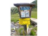 2
2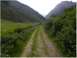 3
3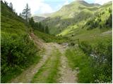 4
4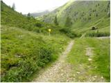 5
5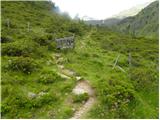 6
6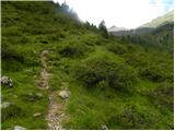 7
7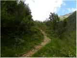 8
8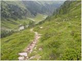 9
9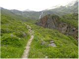 10
10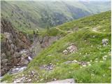 11
11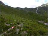 12
12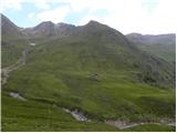 13
13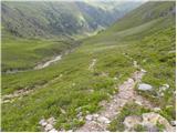 14
14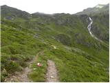 15
15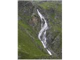 16
16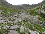 17
17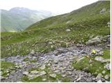 18
18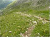 19
19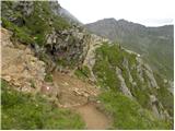 20
20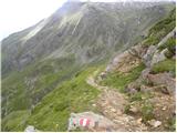 21
21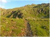 22
22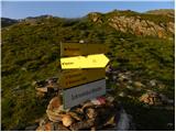 23
23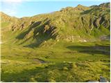 24
24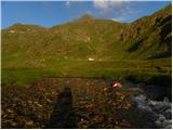 25
25 26
26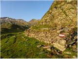 27
27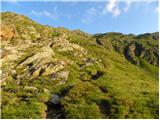 28
28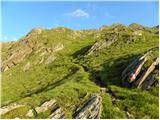 29
29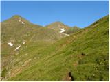 30
30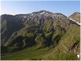 31
31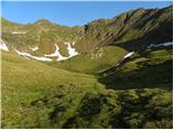 32
32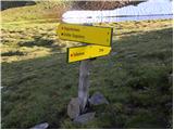 33
33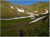 34
34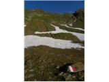 35
35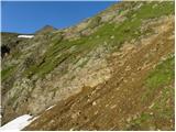 36
36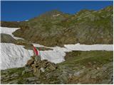 37
37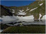 38
38