Volkzeinalm - Leisacher Alm
Starting point: Volkzeinalm (1884 m)
Starting point Lat/Lon: 46.8676°N 12.4392°E 
Time of walking: 1 h 30 min
Difficulty: easy marked way
Difficulty of skiing: partly demanding
Altitude difference: 466 m
Altitude difference (by path): 466 m
Map:
Access to starting point:
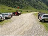
Through the Karawanks Tunnel, we drive to Austria, and then we continue driving towards Spittal and further towards Lienz (a little after Spittal the highway ends). Further, we drive on a relatively nice and wide road through the Drau Valley. In the center of Lienz, in the main roundabout we continue »left« and we continue driving towards Italy (exit from the roundabout in the direction of the villages Leisach, Anras and Silian). In the village Heinfels (the village is located right next to the village Silian) we will notice signs for the Villgratental valley, which point us to the right on an ascending road. A little higher in the village Außervillgraten we continue right in the direction of the village Winkeltal. The mentioned road, which higher loses the asphalt covering, we then follow to the parking lot at the end of the road (the road continues only to the nearby mountain hut).
Path description:
From the parking lot, we continue on the road, on which in 2 minutes we ascend to the mountain hut Volkzeinerhütte.
The marked path bypasses the mentioned mountain hut on the right side and then ascends over an initially gentle grassy slope. We soon come to a marked junction, where we continue right in the direction of »Hochalmspitze and Leisacher Alm« (left Gsaritzer Törl).
The path ahead crosses a torrent stream and then starts to ascend diagonally over increasingly steep slopes. The path, which runs through a thin forest, then descends on a slightly exposed slope into another gully, and then starts to ascend more steeply. The path ahead quickly passes onto grassy slopes, where it turns a little towards the left. Further, we ascend on a scenic path, along which we can observe numerous alpine flowers. The path then approaches the stream, crosses it higher up and then flattens. There follows only a few minutes of easy walking and the path brings us to the scenic mountain pasture Leisacher Alm, on which we notice a larger shepherd hut.
Pictures:
 1
1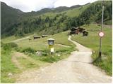 2
2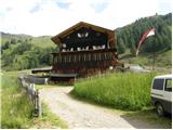 3
3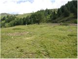 4
4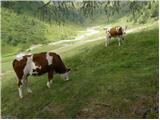 5
5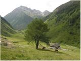 6
6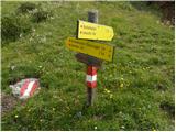 7
7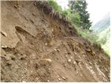 8
8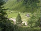 9
9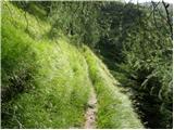 10
10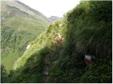 11
11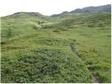 12
12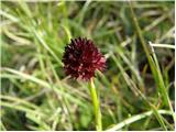 13
13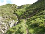 14
14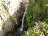 15
15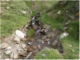 16
16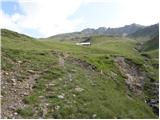 17
17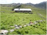 18
18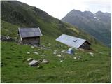 19
19