Starting point: Vršič (1611 m)
Starting point Lat/Lon: 46.4336°N 13.7435°E 
Time of walking: 1 h 15 min
Difficulty: easy marked way
Difficulty of skiing: partly demanding
Altitude difference: 300 m
Altitude difference (by path): 350 m
Map: Kranjska Gora 1:30.000
Access to starting point:
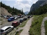
From Kranjska Gora we drive towards Bovec or vice versa, but only to the Vršič pass, where we park.
Path description:
From the Vršič pass we turn onto the path in the direction of Slemenova špica, the Hanz path to Mala Mojstrovka and the Tamar valley (left Mala Mojstrovka - usual path) along the path that begins to ascend transversely to the right. During the ascent, which takes place along the slopes of Šitna glava, we cross several smaller scree fields and torrents, then the path from Erjavčeva koča at Vršič joins us from the right.
Here we continue straight and, passing a viewpoint a few meters away, we climb in a few minutes to the Vratca saddle (1799 m), where the next marked junction is.
To the left continues the secured climbing path to Mala Mojstrovka and an unmarked path towards Sleme, to the right branches off an unmarked but well-trodden path towards Prednje Robičje, and straight ahead continues the usual path towards Sleme and Slemenova špica.
This is followed by a short section of the path where we cross the slopes below Prednje Robičje, then the path gradually begins to descend towards the slopes above the Mala Pišnica valley. When we reach the mentioned slopes the path turns left, then continues with several shorter ascents and descents. In dry conditions the undemanding path takes us a little further to a junction, where the marked path from Tamar through Grlo joins us from the right, as well as an unmarked path through Mala Pišnica.
We continue in the direction of Slemenova špica along the path that continues to cross the slopes high above Mala Pišnica. With beautiful views that reach all the way to nearby Italy and Austria, we soon arrive at the slopes of Slemenova špica, where the slope, but not the path, levels out. This is followed by a short ascent, then we arrive at a less well-marked junction, where we continue slightly to the right (straight ahead leads the path towards Tamar - the path past Črne vode (even if we continue straight it is still possible to reach Slemenova špica)). After a few minutes of further ascent the path completely levels out, and we see smaller lakes in front of us and the famous view towards Jalovec. We bypass the lakes on the right side, or wherever we want, then, passing the inscription box, we climb in a few minutes to the scenic and precipitous summit of Slemenova špica.
Vršič pass - Vratca 0:35, Vratca - Čez Sleme 0:20, Čez Sleme - Slatnica 0:10, Slatnica - Slemenova špica 0:10.
On the way: Razpotje pod Vratci (1705m), Vratca (1800m), Čez Sleme (1773m), Slatnica (1814m), Jezerca na Slemenu (1855m)
Pictures:
 1
1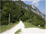 2
2 3
3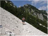 4
4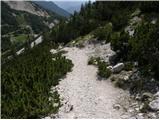 5
5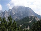 6
6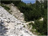 7
7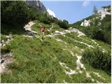 8
8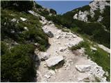 9
9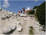 10
10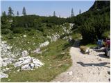 11
11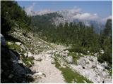 12
12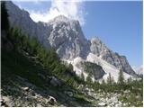 13
13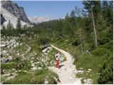 14
14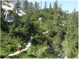 15
15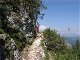 16
16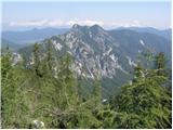 17
17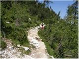 18
18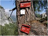 19
19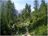 20
20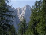 21
21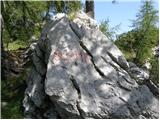 22
22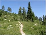 23
23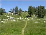 24
24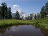 25
25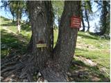 26
26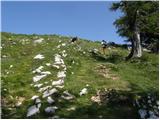 27
27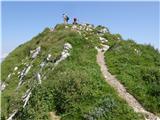 28
28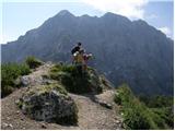 29
29