Starting point: Vršič (1611 m)
Starting point Lat/Lon: 46.4336°N 13.7435°E 
Time of walking: 2 h 15 min
Difficulty: difficult pathless terrain
Difficulty of skiing: more demanding
Altitude difference: 498 m
Altitude difference (by path): 600 m
Map: TNP 1:50.000
Access to starting point:
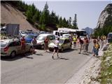
From Kranjska Gora, we drive towards Bovec or vice versa, but only to mountain pass Vršič, where we park.
Path description:
From the parking lot on Vršič we go on at first badly marked path which leads on Mojstrovka and Sleme. After a short ascent, the path brings us to bigger rock on which we notice a sign Mojstrovka left. We continue in the direction of Mojstrovka (right Mojstrovka over Hanza route and Slemenova špica) on the path which is ascending diagonally through a thin larch forest. After approximately half an hour of ascent, the path brings us to extensive scree below Mojstrovka. The mentioned scree we cross on the upper side, and after it, the path brings us into a crumbly gully. Next follows steep and for slipping dangerous ascent on gravel, which we overcome in approximately 15 minutes. On top of the gully steepness decreases and in front of us opens up "sunny" Primorska. Here the path turns right and already after few steps starts ascending steeply (in snow and ice dangerous for slipping). On the top of this ascent we step on a nice vantage point, from which a nice view opens up downwards towards Vršič. The path ahead avoids the ridge a little to the left and then crosses two smaller gullies. And only a little ahead we leave the marked path on Mojstrovka and we go left slightly downwards into a small valley between Mala and Velika Mojstrovka. From here we already clearly see our destination, which we get closer to on easier pathless terrain (we see it a little to the left). Closer, we are to Suhi vrh, steeper it looks. When we come below the foot of Suhi vrh on its right (northern) side we have two options to continue. Orientationally easier but technically demanding path (climbing of 2nd grade) will lead us on a steep ridge straight upwards, all the way to the top. Second easier leads us from northern walls downwards, and then we stick slightly to the left until scree below Suhi vrh opens up. Ahead we ascend on the scree, which brings us on the ridge on which we could come, if we would ascend to the summit on direct path. From here to the top we have for approximately 5 minutes of a steep ascent with climbing to 1st grade.
Pictures:
 1
1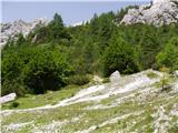 2
2 3
3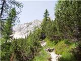 4
4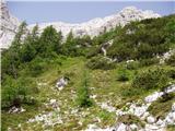 5
5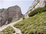 6
6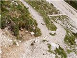 7
7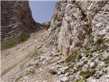 8
8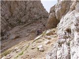 9
9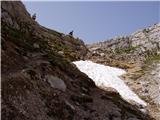 10
10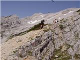 11
11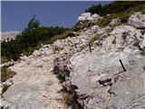 12
12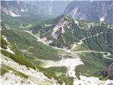 13
13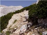 14
14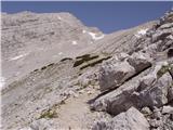 15
15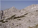 16
16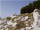 17
17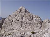 18
18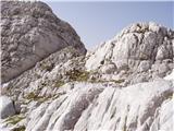 19
19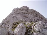 20
20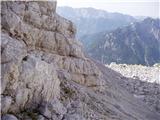 21
21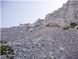 22
22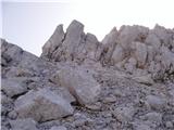 23
23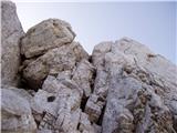 24
24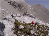 25
25