Vršič - Travnik (at Mojstrovke) (via ridge)
Starting point: Vršič (1611 m)
Starting point Lat/Lon: 46.4336°N 13.7435°E 
Path name: via ridge
Time of walking: 4 h 40 min
Difficulty: difficult pathless terrain
Difficulty of skiing: no data
Altitude difference: 768 m
Altitude difference (by path): 950 m
Map: TNP 1:50.000
Access to starting point:
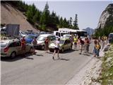
From Kranjska Gora we drive towards Bovec or vice versa, but only to the Vršič pass, where we park.
Path description:
From the parking lot at the Vršič pass we head to the marked path in the direction of Mala Mojstrovka and Slemenova špica. The path quickly splits, and we choose the left path towards Mala Mojstrovka (right Slemenova špica and Hanzova pot to Mala Mojstrovka). This is followed by a traverse ascent to the left, where we initially still go through a belt of bushes, then we arrive among dwarf pines and a sparse larch forest, through which a wide, mostly stony path leads. After about half an hour of ascent we arrive at a larger scree, where an unmarked path branches off to the right to Šitna glava, while straight ahead the marked path continues towards Mala Mojstrovka.
We continue the ascent along the unmarked path, which in a slight traverse ascent to the right leads us towards the slopes of Šitna glava. A relatively well visible footpath then soon brings us into an indistinct little valley between Mala Mojstrovka and Šitna glava. Here the path turns slightly left and climbs a bit more steeply along an increasingly stony slope. When the path already quite approaches the summit, it turns right, crosses a partly overgrown scree and then ascends to the grassy summit of Šitna glava.
From Šitna glava we continue along the ridge towards the west, initially slightly downhill, then uphill in the direction of Mojstrovka (unmarked). The poorly visible footpath along which we continue to ascend brings us after a good 20 minutes of walking from Šitna glava to the place where we join the Hanzova pot to Mojstrovka, which we reach above a very demanding section.
Further the orientation is easier but the path is increasingly steep. After a few more minutes the steepness eases and the path brings us to flatter terrain, which we bypass on the right side. Further the path approaches the ridge, and we see Mangart and Jalovec in front of us. Here the path turns slightly left and brings us to the next steep section, where with the help of a few pitons, mainly without protection, we climb up the steep summit slope of Mala Mojstrovka to its panoramic summit.
From Mala Mojstrovka we continue in the direction towards Velika Mojstrovka. Initially we descend a bit and head to the footpath that leads slightly right towards the saddle between the two Mojstrovkas. The path then crosses the scree and begins to traverse in ascent the steep southern slopes below Velika Mojstrovka. The slope soon becomes less steep and the path turns right upwards. From here only a short ascent along the rocky slope to the eastern summit of Velika Mojstrovka follows.
From the eastern summit we continue along the ridge in the direction towards the west. The path then soon becomes somewhat more demanding and begins to ascend along a slightly crumbly slope on the southern side of the ridge. The path is marked on this section with numerous cairns. This is followed by an ascent towards the ridge where we soon reach the western summit of Velika Mojstrovka.
Also from the western summit we continue further along the very panoramic ridge. The ridge is precipitous on the northern side throughout, but it is wide enough so that walking along it does not present major difficulties. Later the slope on the southern side of the ridge also becomes somewhat steeper and a somewhat steeper ascent along the rocky ridge to the summit of Zadnja Mojstrovka follows.
The path along the ridge subsequently becomes more demanding and if we are not accustomed to walking on demanding unprotected terrain it is recommended that we return a few minutes back, where the southern slopes are not so steep and descend to an unmarked path that runs somewhat lower along less steep southern slopes parallel to the ridge. If we continue along the ridge we first descend a bit along a narrow and quite exposed ridge. The path subsequently gradually becomes less demanding again, then brings us to a somewhat more grassy slope. On this section there is practically no path and a traverse of a steep slope follows on which there is also some scree, so this part is dangerous for slipping. A little later a steep descent into a narrow notch follows from which we then have to climb up a very steep slope. Climbing is only for a few steps, but we need to be very careful because the slope is exposed. The path then becomes less demanding and brings us to the slopes below Travnik. Here the path turns slightly to the left and begins to ascend across screes. Later the path turns to the right and the last ascent along the rocky slope to the summit of Travnik follows.
We can descend along the ascent path or along an easier path that runs somewhat lower on the southern side parallel to the ridge.
Vršič - odcep z markirane poti 0:35, odcep z markirane poti - Šitna glava 0:45, Šitna glava - Rob severne stene Male Mojstrovke 0:20, Rob severne stene Male Mojstrovke - Mala Mojstrovka 0:35, Mala Mojstrovka - Velika Mojstrovka (vzhodni vrh) 0:30, Velika Mojstrovka (vzhodni vrh) - Velika Mojstrovka (zahodni vrh) 0:15, Velika Mojstrovka (zahodni vrh) - Zadnja Mojstrovka 0:25, Zadnja Mojstrovka - Travnik 1:15.
Pictures:
 1
1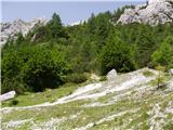 2
2 3
3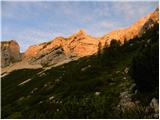 4
4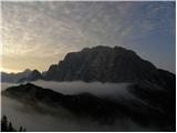 5
5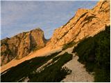 6
6 7
7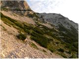 8
8 9
9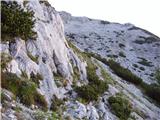 10
10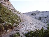 11
11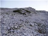 12
12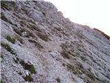 13
13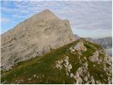 14
14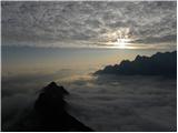 15
15 16
16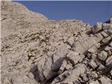 17
17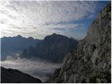 18
18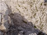 19
19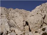 20
20 21
21 22
22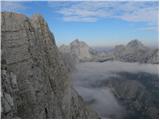 23
23 24
24 25
25 26
26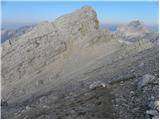 27
27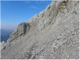 28
28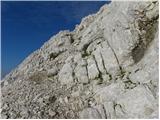 29
29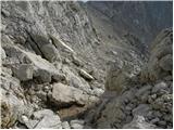 30
30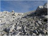 31
31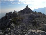 32
32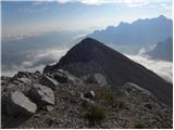 33
33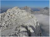 34
34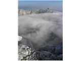 35
35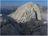 36
36 37
37 38
38 39
39 40
40 41
41 42
42 43
43 44
44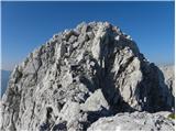 45
45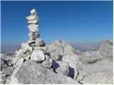 46
46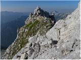 47
47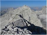 48
48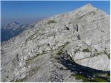 49
49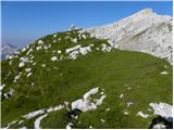 50
50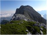 51
51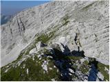 52
52 53
53 54
54 55
55 56
56 57
57 58
58 59
59 60
60 61
61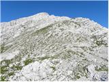 62
62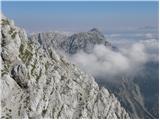 63
63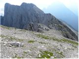 64
64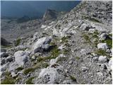 65
65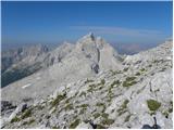 66
66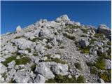 67
67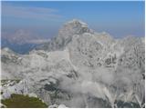 68
68 69
69 70
70 71
71