Vrtovin - Kucelj na Čavnu
Starting point: Vrtovin (360 m)
Starting point Lat/Lon: 45.9099°N 13.8204°E 
Time of walking: 2 h 15 min
Difficulty: easy marked way
Difficulty of skiing: easily
Altitude difference: 877 m
Altitude difference (by path): 877 m
Map: Goriška 1:50.000
Access to starting point:
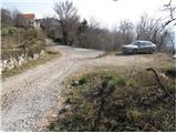
A) From highway Razdrto - Nova Gorica we go to the exit Ajdovščina, and then at the crossroad we turn left in the direction of Nova Gorica. Further, on a regional road towards Nova Gorica we drive to the settlement Vrtovin, there in the middle of the village we turn right in the direction of Čaven. The road which is then ascending through the village at the crossroads we follow in the direction of St. Pavel, Kucelj and Čaven. We park on a smaller parking lot at the end of the village, near the mountain signposts.
B) From highway Nova Gorica - Razdrto we go to the exit Selo, after we drive on the old road Nova Gorica - Ajdovščina we continue right towards Nova Gorica. On regional road towards Ajdovščina we drive to the settlement Vrtovin, there in the middle of the village we turn left in the direction of Čaven. The road which is then ascending through the village at the crossroads we follow in the direction of St. Pavel, Kucelj and Čaven. We park on a smaller parking lot at the end of the village, near the mountain signposts.
Path description:
From the parking lot, we continue on the left road in the direction of Kucelj and St. Pavel. After few minutes of walking, the road brings us to a crossing, where mountain path on Kucelj and Čaven branches off to the right upward (straight still on the road St. Pavel). We continue the ascent on a marked, partly rocky cart track which is ascending through an occasionally thin forest. A little higher we get to a marked crossing, where we continue slightly left in the direction of Kucelj (right Mala gora and Čaven).
Well marked cart track which we follow in the direction of Kucelj a little higher brings us on the forest road which we only cross. The path ahead is ascending gently through a thin forest, but only to a spot, where from the left the path from Sveti Pavel joins.
The path ahead starts steeply ascending through the forest, through which we are then for quite some time ascending. Higher, we cross the path Srednječavenska pot, above which the forest slowly starts to get thinner. A little higher, the path gets very close an old road connection between Vipava valley and plateau Trnovski gozd.
Here, the path branches off to the left on Visoki rob and Selovec, and we continue straight on a marked hiking path, which slowly turns a little to the right. Further, the forest finally ends, and the path from which views opening up towards Veliki rob, Vipava valley and Trstelj, brings us to the last crossing on our path. We again continue right and on a panoramic grassy slope in few minutes we ascend to the top of Kucelj, from which a view opens up also towards Nanos and Golaki.
Pictures:
 1
1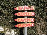 2
2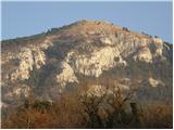 3
3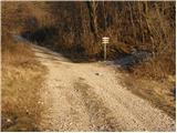 4
4 5
5 6
6 7
7 8
8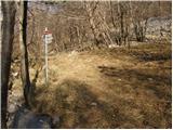 9
9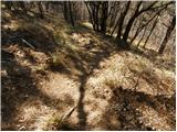 10
10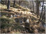 11
11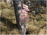 12
12 13
13 14
14 15
15 16
16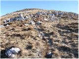 17
17 18
18