Waidisch / Bajdiše - Ferlacher Horn / Grlovec
Starting point: Waidisch / Bajdiše (547 m)
Starting point Lat/Lon: 46.4945°N 14.3483°E 
Time of walking: 3 h 35 min
Difficulty: easy marked way
Difficulty of skiing: partly demanding
Altitude difference: 1293 m
Altitude difference (by path): 1293 m
Map: Karavanke - osrednji del 1:50.000
Access to starting point:
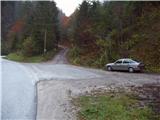
Over the border crossing Ljubelj we drive to Borovlje / Ferlach, where we go right in the direction of village Sele / Zell-Pharre. The road that is ahead mostly ascending we follow to the village Bajdiše / Waidisch. Immediately after the village we notice by the road signs for Grlovec / Ferlacher Horn. We park on a smaller parking lot by the road approximately 100m ahead.
Path description:
From the parking lot, we return back to the signposts, where we go towards Grlovec / Ferlach Horn. Further, we over the bridge cross a stream and the path brings us on a large meadow. On the other side of the meadow, we notice the blazes, which lead in the forest. The path immediately steeply ascends and is ascending above a torrent stream, which we hear right below us. The path then turns a little towards the left and it brings us on the forest road. We follow the road only a short time to the spot, where blazes point us to the right on a footpath. After ten minutes, the path again brings us on the forest road. We continue right upwards and the path brings us to a smaller hamlet, after which marked path goes left on a cart track. Cart track, which is diagonally ascending by the fence soon turns right and it brings us to the hunting observatory on a smaller clearing. And only few steps ahead, the path crosses a forest road and ascends on a quite overgrown meadow. Ahead we few times cross the forest road, then signs point us to the left on the forest road which we follow good 100m to the spot, where the footpath branches off right upwards, which then two more times crosses a forest road. And when by the road we notice a cross, crossing of the roads ends.
Here the path again steeply ascends and through the forest brings us to a crossing, where we continue left. Next follows a shorter diagonal ascent, and then the path turns right and it ascends on a vegetated ridge. The path ahead crosses forest clearing and then brings us on the upper part of the mountain. After few minutes, we step out of the forest and in front of us, we notice a big cross, which stands on the top. Next follows only few minutes of walking on a panoramic grassy slope.
Description and pictures refer to a condition in the year 2007 (October).
Pictures:
 1
1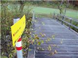 2
2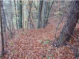 3
3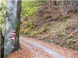 4
4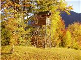 5
5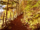 6
6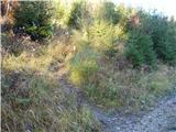 7
7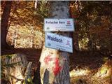 8
8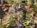 9
9 10
10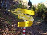 11
11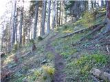 12
12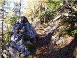 13
13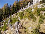 14
14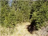 15
15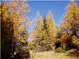 16
16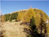 17
17 18
18