Waldheim Hütte - Rothaiden Hutte (Seetal Alps) (via Turkenkreuz)
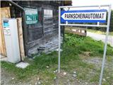
Starting point: Waldheim Hütte (1614 m)
Starting point Lat/Lon: 47.0562°N 14.6305°E 
Path name: via Turkenkreuz
Time of walking: 1 h 15 min
Difficulty: easy marked way
Difficulty of skiing: easily
Altitude difference: 222 m
Altitude difference (by path): 300 m
Map: WK 212 (Seetaler & Seckauer Alpen 1:50.000)
Access to starting point:
From Gorenjska side we go over the border crossing Ljubelj to Celovec / Klagenfurt or over Karawanks tunnel to Beljak / Villach. Ahead we go on the highway in the direction of signs for Gradec / Graz. We leave the highway for approximately 2km long tunnel in the direction of Bad St. Leonhard. Further, we drive past village St. Peter and a little ahead we turn left towards the village St. Anna. At the next crossroads, we follow the road in the direction of Waldheim Hütte. We park on a payable parking lot at the mountain hut.
From Koroška we at first drive into Dravograd and ahead into Austria. We follow the road ahead towards St. Paul, St. Andrä and Wolfsberg. In Wolfsberg we go towards Bad St. Leonhard and forward towards St. Peter. Further follow the description from Gorenjska.
From Štajerska side we drive to Maribor and ahead over the border crossing Šentilj into Austria. We follow the highway in the direction of Celovec / Klagenfurt. We leave the highway in the direction of exit Bad St. Leonhard. Further follow the description from Gorenjska.
Path description:
From the parking lot, we go on the most left road in the direction of Kohlerhütte. The path leads us on a gently sloping road on which occasionally a view opens up a little. A little higher road crosses few streams and it brings us to a resting place named "Maria in der Zirbe". The road is slowly becoming a little worse and is a little steeper ascending. After 40 minutes of walking, the path brings us on grassy slopes, where on the right side we notice a bigger shepherd hut.
We continue on the road five more minutes and we get to Turkish cross (Turkenkreuz). Here we are at the crossing, where we continue through a meadow right upwards by the grazing fence. After few minutes of a light ascent on a grassy slope path again brings us on the road, where we continue right slightly upwards (left dr. Kohler Hütte). After a shorter gentle ascent road brings us to a crossing, where it crosses a cart track. At this spot, we leave the road and we go right downwards on a cart track which we follow only few meters to signposts. We continue left on the path (cart track), which in a gentle descent crosses slopes towards the mountain hut, which we see in front of us. The path which crosses few nice wells after few minutes of walking from the crossing brings us to the hut.
On the way: Turkenkreuz (1839m)
Pictures:
 1
1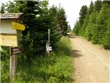 2
2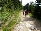 3
3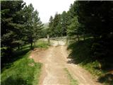 4
4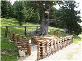 5
5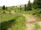 6
6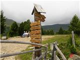 7
7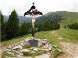 8
8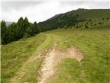 9
9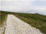 10
10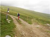 11
11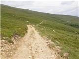 12
12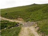 13
13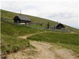 14
14