Starting point: Winklertal (1550 m)
Time of walking: 2 h 15 min
Difficulty: easy marked way
Difficulty of skiing: easily
Altitude difference: 610 m
Altitude difference (by path): 610 m
Map:
Access to starting point:
Over the border crossing Korensko sedlo we descend in Austria, and there in first larger crossroad we continue left in the direction of village Podklošter / Arnoldstein. In the mentioned village, we will get to a roundabout, where we continue right in the direction of "Hermagor". Further, we drive on a wide road which leads us through the valley Gailtal. At the settlement Mauthen we continue left in the direction of the mountain pass Plöckenpass, and after few 100 meters right in the direction of valley Lesachtal. Further, we drive on narrower and quite winding road which we follow to the village Untertilliach. Only a little after the mentioned village (at the second bus stop) left downwards at first still asphalt road branches off. The road then crosses a bridge, after which from the left side joins wide macadam road. We continue straight for approximately 50 meters and then we come to the next unmarked crossroad, where we continue right on the bottom "main" road which only few meters ahead brings us to the marked crossroad. This time we continue left in the direction of "Hochspitz and Oberalm" on an increasingly bad road which higher brings us to an unmarked crossroad in front of which is a smaller parking lot.
Path description:
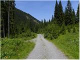
From the parking lot, we continue on the road to hut Gartlhütte at an altitude 1600 meters. From the hut, we then continue on the mountain road which leads us through the valley towards the south and brings us near the stream Winkler Bach. For some time we are ascending by the stream and then the road turns to the right and is long time ascending in zig-zags upwards. The road is mostly ascending on grassy slopes, only occasionally brings us in thin forest. On grassy slopes in the summer time also livestock is grazing. Such road we then follow all the way to the mountain pasture Oberalm at an altitude 2160 meters.
On the way: Gartlhütte (1600m)
Pictures:
 1
1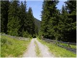 2
2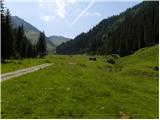 3
3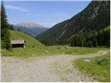 4
4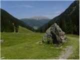 5
5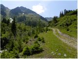 6
6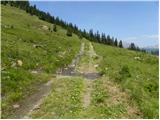 7
7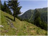 8
8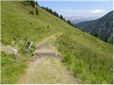 9
9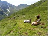 10
10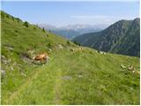 11
11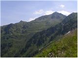 12
12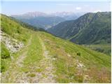 13
13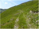 14
14 15
15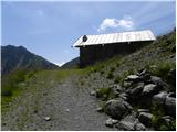 16
16