Starting point: Zadnjica (650 m)
Starting point Lat/Lon: 46.3824°N 13.7604°E 
Time of walking: 3 h 15 min
Difficulty: easy marked way
Difficulty of skiing: demanding
Altitude difference: 1108 m
Altitude difference (by path): 1110 m
Map: Triglav 1:25.000
Access to starting point:
We drive from Kranjska Gora over mountain pass Vršič towards Bovec or vice versa, but only to 50th hairpin turn of Vršič road or Ruska cesta (near the village Trenta). Here we turn on a side road, by which we after few 100 meters park on a parking lot by the road.
Path description:
From the parking lot, we continue on the road, and which past few houses (mainly holiday cottages) in approximately 15 minutes brings us to the spot, where the road splits into two parts (by the crossroad used to be a parking lot, today it is forbidden to park).
We continue on the bottom right road (on the upper road we get to a cargo cableway, which runs on Pogačnikov dom) in the direction of Dolič, Luknja and Prehodavci. At first, a gentle road which leads us through scenic meadows, higher through the forest, we follow almost to its end, or more precisely to a marked crossing, where a marked footpath towards Prehodavci branches off to the right (to here we need approximately 1 hour).
From a crossing at an area named Utro we continue straight, the road here finally changes into a footpath or mule track. We continue the ascent on an old mule track, which is further moderately ascending over occasionally steeper slopes. Further, climbing path over Komar soon branches off to the right, and we go straight and we still continue the ascent on a wide path. Panoramic path, which occasionally runs over very steep slopes, higher brings us to the next marked crossing.
From a crossing we go left in the direction of Pogačnikov dom, Luknja and Triglav (right Koča na Doliču). From the crossing military mule track leads towards the east and crosses steep slopes. Later, the path few times ascends in zig-zags, and then again follows crossing in a gentle ascent all the way to a saddle Luknja.
Pictures:
 1
1 2
2 3
3 4
4 5
5 6
6 7
7 8
8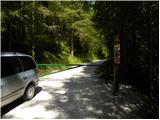 9
9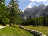 10
10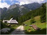 11
11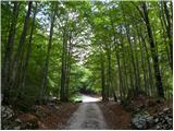 12
12 13
13 14
14 15
15 16
16 17
17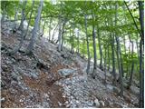 18
18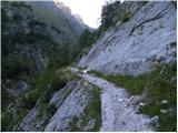 19
19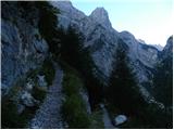 20
20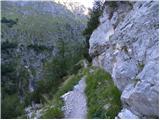 21
21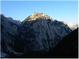 22
22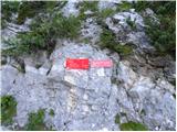 23
23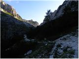 24
24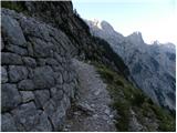 25
25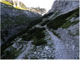 26
26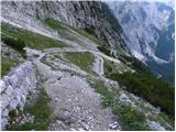 27
27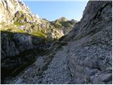 28
28 29
29