Starting point: Zadnjica (650 m)
Starting point Lat/Lon: 46.3824°N 13.7604°E 
Time of walking: 8 h 45 min
Difficulty: very difficult marked way
Difficulty of skiing: no data
Altitude difference: 2090 m
Altitude difference (by path): 2440 m
Map: Triglav 1:25.000
Access to starting point:
We drive from Kranjska Gora over mountain pass Vršič towards Bovec or vice versa, but only to 50th hairpin turn of Vršič road or Ruska cesta (near the village Trenta). Here we turn on a side road, by which we after few 100 meters park on a parking lot by the road.
Path description:
From the parking lot, we continue on the road, and which past few houses (mainly holiday cottages) in approximately 15 minutes brings us to the spot, where the road splits into two parts (by the crossroad used to be a parking lot, today it is forbidden to park).
From the old parking lot we go to the left road in the direction of the mountain hut Pogačnikov dom na Kriških podih (right road leads towards Prehodavci and Dolič). After 15 minutes of additional walking, the road brings us to the bottom station of the cargo cableway, where it ends.
We continue the ascent on a marked footpath (mule track), which is moderately ascending through the forest. The path which is ascending above the valley of Beli potok, quickly brings us on very steep slopes (danger of falling stones), over which leads a very wide footpath. The path ahead crosses a gully Veliki Presek, behind which we come on a short exposed ledge, over which we come with the help of steel cables. Further, the path returns into the forest, where it is in numerous turns moderately ascending. A little further, the path brings us below a smaller overhang, where we will be able to notice numerous sticks, which mountaineers put, so that the rock doesn't roll into the valley (sticks are there for fun, they don't prevent anything). The path ahead crosses some smaller gullies, then past a chapel brings us to a bigger gully. With some caution (undemanding) we cross the mentioned gully behind which in few minutes of additional walking, we ascend to a pleasant resting place (two benches by the path). Further, we cross another bigger gully (in the early summer possible snow fields), and then the path returns into the forest. Higher the forest is becoming thinner, and the path a little steeper and more and more scenic.
The path which is still ascending on an old mule track, then past two more benches brings us into a lane of dwarf pines, after which we pass over on more rocky terrain. Further, we are ascending on smaller scree, on an increasingly panoramic path, which higher brings us to a pleasant well (source).
Only few 10 strides above the mentioned source, we will come on an unmarked crossing, where the unmarked path branches off to the right towards the lake Spodnje Kriško jezero (2 minutes), and we continue slightly left on a still wide mountain path. The path ahead leads us past smaller ruins, and we follow it all the way to a marked crossing, where from the right side joins the path from the valley Vrata. We continue left and after two minutes of additional walking, we get to the mountain hut Pogačnikov dom na Kriških podih.
From the mountain hut Pogačnikov dom we continue in the direction of Razor and Križ on the path which slightly descends and in few steps, it brings us to the next crossing, where we go right (left Razor). Further, we are ascending on at first gentle, after that on a little steeper path which leads us over karst terrain of Kriški podi. A little higher to the right (or straight) path which leads towards Zgornje Kriško jezero branches off, and we continue straight (or left) on the path which higher crosses steep slopes of Kriški rob. When the path at the end of the crossing of Kriški rob brings us on a ridge, we have a nice view towards 2382 meters high Šplevta (mountain with shape of Indian). Further, the path steeply ascends on rugged rocks (dangerous for slipping) and higher brings us on Bovška vratica.
Here we continue straight downwards (right Križ 10 minutes) on a well-beaten path, which after a short descent brings us on Vrh Kriške stene (2289 meters), where from the left joins the climbing path from the valley Krnica. We continue in the direction of Škrlatica and valley Vrata on the path which then leads us on karst terrain. A relatively gently sloping path then soon splits into two parts, and we continue on the left in the direction of Škrlatica. The path then crosses slopes of Gubno (2403 meters) and later also hardly accessible Dovški Gamsovec (2440 meters). After approximately 30 minutes of easy walking, the path again starts ascending steeply. This time is our destination approximately 2500 meters high notch Rdeča škrbina, which we already clearly see in front of us, and to there we ascend on a moderately steep scree.
On the notch Rdeča škrbina, where there is a marked crossing we continue straight (right Dolkova špica 15 minutes) on the path which with the help of steel cables bypasses rocky rib, and then it brings us into a steep gully on the eastern side of previously mentioned notch. The path ahead starts steeply descending on a poorly beaten footpath which is because of substantial steepness and thin gravel on the path dangerous for slipping. After few minutes of steep descent path passes on the scree, on which then in few minutes we descend into Zadnji Dolek, where we join the path from Vrata.
In Zadnji Dolek we go left and we continue the ascent on steep scree, which we follow good 20 minutes, and then blazes point us to the right in the western or southwestern wall of Škrlatica. The path which ahead gets character of climbing path, with the help of fixed safety gear brings us to probably most difficult part of the path. Ahead with the help of numerous stemples and steel cables, we cross smooth and precipitous rounded rock, and then the path passes into rugged rocks, where it is then very steeply ascending. Well secured and all the time for slipping dangerous path, then past the window in Škrlatica brings us on the main ridge, where the path flattens. We continue the ascent on a little less steep path, which then leads us on and by a very panoramic ridge. This path, from which beautiful views opening up on the nearby Rokavi, we then follow all the way to the top of 2740 meters high Škrlatica, and we reach it after few minutes of additional walking.
Pictures:
 1
1 2
2 3
3 4
4 5
5 6
6 7
7 8
8 9
9 10
10 11
11 12
12 13
13 14
14 15
15 16
16 17
17 18
18 19
19 20
20 21
21 22
22 23
23 24
24 25
25 26
26 27
27 28
28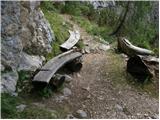 29
29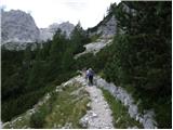 30
30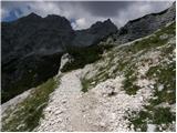 31
31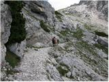 32
32 33
33 34
34 35
35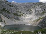 36
36 37
37 38
38 39
39 40
40 41
41 42
42 43
43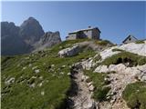 44
44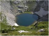 45
45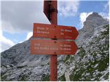 46
46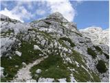 47
47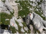 48
48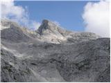 49
49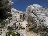 50
50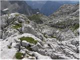 51
51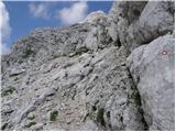 52
52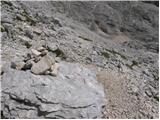 53
53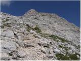 54
54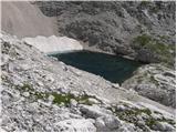 55
55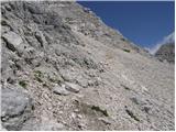 56
56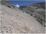 57
57 58
58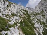 59
59 60
60 61
61 62
62 63
63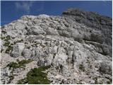 64
64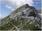 65
65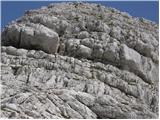 66
66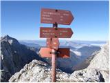 67
67 68
68 69
69 70
70 71
71 72
72 73
73 74
74 75
75 76
76 77
77 78
78 79
79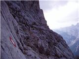 80
80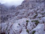 81
81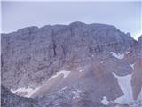 82
82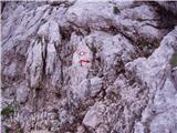 83
83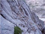 84
84 85
85 86
86 87
87 88
88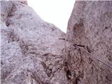 89
89 90
90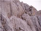 91
91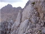 92
92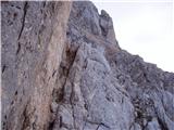 93
93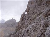 94
94 95
95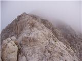 96
96 97
97 98
98 99
99 100
100 101
101 102
102