Zagorje ob Savi - Vinski vrh
Starting point: Zagorje ob Savi (250 m)
Starting point Lat/Lon: 46.13459°N 14.99603°E 
Time of walking: 1 h
Difficulty: easy unmarked way
Difficulty of skiing: no data
Altitude difference: 366 m
Altitude difference (by path): 370 m
Map:
Access to starting point:
From the road Ljubljana - Trbovlje, or the Štajerska highway exit Trojane, we drive to Zagorje ob Savi, where we park in one of the parking lots in town. The described path starts on road Cesta 9. avgusta at the crossroad with street Levstikova ulica.
At the starting point are located the Kulturni center Delavski dom Zagorje ob Savi, the Knjižnica Mileta Klopčiča Zagorje ob Savi, the Plesni klub KATTAN, the Okrepčevalnica Vrt, the Občina Zagorje ob Savi...
Path description:
By the beginning of the path, signs for Čemšeniška planina direct us onto street Levstikova ulica, along which we start at first gently, but when we reach the gorge, we ascend a little more steeply. We bypass the company Gip beton MTO Zagorje on the left side, then go slightly right onto the road, where the blazes continue. A little further, at the last house, the road ends, and we continue on a footpath that bypasses gardens on the left side. The path then flattens and soon joins a macadam road, which in a few steps leads us to an asphalt road that we follow to the left. The asphalt road also brings us to a crossroad in a few steps, and we continue on a footpath that bypasses the left road on the right side and then leads us by the sports airport. When we reach the next road on the other side of the meadow, we follow it to the right, ascending along it to a crossroad a few minutes away, located at the chapel, where there is also a bench for resting.
Here we go right, but just a few steps past the chapel, we turn left, then ascend through the meadow into the forest. Through the forest, we ascend diagonally to the left for a few minutes, then climb onto a ridge, where we quickly reach a smaller crossing by a religious symbol.
At the cross, we go left (straight along the marked path to Čemšeniška planina) and continue the ascent on a slightly narrower unmarked footpath, which then steeply ascends along the eastern ridge of Vinski vrh. During the ascent along the ridge, a beautiful view briefly opens up toward Zagorje ob Savi, and then the path flattens a bit and in a few minutes of further walking leads us to the indistinct, forest-covered Vinski vrh.
Description and pictures refer to the condition in January 2025.
Pictures:
 1
1 2
2 3
3 4
4 5
5 6
6 7
7 8
8 9
9 10
10 11
11 12
12 13
13 14
14 15
15 16
16 17
17 18
18 19
19 20
20 21
21 22
22 23
23 24
24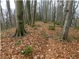 25
25