Starting point: Zazid (390 m)
Starting point Lat/Lon: 45.4994°N 13.9315°E 
Time of walking: 2 h 10 min
Difficulty: easy marked way
Difficulty of skiing: no data
Altitude difference: 61 m
Altitude difference (by path): 300 m
Map: Slovenska Istra - Čičarija, Brkini in Kras 1:50.000
Access to starting point:
From the Ljubljana–Koper highway, take the Črni Kal exit. From Črni Kal, continue driving on the old road towards the sea, but drive along it only to the next somewhat larger intersection, where turn left towards the Sočerga border crossing. Drive for a short time on the mentioned road, then signs for Predloka, Loka, Bezovica, Podpeč, Zanigrad, Zazid and Rakitovec direct you left onto a somewhat narrower local road. Further on, drive to Bezovica, where at the smaller intersection in the middle of the village continue left towards Podpeč. Further, drive through Podpeč (the road through the mentioned settlement is very narrow) to the village Zazid, where park on the parking lot by the sports field.
Path description:
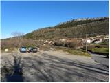
We start at the sports field, where we first walk between the sports field and some sort of small grandstand. On the other side of the field the path goes among bushes, through which it starts to ascend lightly. After a few minutes of ascent through bushes we step on a macadam road, on which we continue the ascent, and from there a nice view opens up on Jampršnik. The road quickly brings us to a small intersection, where the road branches off to the right towards the ridge of Jerebine (Jerebine is the ridge between Hrastovlje and Zazid - the highest peak of the ridge is Zazidski Brgod 443 m), and we continue straight on the road, which gradually starts descending. The road quickly flattens, and then continues by ample pastures. A little further, the road turns slightly to the right and crosses a grazing fence, and right on this spot we leave it and continue straight on a marked cart track. We continue on a moderately ascending cart track, to which a little ahead also joins a marked path from Slavnik, Ž.P. Zazid and the path from the starting point Martin dol. Here we go straight as well and continue the ascent in the direction of Lačna. A little further, with good visibility a view opens up on the Alps, and the path after that descends and joins a wider cart track. When we step on the mentioned cart track we continue left, and along it in less than 10 minutes we ascend to a panoramic ridge, only a few meters west from the peak Veliki Gradež.
Here a short pathless approach branches off to the left to the mentioned peak, and we continue straight on the marked path, which quickly descends to a poor forest road, which we reach at the marked junction. When we step on the road, we continue right (left Tri učke), and with nice views we walk to the second junction.
At the mentioned junction we continue straight in the direction of Lačna (right Kuk 1 minute) and then first gently, then for a short time more steeply descending. Lower, the path flattens, and then it slowly stops descending, or later it starts gently ascending. A little higher, the path brings us to the slopes of Krog, whose peak we bypass on the right side. The path ahead leads us through a medium-sized clearing, behind which it enters a belt of pine forest. From here a few more minutes of walking follow and the path brings us to Vrh križa.
From Vrh križa we continue on a grassy cart track, which gently descends towards the northeast. The path ahead also leads past a natural cave, then we arrive at a marked junction, where from the left also joins a marked path from Komare Valley.
From the junction we go straight and continue further on the cart track, which in a gentle ascent leads us over partly grassy slopes. After a few minutes the markers from the cart track direct us right onto a marked footpath, on which we quickly arrive at the top of Lačna.
From the top we can also ascend to the lookout tower, from which a nice view opens up towards Slavnik, Učka, Gulf of Trieste, and in good weather all the way to the Dolomites and Julian Alps.
Pictures:
 1
1 2
2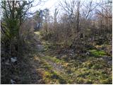 3
3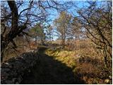 4
4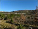 5
5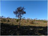 6
6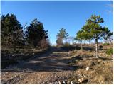 7
7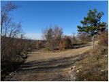 8
8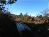 9
9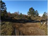 10
10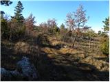 11
11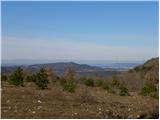 12
12 13
13 14
14 15
15 16
16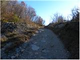 17
17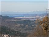 18
18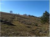 19
19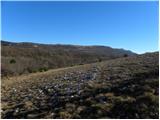 20
20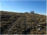 21
21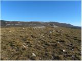 22
22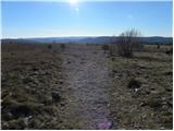 23
23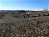 24
24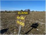 25
25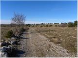 26
26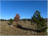 27
27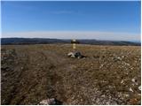 28
28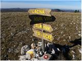 29
29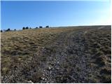 30
30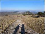 31
31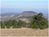 32
32 33
33 34
34 35
35 36
36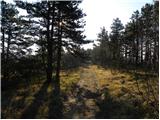 37
37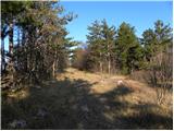 38
38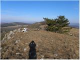 39
39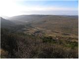 40
40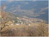 41
41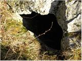 42
42 43
43 44
44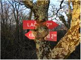 45
45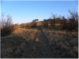 46
46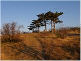 47
47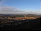 48
48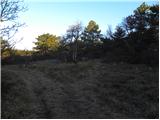 49
49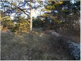 50
50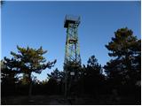 51
51 52
52