Zell-Schaida / Šajda - Obirska planina
Starting point: Zell-Schaida / Šajda (1069 m)
Starting point Lat/Lon: 46.4791°N 14.4675°E 
Time of walking: 1 h 30 min
Difficulty: easy marked way
Difficulty of skiing: demanding
Altitude difference: 203 m
Altitude difference (by path): 225 m
Map: Karavanke - osrednji del 1:50.000
Access to starting point:
A) Over the border crossing Jezerski vrh or Pavličev vrh we drive to Železna Kapla / Bad Eisenkappel, from there we continue driving left towards Šajda / Zell-Schaida. When is we get into a village Šajda / Zell-Schaida we will near the church notice the parking lot and signposts for Ojstrc / Hochobir, where we park.
B) Over the border crossing Ljubelj we drive to Austria, and the main road towards Celovec / Klagenfurt we follow to the village Podljubelj / Unterloibl, where we turn right towards the settlement Borovlje / Ferlach. From Borovlje we continue driving through the village Medborovnica / Unterferlach, Ostrovca / Ostrouza, Trata / Tratten, Glinje / Glainach, Vesca / Dörfl, Ždovlje / Seidolach, Dobrova / Dobrowa, Kočuha / Gotschuchen, Šmarjeta / St. Margarethen, Dolnja village / Niederdörfl, and then past the settlement Zgornja Vesca / Oberdörfl we descend to the stream Borovnica / Freibach. Mentioned stream we cross, and then we quickly ascend to a crossroad, where we continue right towards Borovnica dammed lake / Freibach - Stausee, Šajda / Zell - Schaida. A little above the dammed lake we leave the main road which leads towards the hamlet Sele - Pri cerkvi / Zell - Pfarre, Sele - Borovnica / Zell - Freibach and we continue driving left towards the hamlet Sele - Šajda / Zell - Schaida and mountain pass Šajda. The road which is then a little steeper ascending, we then follow to mountain pass Šajda, where on an appropriate place near the church or mountain pass we also park.
Path description:
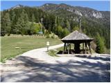
From the parking lot, we go on an asphalt road which goes towards Železna Kapla / Bad Eisenkappel. After few ten meters of walking, the footpath branches off to the left, on which we go. The path which is only slightly ascending, crosses large number of gullies, mostly through the forest. But because the path has quite a few crossings we have to carefully follow the blazes. Few minutes before the mountain pasture Obirska planina we run into an exposed passage, which is well secured and in dry does not pose a greater risk. In the snow and ice a great caution is needed. After that we step on the mountain pasture, on which we walk to the shepherd hut.
Pictures:
 1
1 2
2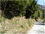 3
3 4
4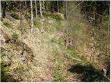 5
5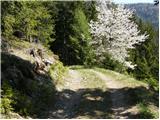 6
6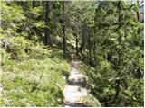 7
7 8
8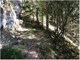 9
9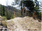 10
10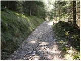 11
11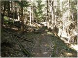 12
12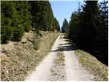 13
13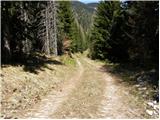 14
14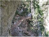 15
15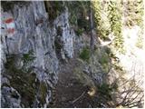 16
16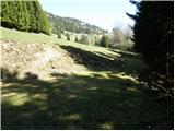 17
17 18
18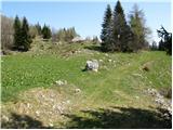 19
19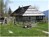 20
20