Ženavlje (memorial plaque) - Križarka
Starting point: Ženavlje (memorial plaque) (299 m)
Starting point Lat/Lon: 46.83363°N 16.17332°E 
Time of walking: 1 h 5 min
Difficulty: easy unmarked way
Difficulty of skiing: no data
Altitude difference: 114 m
Altitude difference (by path): 145 m
Map: Pomurje 1:40.000
Access to starting point:
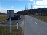
We drive to Murska Sobota, and then we continue driving towards the border crossing Hodoš. In Gornji Petrovci from a somewhat larger crossroads we continue left in the direction of the settlements Kuzma and Martinje. When we get to Šulinci, at the village fire station we leave the main road which turns right and we continue straight on a side road which on the left side bypasses the fire station. When Šulinci end we soon get to the memorial Balon, and we drive approximately 50 meters further to a marked parking lot, where we park.
Path description:
From the parking lot, we walk to the approximately 50 m distant memorial to balloonists (the balloonists were Max-a Cosyns and Nere van Elst, who on 18th August 1934 landed unplanned in Ženavlje), where we leave the main road and continue right on a side road which over a small bridge over the stream Merak brings us to a hamlet with a few houses.
In the hamlet we go slightly left on the forest road, on which we start moderately ascending through the forest, and when a little higher we step out of the forest, we go right and continue on a cart track which leads us between the field on the left and the forest on the right. The cart track soon returns into a pleasant pine forest through which we ascend gently to moderately. We follow this path to an indistinct peak, on which there stands a baroque church of St. Ana from the 16th century.
From the crossroad left from the church we continue on the left road which goes into the forest and after a few minutes brings us to a crossroad, where we join the road from Stanjevci.
We continue right and further we walk on a wider macadam road which continues with some shorter ascents and descents, and at the crossroads we continue straight. Some 10 steps before we reach the asphalt road, on the right we notice a worse footpath which then parallel with the nearby asphalt road ascends lightly to the indistinct peak of Križarka.
Izhodišče - sv. Ana 0:30, sv. Ana - Križarka 0:35.
Description and pictures refer to the condition in February 2021 and May 2022.
Pictures:
 1
1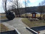 2
2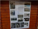 3
3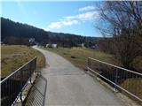 4
4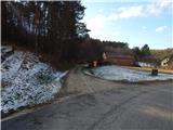 5
5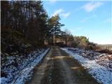 6
6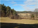 7
7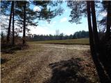 8
8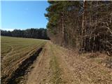 9
9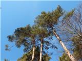 10
10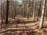 11
11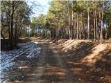 12
12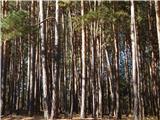 13
13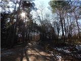 14
14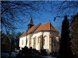 15
15 16
16 17
17 18
18 19
19 20
20 21
21 22
22 23
23 24
24 25
25