Zettersfeld - Schleinitz (Klettersteig)
Starting point: Zettersfeld (1860 m)
Starting point Lat/Lon: 46.8678°N 12.78353°E 
Path name: Klettersteig
Time of walking: 4 h 30 min
Difficulty: very difficult marked way
Ferrata: B
Difficulty of skiing: no data
Altitude difference: 1045 m
Altitude difference (by path): 1200 m
Map:
Access to starting point:
Through the Karawanks Tunnel, we drive to Austria, and then we continue driving towards Spittal and forward towards Lienz (a little after Spittal highway ends). Further, we drive on a relatively nice and wide road through Drau valley. In the center of Lienz, at the roundabout, we continue right towards the settlement Matrei. Already after few hundred metrers after the roundabout we continue sharply right and then left over a bridge towards the settlement Thurn. Further, we all the time follow green signs »Zettersfeld Zentrum«. A little before the ski center, when the road starts descending we will on the left side of the road notice a macadam road which leads towards the ski slope and is closed for traffic. By the road are also yellow signposts. We park on one of the smaller parking lots nearby. A little further on the main road there is also a larger parking lot.
Path description:
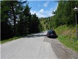
From the starting point, we go on a macadam road (path 9b) following the signs »Steinermandl«. The road which is closed for traffic is ascending towards the east and brings us on a ski slope where we soon come to a crossroad.
We continue left following the signs »Steinermandl« and we are then for some time ascending below the chairlift, which runs towards the summit Steinermandl. The road later turns left and it ascends a little steeper. From the path, we have otherwise all the time a very nice view towards Lienz Dolomites and settlement Lienz. The road then becomes less steep and leads us past a large artificial lake, which is intended for snowmaking. Here the road turns slightly to the right and it brings us to a marked crossing.
Ahead on the road leads the path towards the summit Steinermandl and the upper chairlift station. We continue left upwards on a footpath which starts ascending on a grassy slope. Higher when the slope becomes less steep we come again to a crossing.
From the right joins the path from the upper station of a chairlift, straight leads the path on the north side of the peak Goiselemandl (Goiselemandlweg Nord), and we continue left on the path 913 following the signs »Goiselemandl, Schleinitz«. Further, the path runs towards the northwest and brings us below the slopes of the peak Goiselemandl. Here we come to a crossing where the path on Goiselemandl branches off to the right. We continue straight and we cross a little steeper western slopes of the mentioned summit. When we come on the northern side of the peak the path is still crossing slopes on the left side of the ridge and on a shorter part we also get help from some steel cables. Further, the path brings us on the right (northeast) side of the ridge and starts slightly ascending. Such a path then brings us on gentle grassy slopes on which we soon get to a marked crossing.
Left leads the path towards the summit Schleinitz, and we continue right and we slightly descend to the lake, which we already see in front of us.
At the lake, we continue on a marked path which leads by the lake and soon from the right joins also the path which runs on the northern side of the peak Goiselemandl and the path from the valley Debanttal. We continue on the path following the signs »Östlicher Sattelkopf« and we start ascending on a mostly grassy terrain all the way to the ridge where there is a crossing.
At the crossing, we continue left on a secured climbing path towards the summit Schleinitz, and right on the ridge is only a short ascent to the top of Östlicher Sattelkopf. From the crossing, the path runs by the ridge and soon brings us to the first fixed safety gear with the help of which we ascend towards the ridge. The path then ascends on a secured ridge on 2697 meters high unnamed peak, from which we descend and then ascend also on the second peak in the ridge (2685m). The path most of the time runs on the ridge and difficulty on this part is graded with difficulty level A (according to a sign at the beginning of the path). Which is maybe a little too low grade because on some spots, it relatively steeply ascends by the steel cable. When we descend also from the second peak we come on a little less steep slopes on which it is possible to leave the secured path and return towards the lake Neualplseen.
Next follows an ascent on less steep ridge to the next peak, which is less steep and therefore appropriate for a rest. From here we then descend into a notch Trelebitschscharte (2663 meters). Further, the path becomes even a little more demanding and several times it steeply ascends by the steel cable. After few steep ascents path brings us to an inscription box where there is again appropriate space for a rest.
From the inscription box path becomes slightly less steep and few more times ascends by a secured ridge. In the last part, the path becomes easier and few meters below the summit from the left side joins also a normal easier path on the mountain.
We descend on the easier path past a cross and then past lakes Neualplseen back to the starting point.
Pictures:
 1
1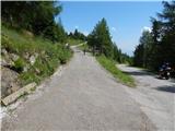 2
2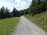 3
3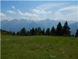 4
4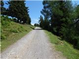 5
5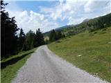 6
6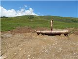 7
7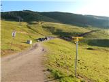 8
8 9
9 10
10 11
11 12
12 13
13 14
14 15
15 16
16 17
17 18
18 19
19 20
20 21
21 22
22 23
23 24
24 25
25 26
26 27
27 28
28 29
29 30
30 31
31 32
32 33
33 34
34 35
35 36
36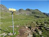 37
37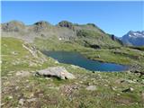 38
38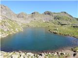 39
39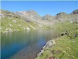 40
40 41
41 42
42 43
43 44
44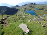 45
45 46
46 47
47 48
48 49
49 50
50 51
51 52
52 53
53 54
54 55
55 56
56 57
57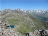 58
58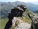 59
59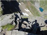 60
60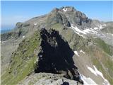 61
61 62
62 63
63 64
64 65
65 66
66 67
67 68
68 69
69 70
70 71
71 72
72 73
73 74
74 75
75 76
76 77
77 78
78 79
79 80
80 81
81 82
82 83
83 84
84 85
85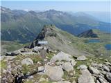 86
86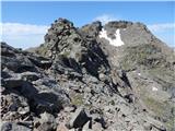 87
87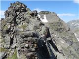 88
88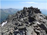 89
89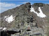 90
90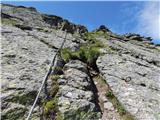 91
91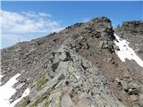 92
92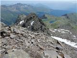 93
93 94
94 95
95 96
96