Zgornja Rečica (Maček) - Govško brdo
Starting point: Zgornja Rečica (Maček) (328 m)
Starting point Lat/Lon: 46.16755°N 15.17047°E 
Time of walking: 1 h 35 min
Difficulty: easy marked way
Difficulty of skiing: no data
Altitude difference: 483 m
Altitude difference (by path): 483 m
Map:
Access to starting point:
We drive into Laško, and then at the traffic light crossroad we drive in the direction of Spodnja Rečica. Further, Laško ends and we arrive in Spodnja Rečica, and later also in Zgornja Rečica, and we drive to the bus stop Zgornja Rečica Maček, where the described path begins. At the starting point, there aren't any parking spots.
Path description:
Near the bus stop is a recycling spot and a small crossroad, by which there are signs for Govce. We take a side road in the direction of Govce, where we first cross the stream Rečica, then ascend to the homestead Jutršek, where the road turns to the right. Over a grassy area follows an ascent to a chapel, where the road turns to the left and enters the forest. Next follows a diagonal ascent through the forest on an initially asphalt road; when the asphalt road starts descending, we turn right onto a macadam road. We continue ascending diagonally to the left on the macadam road, and at the cross, a path on a cart track from the starting point in Huda Jama joins us.
We continue on the road, and a little further, a footpath from the starting point in Huda Jama also joins us.
The path ahead passes onto the southeastern slopes of Govško brdo, where the slope becomes slightly steeper; when the slope flattens, we arrive at a small crossing. To the left, a forest road continues, which ends lower down; to the right, a less-trodden footpath continues.
Here, we can continue straight on the road, which, a little higher after a right turn, is joined by a marked path starting in Laško, or we can turn right onto a footpath that continues through the forest and returns to the road just before the hunting lodge.
When both paths merge, we leave the forest and arrive at a crossing near the hunting lodge.
At the hunting lodge the path splits, and we take the path towards Govško brdo, continuing along a poorer macadam road (slightly above the road, a path leads to the shepherd chapel). When we pass through the meadow into the forest, the poorer road splits into three branches, and we continue on the middle path, which proceeds in roughly the same direction as before. Next follows a short crossing, and then we arrive at the edge of a scenic meadow, from which a beautiful view opens towards Kum, and the path leads along the upper edge of the meadow. A little further, blazes direct us right into the forest, where we continue briefly on a gentle path, then begin steeply ascending a steep, well-trodden path. Higher up, we reach a small crossroads, from which we continue straight (a poorer footpath branches sharply to the right, leading to the shepherd chapel), and we keep ascending steeply. Further on, the path leads us past a small natural window, and upon reaching the ridge, a path joins from the right, passing the shepherd chapel and coming from the Rečica valley.
Here we veer slightly left, following the ridge path to Govško brdo, a few minutes away.
Starting point - Govce 0:45, Govce - Govško brdo 0:50.
The description refers to the condition in February 2025, while the pictures are from April 2023 and February 2025.
Pictures:
 1
1 2
2 3
3 4
4 5
5 6
6 7
7 8
8 9
9 10
10 11
11 12
12 13
13 14
14 15
15 16
16 17
17 18
18 19
19 20
20 21
21 22
22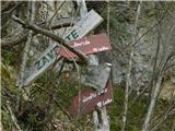 23
23 24
24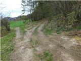 25
25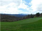 26
26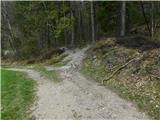 27
27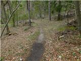 28
28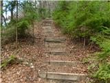 29
29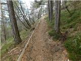 30
30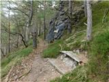 31
31 32
32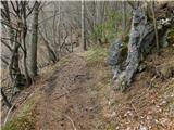 33
33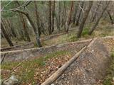 34
34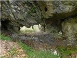 35
35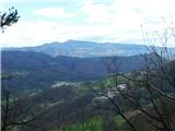 36
36 37
37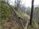 38
38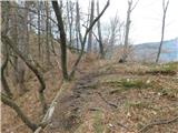 39
39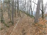 40
40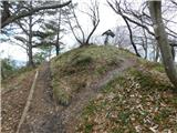 41
41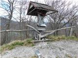 42
42