Zgornje Jezersko - Roblekova planina
Starting point: Zgornje Jezersko (880 m)
Starting point Lat/Lon: 46.3952°N 14.4986°E 
Time of walking: 1 h 40 min
Difficulty: easy unmarked way
Difficulty of skiing: no data
Altitude difference: 404 m
Altitude difference (by path): 450 m
Map: Karavanke - osrednji del 1:50.000
Access to starting point:
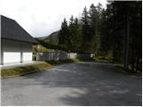
From highway Ljubljana - Jesenice we go to the exit Kranj - vzhod and follow the road ahead in the direction of Jezersko. In Zgornje Jezersko, at the crossroad at the gas station, we turn left towards the church of St. Ožbolt in Jezersko (straight border crossing Jezersko). Further, we drive past the hotel Planinka, and we follow the road to the near church of St. Ožbolt. We park near the church, or a little lower on the settled parking lot by the cemetery.
Path description:
From the parking lot, we at first walk to the church of St. Ožbolt and to the nearby presbytery, and from there we continue on a marked hiking path towards Virnikov Grintovec. The path at first leads by the edge of panoramic pasture, from where a nice view opens up on Grintovci and Zgornje Jezersko, the path quickly passes into the forest, where it soon crosses the first stream. Further path ascends a little steeper and in few minutes it brings us to the second stream. Here we continue left, we cross the stream and we ascend past sheep stable to a nearby road which we reach right at its end at homestead Žmitek.
We continue straight upwards on at first a steep footpath which is ascending through the forest. The path ahead gradually flattens and it is further ascending diagonally towards the right. A little higher we reach an old cart track, on which we ascend to a smaller saddle between Žmitkov špic (on maps Olipov rob) on the left and Žmitkov vrh on the right.
Here short unmarked path on Žmitkov špic branches off to the left, and we continue right and the cart track, from which a nice view opens up on Virnikov Grintovec we follow to a nearby road which we reach right at its end.
When we reach the end of the road, signpost for Virnikov Grintovec pointing left on the road, and we continue straight on an unmarked cart track which starts ascending through the forest. At first easy to follow cart track is becoming more and more grassy and higher it turns a little to the right, where it ends. From the end of the cart track, we continue on a less beaten footpath which ascends diagonally towards the right, and it quickly brings us on an indistinct ridge, where it turns to the left and after few steps it brings us to a crossing of several cart tracks. We go again straight and continue on a cart track which starts descending steeper. After a good 5 minutes of descent we reach the forest road which we follow to the left. On the road, we are moderately ascending, and higher it leads on quite panoramic slopes, from which a nice view opens up on the highest peaks of Kamnik Savinja Alps. Higher, the road flattens and it brings us on the border ridge. When the road passes on the Austrian side we leave it and we continue slightly right on easy to follow path which continues on the border ridge. We continue on a gentle ridge, on which we walk to the near Roblekova planina, which we reach after 5 minutes of additional walking.
Pictures:
 1
1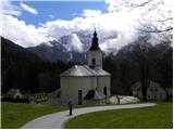 2
2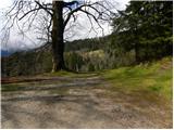 3
3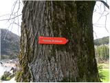 4
4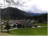 5
5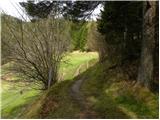 6
6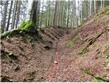 7
7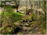 8
8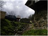 9
9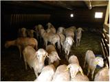 10
10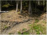 11
11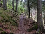 12
12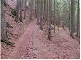 13
13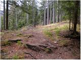 14
14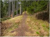 15
15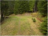 16
16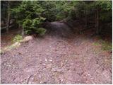 17
17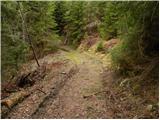 18
18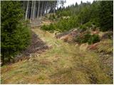 19
19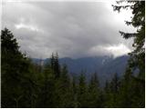 20
20 21
21 22
22 23
23 24
24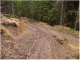 25
25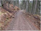 26
26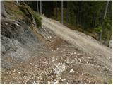 27
27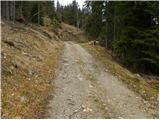 28
28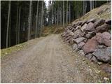 29
29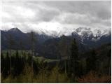 30
30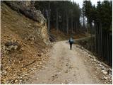 31
31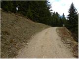 32
32 33
33 34
34 35
35 36
36 37
37 38
38 39
39