Zgornje Poljčane - Boč (via Baba)
Starting point: Zgornje Poljčane (360 m)
Starting point Lat/Lon: 46.2971°N 15.5834°E 
Path name: via Baba
Time of walking: 1 h 45 min
Difficulty: easy marked way
Difficulty of skiing: partly demanding
Altitude difference: 618 m
Altitude difference (by path): 618 m
Map: Posavsko hribovje (Boč - Bohor) 1:50.000
Access to starting point:
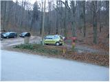
From the highway Ljubljana - Maribor, we head to the exit Slovenske Konjice and Poljčane. At the first intersection after leaving the highway, we continue left in the direction of Poljčane (right Slovenske Konjice). The road then takes us through Draža vas, Žiče and Loče. In the village Loče we come to a roundabout, where we continue "straight" in the direction of Poljčane (the exit from the roundabout is not marked). A little further on, the road brings us to a larger intersection, where we continue right in the direction of Zgornje Poljčane (left Poljčane). We follow this road to the village, where the road sign for Boč directs us left upwards. We then drive to the first hiking signposts beside which there is a parking lot where we park.
Path description:
From the parking lot, we continue right on the path in the direction of the mountain hut Dom na Boču over Babe. The path which runs through the forest already starts relatively steeply ascending and after approximately 15 minutes of ascent crosses a road. The steepness of the path after a further few minutes of ascent decreases. Next follows a shorter crossing of the slopes on a wide path, and then the path for a short time moderately ascends. A little higher, the path brings us on a wide cart track which we follow to the right and then we soon leave it. Further, blazes point us to the left upwards. After initial few steep meters from the spot when we left the cart track, the path barely ascends to the spot when it brings us to the road. Further follows a 5-minute walk on the road that runs in the middle of a large meadow to the mountain hut, which is situated on the other side of the extensive meadow.
From the hut, we continue straight on the path in the direction of Boč. The path at first crosses the meadow and then goes into the forest, where it soon brings us on a cart track, where we have two options to continue, which are approximately equally long. We continue right in the direction of the shady path Senčna pot. After a few steps of easy walking on the cart track, a marked footpath branches off to the left upwards, that in some parts starts relatively steeply ascending (straight ahead the cart track brings us to the road).
The path which all the way to the top runs through the forest after 45 minutes of walking from the mountain hut brings us to Boč. Here the ascent does not end yet. In front of us we see a 20 m high lookout tower on which we ascend via steep stairs. The ascent to the top of the tower rewards us with a nice view.
Pictures:
 1
1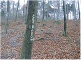 2
2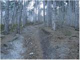 3
3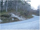 4
4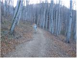 5
5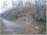 6
6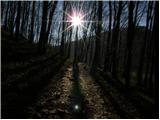 7
7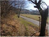 8
8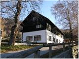 9
9 10
10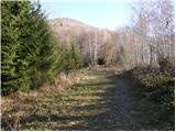 11
11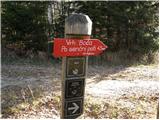 12
12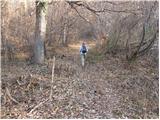 13
13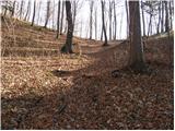 14
14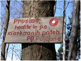 15
15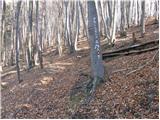 16
16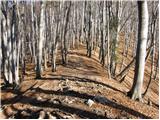 17
17 18
18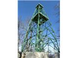 19
19