Zgornje Poljčane - Boč (via Balunjača)
Starting point: Zgornje Poljčane (360 m)
Starting point Lat/Lon: 46.2971°N 15.5834°E 
Path name: via Balunjača
Time of walking: 1 h 35 min
Difficulty: easy marked way
Difficulty of skiing: demanding
Altitude difference: 618 m
Altitude difference (by path): 618 m
Map: Posavsko hribovje (Boč - Bohor) 1:50.000
Access to starting point:
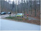
From highway Ljubljana - Maribor we go to the exit Slovenske Konjice and Poljčane. In the first crossroad from the spot, when we left the highway, we continue left in the direction of Poljčane (right Slovenske Konjice). The road then runs through Draža vas, Žiče and Loče. In the village Loče we come to a roundabout, where we continue "straight" in the direction of Poljčane (exit from the roundabout isn't marked). A little further, the road brings us on a bigger crossroad, where we continue right in the direction of Zgornje Poljčane (left Poljčane). We follow this road to the village, where the road sign for Boč points left upwards. Further, we drive to first signposts by which there is a parking lot on which we park.
Path description:
From the parking lot, we continue on forest learning path, which at first runs on a cart track and is ascending on the bottom of the small valley. After a good 10 minutes of walking, the path crosses a road and continues to ascend on small valley by which on the left side we notice feed site for animals. Cart track, which is ascending steeper at the right turn changes into a footpath which in a diagonal ascent goes away from a small valley through which we were walking. The path ahead starts steeply ascending and in few minutes brings us on a cart track which we only cross (path right goes to hut Dom na Boču).
The path ahead is moderately ascending and past a cross, which we notice by the path brings us on the next cart track. Further, we follow the cart track which is slightly ascending and after few minutes turns into a footpath. The footpath quickly starts ascending steeply and after few minutes brings us to a crossing, where we have two options to continue. The left path on which we go, is called path over Balunjača, and right steep path (both paths higher joins). The path over Balunjača then in a moderate ascent crosses slopes of Boč to rocky cliffs, which we see in front of us. After that, the path with the help of fixed safety gear crosses foot of those cliffs. The passage below the cliffs isn't difficult but it is slightly exposed to falling stones. By the foot of the cliffs we can notice some smaller cavities, which brighten up a day mainly to younger mountaineers. Further, the path steeply ascends and in few minutes brings us to the spot, where our and steep path joins again. The steepness of the path then gradually decreases and the path brings us on a cart track which is gently ascending by the military area. When we leave vicinity of military area follows only five minutes of walking on the upper still with a forest covered slope. On the summit ascent doesn't end yet. We notice in front of us 20m high lookout tower on which we ascend on steep stairs. Ascent to the top of the tower rewards us with a nice view.
Pictures:
 1
1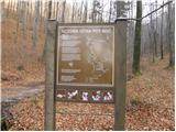 2
2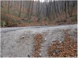 3
3 4
4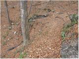 5
5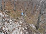 6
6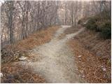 7
7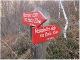 8
8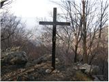 9
9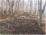 10
10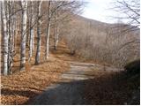 11
11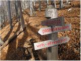 12
12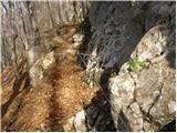 13
13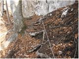 14
14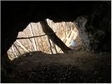 15
15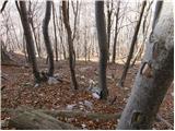 16
16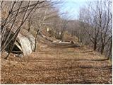 17
17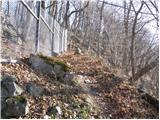 18
18 19
19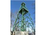 20
20