Zgornji Gabernik - Boč (over Galke in Balunjača - circular path)
Starting point: Zgornji Gabernik (301 m)
Path name: over Galke in Balunjača - circular path
Time of walking: 3 h 30 min
Difficulty: easy marked way
Difficulty of skiing: no data
Altitude difference: 677 m
Altitude difference (by path): 699 m
Map: Posavsko hribovje Boč - Bohor 1:50.000
Access to starting point:
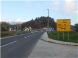
A) From highway Ljubljana - Maribor we drive to exit Dramlje and we leave the highway. We continue right in the direction of Šentjur. In Šentjur we follow the signs for Rogaška Slatina and Podčetrtek (in 3rd and 4th traffic light we turn left). The path leads us then all the time straight through the settlement Grobelno, Šentvid, Šmarje pri Jelšah, Belo, Mestinje. In Mestinje we drive straight in the direction of Rogaška Slatina until we get to Podplat. In Podplat we turn at the traffic light left in the direction of Poljčane and we drive straight on the main road until on the left side we notice car service and roadworthiness tests Strašek. We drive past service over a bridge and we immediately turn right towards Gabernik (wine road). We follow local road straight until in front of us we notice foot of Boč and 5-branched (»strange«) crossroad, where we drive straight towards grassy football field. Next to it stands signpost and picture of Boč. We got to the starting point of the path.
B) From the direction Poljčane we drive in the direction of Rogaška Slatina over Pečica and descend towards Podplat. Before car service and roadworthiness tests Strašek we turn left towards Gabernik and we follow the upper description.
Path description:
From the parking lot, we continue straight on an asphalt road and follow the signs for mountain hut Dom na Boču. Signposts take us to tourist farm Ogrizek, where the path turns right and takes us on an asphalt road uphill in the forest. The asphalt ends and macadam road brings us out of the forest to the quarry Jagodič. We go past the piles of sand through right turn, where the trail blaze points us left on a macadam road. We continue uphill on a macadam road (on the right side we are accompanied by rocks of Galke) to a holiday cottage. We follow the macadam road past a holiday cottage and then we immediately turn right steep uphill on the path by vineyard. We ascend to the highest holiday cottage, we cross the access road and we continue on a steep hill upwards in the forest. We follow marked mountain path and after 5 minutes on the right side in a wall we notice Mary's chapel. We continue to the vantage point, where we can see our starting point. The path continues to ascend straight to a nice panoramic »rock«, where there is a nice view above entire valley of Gabernik and good point to take photos. We continue uphill and after approx. 15 minutes we get to the top of rocks of Galke. The path from Pečica joins. One third of the path is behind us.
We continue straight gently uphill on forest ridge, which after approx. 200 meters brings us to a crossroad, where we turn right on flat path (path straight leads to the top of smaller hill). We continue on a nicely routed crossing, where we get to a bench with a nice view. After a shorter stop we continue on a nicely routed path and after approx. 20 minutes, the path widens and brings us out of the forest at hunting lodge on Boč. By the path there's more marks for forest teaching trail. We continue in the direction of the mountain hut Dom na Boču past protected site of greater pasque flower. After approx. 15 minutes we get to the mountain hut Dom na Boču.
From the mountain hut Dom na Boču we continue straight on a meadow on tree-lined path to partisan monument above the hut. At the monument, we go left towards spruce forest, where a nice path brings us to a smaller wooden cottage. Above the wooden cottage path splits straight and left. We continue straight and after few meters of steep ascent we come on a macadam road, where we turn left. We follow the road, where from the left side joins the path from Poljčane. The road soon ends and starts last third part of the path to the top.
On at first steep part of winding path we get to a signpost, where we have two options to continue. The left path on which we go, is called path over Balunjača, and right steep path (both paths higher joins). The path over Balunjača then in a moderate ascent crosses slopes of Boč to rocky cliffs, which we see in front of us. After that, the path with the help of fixed safety gear crosses foot of those cliffs. The passage below the cliffs isn't difficult but it is slightly exposed to falling stones. By the foot of the cliffs we can notice some smaller cavities, which brighten up a day mainly to younger mountaineers. Further, the path steeply ascends and in few minutes brings us to the spot, where our and steep path joins again. The steepness of the path then gradually decreases and the path brings us on a cart track which is gently ascending by the military area below transmitter. When we leave vicinity of military area follows only five minutes of walking on the upper still with a forest covered slope. On the summit ascent doesn't end yet. We notice in front of us 20 meters high lookout tower on which we ascend on steep stairs. Ascent to the top of the tower rewards us with a nice view.
We will return on circular less steep path. From the tower we continue forward on vegetated slope in the opposite direction, as we came up or in the direction of Donačka gora. After 5 minutes of walking on a ridge path branches off right and on winding path we descend to the mountain hut Dom na Boču. From the mountain hut Dom na Boču we go back towards site of greater pasque flower, where we turn left on a macadam road or in the direction of the mountain hut Planinska koča Velikonočnica. We stick to the road, where at two crossings we turn right downwards until we come to a water catchment. We continue on a macadam road, where after few minutes we get to the mountain hut Velikonočnica. From Velikonočnica we continue 100 meters straight on the road and in first left turn we turn right in the forest on stairs. We continue the descent on the path which past half destroyed structure brings us to the chapel, where we can ring the bell and sit on bench. Bench offers nice views on rocks of Galke and surrounding hills and valleys. We continue downwards by the edge of a meadow, where we come to a crossing and we continue straight to holiday cottages. From holiday cottages we descend on the road to a crossroad, where we can continue straight or left. Both road bring us on same spot, the road straight is shorter. We continue straight past vineyards and we descend to access road. We continue downhill to an asphalt road which we follow until we come to the starting point, where we've parked the car.
Pictures:
 1
1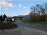 2
2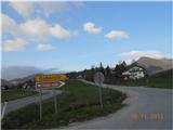 3
3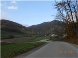 4
4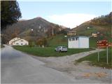 5
5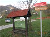 6
6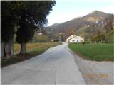 7
7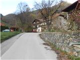 8
8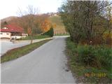 9
9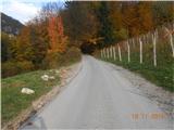 10
10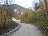 11
11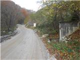 12
12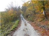 13
13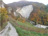 14
14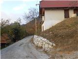 15
15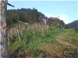 16
16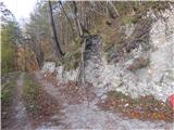 17
17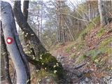 18
18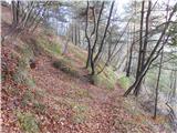 19
19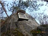 20
20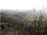 21
21 22
22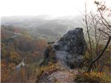 23
23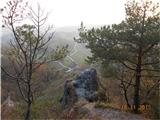 24
24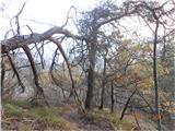 25
25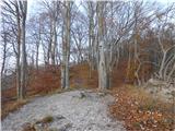 26
26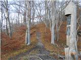 27
27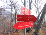 28
28 29
29 30
30 31
31 32
32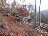 33
33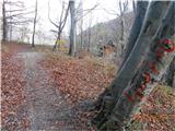 34
34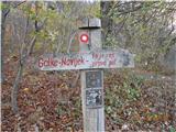 35
35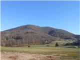 36
36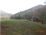 37
37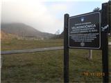 38
38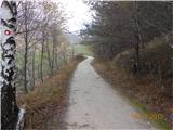 39
39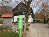 40
40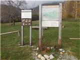 41
41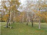 42
42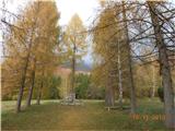 43
43 44
44 45
45 46
46 47
47 48
48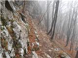 49
49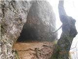 50
50 51
51 52
52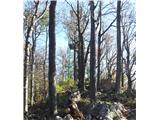 53
53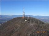 54
54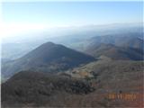 55
55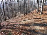 56
56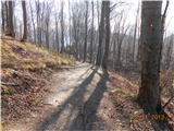 57
57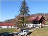 58
58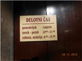 59
59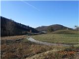 60
60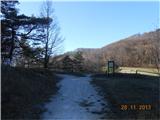 61
61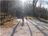 62
62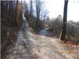 63
63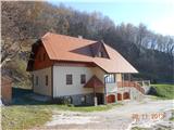 64
64 65
65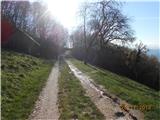 66
66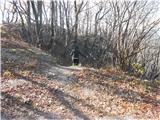 67
67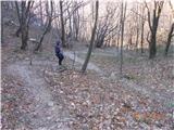 68
68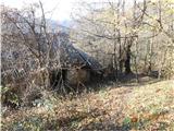 69
69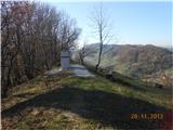 70
70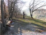 71
71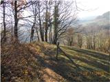 72
72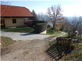 73
73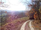 74
74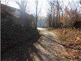 75
75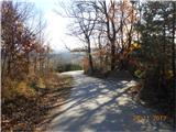 76
76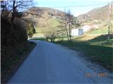 77
77