ZipLine Kanin before Planina Krnica - Vratni vrh (Military mule track on Vratni vrh)
Starting point: ZipLine Kanin before Planina Krnica (1176 m)
Starting point Lat/Lon: 46.34885°N 13.5052°E 
Path name: Military mule track on Vratni vrh
Time of walking: 2 h
Difficulty: easy marked way, partly demanding unmarked way
Difficulty of skiing: no data
Altitude difference: 807 m
Altitude difference (by path): 807 m
Map:
Access to starting point:
We get to Bovec, where we have to turn into the old part of the center and there at the roundabout we turn uphill towards Plužna and B station (B postaja). When we get to a crossing with a macadam road we turn left and we continue towards B station. When we reach it, we continue still towards the valley Krnica, where we park by the Zip line. We can drive also to the mountain pasture Krnica but at the beginning the road is bad.
Path description:
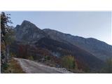
From the parking lot at the Zip line we go on the road towards the mountain pasture Krnica. Here we turn left upwards on a marked footpath towards the valley of Krnica. We continue there approx 15 minutes, and then we have to look for an unmarked footpath or a little higher mule track, which branches off right below the wall of the beginning of the ridge Vratni vrh. The mule track runs above the forest tongue. When we get to a small saddle above the forest tongue we turn left on stones and a little ahead around the corner with a steel cable. Here opens up a steep grassy valley through which runs a mule track all the way to two abysses, where the path branches off to the right for Plešivec, and between the both abysses we turn left on a grassy slope upwards towards Vratni vrh (pathless terrain with occasional cairns). We stick slightly towards the right, so that we get to the ridge right from Vratni vrh. When we ascend over a light jump, we notice the window on Vratni vrh. We continue left on a slightly exposed ridge to the cairn on the top.
Pictures:
 1
1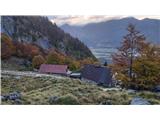 2
2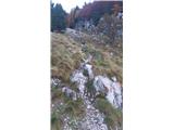 3
3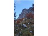 4
4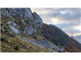 5
5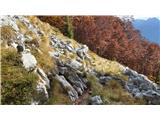 6
6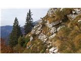 7
7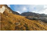 8
8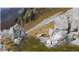 9
9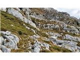 10
10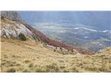 11
11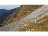 12
12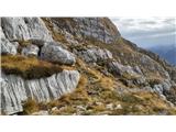 13
13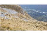 14
14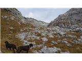 15
15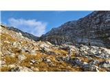 16
16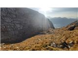 17
17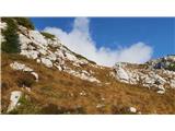 18
18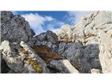 19
19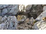 20
20 21
21 22
22 23
23 24
24 25
25