18th hairpin turn of road on Strma Reber - Bezgarska planina
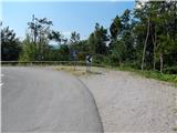
Starting point: 18th hairpin turn of road on Strma Reber (652 m)
Starting point Lat/Lon: 45.5501°N 14.7107°E 
Time of walking: 45 min
Difficulty: easy marked way
Difficulty of skiing: no data
Altitude difference: 243 m
Altitude difference (by path): 243 m
Map:
Access to starting point:
A) First, we drive to Ribnica, and then we continue driving towards Kočevje. After Dolenja vas we continue right in the direction of Grčarice, Gotenica and Kočevska Reka. In Kočevska Reka we continue right in the direction of Borovca pri Kočevski Reki, mountain pass Strma Reber and Osilnice. In Borovec we once again continue right, and then past hamlet Ravne in few kilometers we get to mountain pass Strma Reber, which is situated at an altitude 993 meters. After the mountain pass the road starts descending, and we follow it to 18th marked zig zag, where we park on an appropriate place by the hairpin turn.
B) From Kočevje we drive towards the border crossing Petrina, and then at the end of the settlement Štalcerji we continue right towards Kočevska Reka. In Kočevska Reka we continue left in the direction of Borovec pri Kočevski Reki, mountain pass Strma Reber and Osilnice. In Borovec we continue right, and then past hamlet Ravne in few kilometers we get to mountain pass Strma Reber, which is situated at an altitude 993 meters. After the mountain pass the road starts descending, and we follow it to 18th marked zig zag, where we park on an appropriate place by the hairpin turn.
C) From Osilnica or Sela pri Osilnici we continue in the direction settlements Žurge, Padovo pri Osilnici, Zgornji Čačič and mountain pass Strma Reber. Further, we drive on at first slightly winding, and higher a zig zag road which we follow to 2nd or 18th marked zig zag. We park on an appropriate place by the hairpin turn.
Path description:
From the starting point, we continue in the forest, on the path in the direction of Kočevje and Šajbnik. After few steps, we join the marked path from Osilnica, and we follow it to the right, where we start steeply ascending. Higher in a diagonal ascent we get to steep small valley, through which we continue the ascent. Further blazes from rough small valley lead left, on the path which passes to the edge of occasionally precipitous ridge. We continue the ascent on occasionally a little more overgrown path, which avoids precipices a little to the right, and occasionally some view opens up on surrounding hills. Few minutes higher we reach a wide cart track which we follow to the left, we walk there to the spot, where it splits into two parts.
We continue on a slightly left cart track (right cart track bypasses Bezgarska planina and leads towards the mountain pass Strma Reber), which quickly leads out of the forest on the bottom part of the mountain pasture Bezgarska planina. When we reach the mountain pasture through a meadow in a minute or two, we walk to bigger hunting observatory.
Description and pictures refer to a condition in the year 2015 (August).
Pictures:
 1
1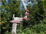 2
2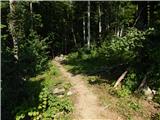 3
3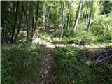 4
4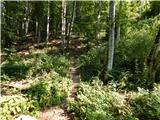 5
5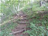 6
6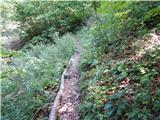 7
7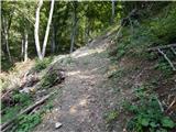 8
8 9
9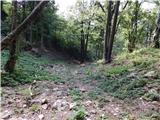 10
10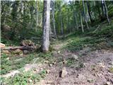 11
11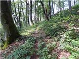 12
12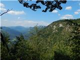 13
13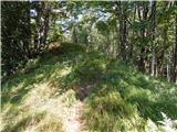 14
14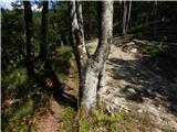 15
15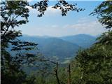 16
16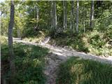 17
17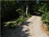 18
18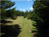 19
19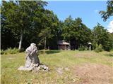 20
20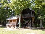 21
21