|
|
|
|
 Razor RazorAlso the two of us with the better half today on Razor. It has been waiting a long time to come on t...  Mojčin dom on Vitranc Mojčin dom on VitrancNina, 328 m ascent in a kilometer is steep, but its not extreme steepness. There are quite a few eas...
|
|
|
|
|
|
|
 Slovenian two-thousanders Slovenian two-thousandersNice, you told them, Vinko! Those who refer to prominence are looking for an excuse in them and some...  Found/Lost Found/Lost30.7.26 on the path across Škarjev rob (Storžič- Dom pod storžičem) lost pink sports sunglasses (bra...
|
|
|
New trips
 Stari trg (Pilštanj) - Veliki Javornik (Bohor) Stari trg (Pilštanj) - Veliki Javornik (Bohor)Veliki Javornik, at 1023 meters, is the highest peak of Bohor. Although the summit is unvegetated and there are no higher hills nearby, there is no view from the top as it is surrounded by dense fores... 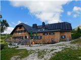 Jassing - Sonnschienhütte Jassing - SonnschienhütteThe Sonnschienhütte mountain hut stands on the extensive and picturesque Sonnschienalm alpine pastur...
|
|
|
|
|
|
|
|
|
|
|
Random trip
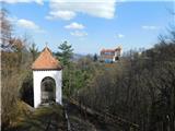 Podsreda castle Podsreda castlePodsreda Castle (original German name Hörberg or Herberch) is promoted by its operator (Kozjanski Park) as "the most castle-like among Slovenian castles". Its beginnings likely date back to the 12th century, and it certainly stood by 1213, when it was first mentioned in written sources. Throughout h...
|
|
|
|
|
|
|