Brest - Špičasti vrh (pri Žbevnici) (položna pot)
Starting point: Brest (700 m)
Starting point Lat/Lon: 45.45422°N 14.00862°E 
Path name: položna pot
Time of walking: 1 h 25 min
Difficulty: easy marked way
Difficulty of skiing: no data
Altitude difference: 257 m
Altitude difference (by path): 280 m
Map:
Access to starting point:
a) Leave the Primorska motorway at the Kastelec exit and follow the signs for Podgorje. Through the Podgorje border crossing we arrive in Croatia. We drive through Jelovice to Vodic, where we turn right. Then we drive through Dane to the next intersection, where we turn right towards Brest. The road makes a serpentine and we drive along the slope of Žbevnica. When we arrive in Brest, we park on the right side by the road at the bocce court.
b) Leave the Primorska motorway at the Črni Kal exit and continue on the old road towards the sea, but drive on it only to the next somewhat larger intersection, where we turn left towards the Sočerga border crossing (MP Sočerga). On the said road we drive past Kubed to the village of Gračišče, where at the intersection we turn left towards Rakitovec, Movraž and Smokvica. We drive through Smokvica and Movraž to the next intersection, where we turn right towards the Rakitovec border crossing (MP Rakitovec). We can also reach this point via Zazid. When we arrive in Croatia, we reach a wider road coming from Buzet, we continue left towards Brest. The winding road leads us to the village, where at the end we park on the left by the road at the bocce court.
Path description:
At the starting point, signs direct us onto a wide and initially level path into the forest. The path leads past a water intake and soon after also a concrete structure, then becomes steep. We traverse to the right and after a few minutes arrive at a technically undemanding short steep rocky section. The path is nicely routed over it, we just need to watch that we don't slip. After the rocky section we reach the Planinska koča Žbevnica hut. From the hut we continue to the forest road, which we follow to the left. Straight ahead is the steep path to Žbevnica. The forest road ascends steeply for a short time, then levels out. After about 15 minutes of mostly flat walking along the forest road, the markers direct us right onto a meadow and later back into the forest. Straight ahead towards Kavčič and Stargat. The forest road becomes narrower and starts to ascend steeply through mixed forest. Soon the forest begins to thin. After about 15 minutes we finally exit the forest onto the grassy slopes of Muzarov. The path ascends all the way to the saddle between the unnamed peak and Žbevnica, where there is a junction; continue left towards Špičasti vrh. Right to Žbevnica 5 minutes. We ascend along the ridge over the unnamed peak, after it the path descends again. The marked path follows strictly along the ridge, where the path is barely traceable, while the forest road goes slightly off the ridge and is well traceable. The path begins to ascend and soon we arrive at Muzare, from where a nice view opens in all directions.
Continue ahead along the grassy ridge, which begins to descend. The path then levels out and we arrive at a junction, where we turn onto the trail. Straight ahead path to Golič, which bypasses Špičasti vrh. The path climbs along a panoramic grassy slope and in 5 minutes we are at Špičasti vrh.
Description and photos refer to the condition in November 2024 and 2025.
Pictures:
 1
1 2
2 3
3 4
4 5
5 6
6 7
7 8
8 9
9 10
10 11
11 12
12 13
13 14
14 15
15 16
16 17
17 18
18 19
19 20
20 21
21 22
22 23
23 24
24 25
25 26
26 27
27 28
28 29
29 30
30 31
31 32
32 33
33 34
34 35
35 36
36 37
37 38
38 39
39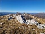 40
40 41
41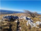 42
42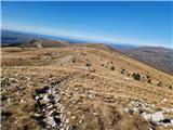 43
43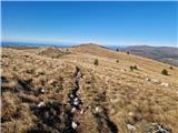 44
44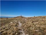 45
45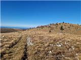 46
46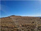 47
47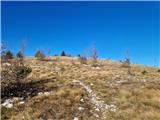 48
48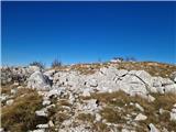 49
49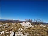 50
50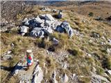 51
51 52
52