Belopeška jezera - Strug (Via della Vita - Vevnica - Strug)
Starting point: Belopeška jezera (929 m)
Starting point Lat/Lon: 46.4733°N 13.6713°E 
Path name: Via della Vita - Vevnica - Strug
Time of walking: 9 h
Difficulty: extremely difficult marked way
Difficulty of skiing: no data
Altitude difference: 1336 m
Altitude difference (by path): 1600 m
Map: Tabacco 019
Access to starting point:
From Ljubljana direction on Gorenjska highway to exit Hrušica. From there on a regional road to the border crossing Rateče and ahead few kilometers to the settlement Fužine (Fusine). Here we drive past the former factory that made chains and ahead over a bridge. Right after it there is a marked turn-off of the road (sharply left) towards lakes Belopeška jezera. On this road we continue to the upper lake, where there is a large parking lot. From Ljubljana to here we need approximately 1 hour.
Path description:
Access to ferrata: We will go in the direction of the mountain pasture Alpe Vecchia, or on shortest approach to ferrata Via de la Vita. There we will ascend towards Vevnica.
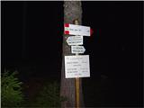
The beginning of the path and signposts we find by small inn on the edge of the parking lot. We continue past it on a nice macadam road in the direction of marks 512. We soon come to a crossing, where we continue on the right road with sign 513. This leads to the mountain pasture Tamar and continues by its left edge. Soon after the mountain pasture there is the next crossing. Here we go left. Paths number is still 513. When we start ascending uphill, we have to pay attention to turn off, where macadam path passes into a forest footpath. If we walk in dark, it can be poorly visible. The turn-off is marked on cutted trunk of a spruce just by the road (look pictures). On a forest path we are gently ascending towards the mountain pasture Alpe Vecchia and when we step out of the forest, we are at the turn-off for ferrata Via de la Vita. To here we can without a problem walk in dark (with appropriate lighting of course).
The crossing is now nicely marked and also the footpath towards ferrata Via de la Vita is well beaten. Beginning runs through a meadow and its course is clearly visible. The problem arises, when footpath turns on gravel terrain and becomes hard to follow. The path runs by the right edge, where we occasionally see red dots. We continue in the direction of a large boulder, which is located right from a rocky rib. We DO NOT turn on this ridge, even though the beaten path leads there as well. We continue past the boulder and above it we will again catch marked footpath which above the already mentioned rib turns to the left. From here on, there aren't any problems with following to the entrance in ferrata. Difficulties can be caused by crossing a snow field little before the entrance, which usually stays there entire year.
Ferrata Via de la Vita: Entrance in ferrata is a little before the beginning of the scree, on the left side. It is marked with a red dot. In the early summer here can cause problems a randkluft, which is preventing normal entrance. The beginning of the path is another story. If you will have problems already here, you shouldn't go higher. Protective steel cable is ruined and is useless. This rocky jump we easiest overcome with free climbing on the right edge. For less experienced belaying with a rope is very recommended. Higher the fixed safety gear are good. The path continues on system of ledges and crosses more rocky parts. We are ascending towards the main wall of rocky massif. The atmosphere is great, views wonderful. We are getting closer to the most interesting part of the path, unfortunately also the most exposed to falling stones, which are usually triggered by other mountaineers. This part starts with smooth rounded plate, on which we already from far see chains and iron footholds. Here we need to go. We grab the chain, we look for a good stance, we look for holds and we go …. We are already past. Be carefully with a chain. It isn't always very well attached, which we usually see only when we are past.
Continuation is even more interesting. On system of chains and stemples we are long time ascending almost vertically to distinct traverse where we turn right. Here is space for the most attractive photos. There isn't much resting. Ascents and crossings continue all the way until mountain wall breaks and we come to the scree. The most difficult part is here behind us. We follow the path and red dots to rocky slopes in the main part of the gully. On the left side, there is a faded sign Via de la Vita. We have to go past it and we start crossing unsecured rocky slope in the direction of easiest footholds. There is enough holds, and the slope isn't too exposed, so we can quickly move forward. We follow red dots, or we are ascending towards the upper left edge. There we notice metal ladder, which doesn't represent a problem, because it is entirely attached both on the bottom and top. Above it this part of Via de la Vita ends. We continue to a crossing, where right path leads to bivouac, and left on Vevnica.
Vevnica: Path on Vevnica technically isn't demanding, but is poorly visible. In fog is practically unrecognizable. Red dots are rare, so we have to look for continuation from far. Fixed safety gear are rare and are mostly in good condition. In the initial part, the path is overcoming rocky sections, and higher it passes on a ridge crossing on a crumbly gravel terrain. When we come to the saddle, it is only few minutes to the top.
Strug: From Vevnica we continue in the direction of Ponce. Beginning is easy. Ridge of Vevnica is easy passable and we quickly get to its end. Here we get to descent into notch Vevniška škrbina. For long time this was the most difficult part of the crossing of the ridge towards Strug and forward towards Ponce, because fixed safety gear were completely ruined. Years ago they renovate them and are currently in relatively good condition. On some spots are otherwise damaged (look comments of pictures), but there aren't any bigger problems. This is also only part of the path which is well secured, because further it isn't anymore. We otherwise meet remains of old fixed safety gear, which are extremely unreliable, therefore be careful when using them. After the descent into a notch it starts ridge crossing with spots, which occasionally demand climbing of 2nd grade. Red dots lead us. Sometimes are well visible, next time less. If they vanish, we went astray, so we need to return and find the continuation. The path on problematic parts always goes on the Italian side and it can run on very exposed slopes. Permanently are taking turns ascents, descends, ridges, slopes. The crossing is full of adrenaline and very interesting. When by the path, we meet stone with the caption Strug, we are practically at destination. After few 10 meters you will step on the most lonely mountain of the ridge.
Descent: There isn't any classical descent. On Strug we usually go when we are crossing the ridge from Vevnica to Ponce or in the reverse direction. In emergency we can descend towards the mountain hut Zacchi on completely unsecured path for which the signpost is few minutes ahead from Strug. This descent is really an emergency variant, because it demands even more experiences than crossing the ridge. Direction of descent is shown by rare red dots.
Pictures:
 1
1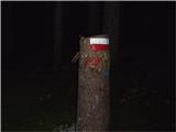 2
2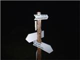 3
3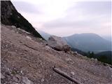 4
4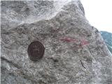 5
5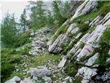 6
6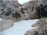 7
7 8
8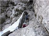 9
9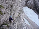 10
10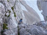 11
11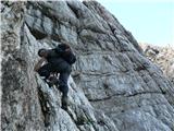 12
12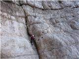 13
13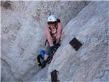 14
14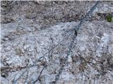 15
15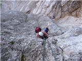 16
16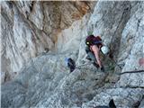 17
17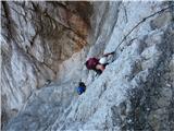 18
18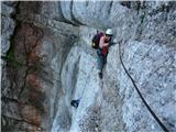 19
19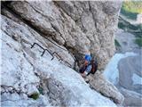 20
20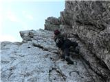 21
21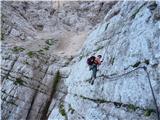 22
22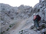 23
23 24
24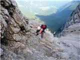 25
25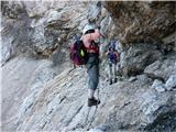 26
26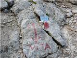 27
27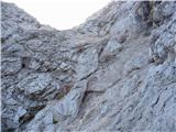 28
28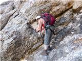 29
29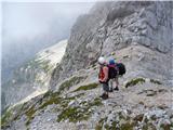 30
30 31
31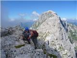 32
32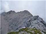 33
33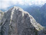 34
34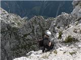 35
35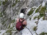 36
36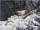 37
37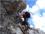 38
38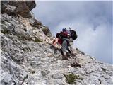 39
39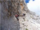 40
40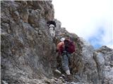 41
41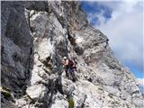 42
42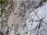 43
43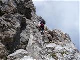 44
44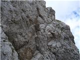 45
45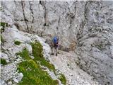 46
46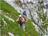 47
47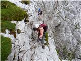 48
48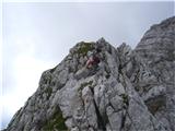 49
49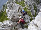 50
50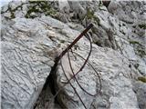 51
51 52
52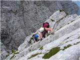 53
53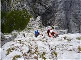 54
54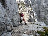 55
55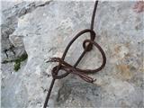 56
56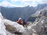 57
57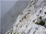 58
58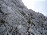 59
59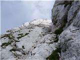 60
60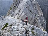 61
61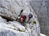 62
62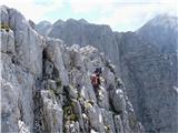 63
63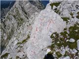 64
64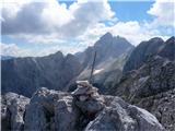 65
65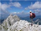 66
66