Bled (Velika Zaka) - Galetovec
Starting point: Bled (Velika Zaka) (480 m)
| Latitude/Longitude: | 46,36240°N 14,08150°E |
| |
Walking time: 3 h 35 min
Difficulty: easy unmarked way
Elevation gain: 785 m
Elevation difference along the route: 830 m
Map: TNP 1:50.000
Recommended equipment (summer):
Recommended equipment (winter): ice axe, crampons
Views: 2.430
 | 1 person like this post |
Access to starting point:
A) We leave the Gorenjska highway at the Lesce exit, then follow the signs for Bled and Bohinj. A little before the end of Bled, we leave the main road towards Bohinj and continue slightly right in the direction of the camp. After approximately 1.5 km of additional driving, we arrive at Camp Bled, where at the edge of the camp we park on a paid parking lot. The parking price is 3 eur/h (November 2019).
B) We drive to Bohinjska Bistrica, then continue driving towards Bled. At the beginning of Bled we go left in the direction of Camp Bled. After approximately 1.5 km of additional driving, we arrive at Camp Bled, where at the edge of the camp we park on a paid parking lot. The parking price is 3 eur/h (November 2019).
Route description:
From the starting point, we head onto a macadam road, alongside which there are signs for Bohinjska Bela, Stan, Rčitno and Pokljuka. Initially we walk alongside Camp Bled and the stream, then gradually approach the railway line, crossing to the other side through the underpass. After the underpass we go left, at the nearby marked junction choosing the right path towards Rčitno (straight Bohinjska Bela). A few steps further we cross the stream over the bridge, after the bridge going right where we follow the blazes. There follows a walk through the forest, while we ascend along a cart track from which a view opens onto the torrent over which in rainy periods a larger waterfall falls. Here the path turns somewhat more to the left and ascends mostly transversely. Higher up we cross the torrent stream again, where at high water levels the crossing is quite tricky, the path shortly afterwards turns right bringing us to a shorter panoramic section from which a fine view opens extending from Lake Bled to the Kamnik-Savinja Alps. There follows traversing to the right, where the blazes disappear for a while, when the cart track begins to ascend we notice them again. When somewhat higher we reach the macadam road we follow it left (right Bled by road) along which we ascend moderately. Higher we pass the trough below Križi, shortly further the path from Bohinjska Bela joins from the left.
We continue straight in the direction "Rčitno" and continue ascending the macadam road. Further the road enters a valley below Strešno brdo, when we leave the valley we move onto the slopes of Gače, from where transiently some views open onto the surrounding hills. The path ahead transiently returns to the forest, when we leave it we already reach Rčitno where some huts stand.
In the middle of the lower part of the pasture we continue left towards Bohinjska Bela and along the road which soon turns into a cart track, with moderate ascent we climb to the upper southern edge of the pasture where we continue right (straight Bohinjska Bela) past the hut into the forest. In the forest we soon notice signs for Pokljuka, while we ascend transversely to the forest road which we follow sharply left (slightly right continues the marked path towards Pokljuka).
Somewhat further a fine view opens onto Lake Bled, the road further on mainly gently to moderately ascends. When after a longer right bend the road brings us onto the meadow, we leave it still before the feeding trough and continue right onto the often quite rutted cart track. At the first cart track junction we choose the left, at the second the right branch, in both cases the wider cart track. When the cart track flattens, slightly left of the cart track we notice a path which continues parallel above the cart track. Some 10 steps further another path joins from the right which branches off the cart track somewhat further ahead, while along the path running through the forest we continue to a smaller saddle where we join another cart track along which we quickly ascend to the macadam road which we follow left. While walking along the road the marked path from Bohinjska Bela joins from the left - path over Slamniki.
Here a few steps further, just a little before the NOB memorial, straight ahead or slightly left branches the path to the few minutes distant Turn (1249 m), while we continue right along the marked path which continues along the road.
At the next junction located not far away, we leave the road and continue left along the path towards Galetovec (straight Belska planina).
The path ahead leads us along a pleasant cart track which after a few minutes we leave as the signs for Galetovec direct us left onto an initially less noticeable path which descends along the forest edge to a small valley where it enters the forest. Through the forest we follow the blazes and forest path along which in a few minutes we ascend to the panoramic summit.
Starting point - Rčitno 2:00, Rčitno - Galetovec 1:35.

Along the route: Planina Rčitno (900m)
Photos:
 1
1 2
2 3
3 4
4 5
5 6
6 7
7 8
8 9
9 10
10 11
11 12
12 13
13 14
14 15
15 16
16 17
17 18
18 19
19 20
20 21
21 22
22 23
23 24
24 25
25 26
26 27
27 28
28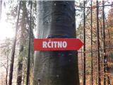 29
29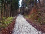 30
30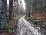 31
31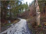 32
32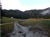 33
33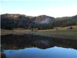 34
34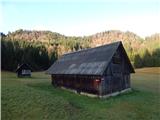 35
35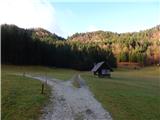 36
36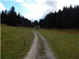 37
37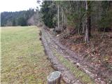 38
38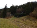 39
39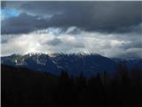 40
40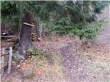 41
41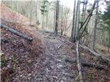 42
42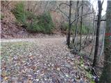 43
43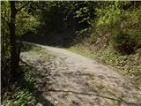 44
44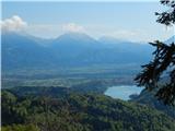 45
45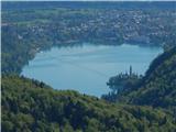 46
46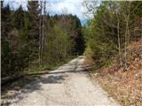 47
47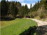 48
48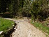 49
49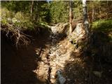 50
50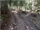 51
51 52
52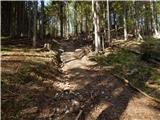 53
53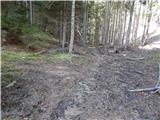 54
54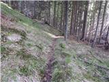 55
55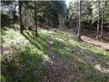 56
56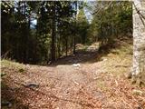 57
57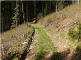 58
58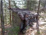 59
59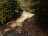 60
60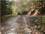 61
61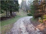 62
62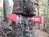 63
63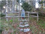 64
64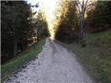 65
65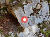 66
66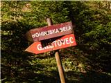 67
67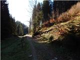 68
68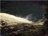 69
69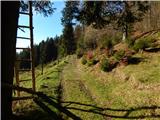 70
70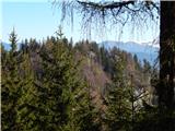 71
71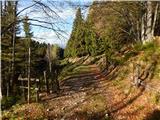 72
72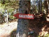 73
73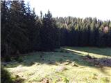 74
74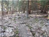 75
75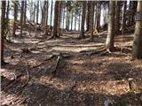 76
76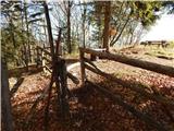 77
77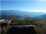 78
78 79
79
Discussion about the trip Bled (Velika Zaka) - Galetovec
|
| tango8. 03. 2025 08:58:43 |
Friday was gorgeous and just right for repeating the hike. And we didn't regret it. Paths and tracks are in good condition, here and there you need to be a bit careful as there are still some icy patches in the morning, but completely unproblematic. From Galetovec really beautiful views. On the way back we took it via Slamnike, but not to Bohinj. White snail at the junction to Planina Rtično and then standard to Zaka.
|
|
|
To post a comment you must log in:
If you do not yet have a username, you must first
register.