Bohinjska Bela (Zgornja vas) - Galetovec (east path (via Iglica))
Starting point: Bohinjska Bela (Zgornja vas) (500 m)
Starting point Lat/Lon: 46.3479°N 14.0591°E 
Path name: east path (via Iglica)
Time of walking: 2 h 30 min
Difficulty: partly demanding marked way
Difficulty of skiing: no data
Altitude difference: 765 m
Altitude difference (by path): 775 m
Map: TNP 1:50.000
Access to starting point:
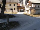
A) From highway Ljubljana - Jesenice we go to the exit Lesce, and then we follow the road towards Bled and forward towards Bohinjska Bistrica. Approximately 1 km after Bled, we get to a crossroad, where we turn right towards Bohinjska Bela. When we get to Bohinjska Bela at first we drive through the hamlet Spodnja vas, and we further follow the signs for Iglica, which take us to a hamlet Zgornja vas and a little further also to a smaller parking lot above the hamlet, which is situated at the end of the road. We can also park lower by the church of St. Marjeta, by the railway station or elsewhere on an appropriate place.
B) From Bohinjska Bistrica we drive towards Bled, and then before Bled we turn left towards Bohinjska Bela. When we get to a hamlet Zgornja vas, we follow the signs for Iglica, which brings us above the hamlet, where we park on a smaller parking lot by the end of the road. We can also park lower by the church of St. Marjeta, by the railway station or elsewhere on an appropriate place.
Path description:
From the end of the road on a cart track in few steps we ascend to the foot of climbing area. In the middle of climbing area we will notice secured path, which almost vertically ascends on narrow chimney below Iglica. The path on chimney is mostly secured with wooden ladder and a steel cable. When we step from the gully we cross a small bridge and in few steps we step to the summit of Iglica, from where a beautiful view opens up.
From the top, we return to a small bridge, and then on the other side we continue on the path, on which we quickly step out of the forest and we get to a hamlet Brezje, where we step on an asphalt road which we follow to the left, and there we quickly get above the hamlet.
From the end of hamlet we continue on the road which a little higher brings us to a crossroad, where we continue right. The road which runs through the forest, higher brings us to lower slopes of Slamniki. Here at first on the left side we bypass cottage, and then the path brings us to a crossroad, where we continue left in the direction of Galetovec and Slamniki (right mountain pasture Rčitno). The path ahead crosses a lane of a forest and then it brings us on a panoramic slope of Slamniki, on which stand few cottages. The road then goes into the forest and it brings us to the smaller crossroad, where we continue right. This road we soon leave because poorly visible blazes point us to the left in the forest. Further, we are relatively steeply ascending on ruined path (fallen trees) through the forest. When the path passes from deciduous into conifer forest also fallen trees end. Ascent ahead is much easier as among fallen trees. A little higher, the path brings us on the forest road which we follow to the left. After few minutes of walking on the road, we come to the crossroad, where we continue sharply left in the direction of Galetovec. The road, on which we walk we leave at the spot, where signs for Galetovec point us to the left through a meadow, at first downwards, after that upwards. The path then goes into the forest, where runs all the way to the last meters below the summit, from which a nice view opens up.
Pictures:
 1
1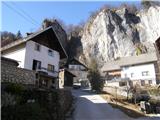 2
2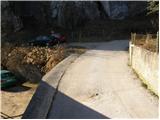 3
3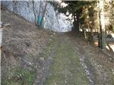 4
4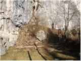 5
5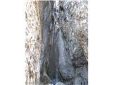 6
6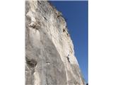 7
7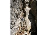 8
8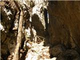 9
9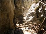 10
10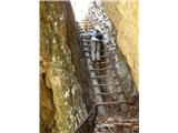 11
11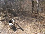 12
12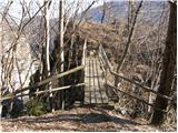 13
13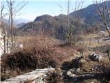 14
14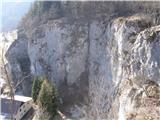 15
15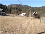 16
16 17
17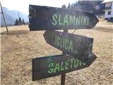 18
18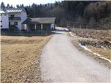 19
19 20
20 21
21 22
22 23
23 24
24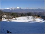 25
25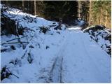 26
26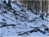 27
27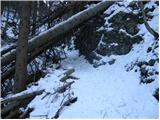 28
28 29
29 30
30 31
31 32
32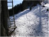 33
33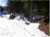 34
34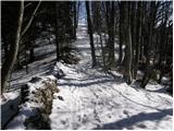 35
35 36
36