Bohinjska Bistrica - Izvir Bohinjske Bistrice
Starting point: Bohinjska Bistrica (523 m)
Starting point Lat/Lon: 46.26451°N 13.94221°E 
Time of walking: 50 min
Difficulty: easy marked way
Difficulty of skiing: no data
Altitude difference: 107 m
Altitude difference (by path): 87 m
Map: TNP 1:50.000
Access to starting point:
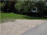
From the local road Bled - Bohinj, at the exit from Bohinjska Bistrica, at the bridge, we turn left and then drive along the stream for another kilometre to the end of the asphalt and to the signpost for the source of the Bistrica.
Path description:
From the parking lot, we continue in the direction of the sign (source of Bistrica). The path moderately ascends on a forest path and after 25 minutes of walking we come to a wider macadam road, where the path splits; we continue right, in the direction of the poorly visible sign for the source. Further on, we follow the blazes, where we come to the first waterfall, where the stream running along the road makes the path a little harder. Next, we come to the wooden bridge, which we do not cross but continue straight ahead, where signs direct us over a footbridge. Another five minutes of walking (dangerous for slipping in places) bring us to the source of Bistrica.
Pictures:
 1
1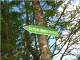 2
2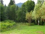 3
3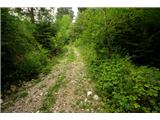 4
4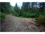 5
5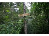 6
6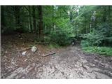 7
7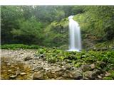 8
8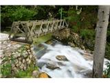 9
9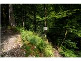 10
10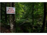 11
11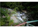 12
12 13
13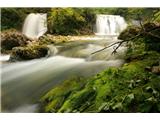 14
14