Brancljeva senožet - Županov vrh
Starting point: Brancljeva senožet (930 m)
| Latitude/Longitude: | 45,90840°N 14,45730°E |
| |
Walking time: 50 min
Difficulty: easy unmarked way
Elevation gain: 69 m
Elevation difference along the route: 150 m
Map: Ljubljana - okolica 1:50.000
Recommended equipment (summer):
Recommended equipment (winter):
Views: 3.928
 | 3 people like this post |
Access to starting point:
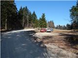
A) First, we drive to Ig, and from there we continue driving in the direction of Iška vas and Iški Vintgar. Immediately after Iška vas we will arrive in the village Iška, where the road towards Gornji Ig and Rakitna branches off sharply to the right. We head onto the mentioned ascending road, on which we drive past Gornji Ig and higher also past the turn-off of the road to Krim. A few hundred meters ahead of the turn-off for Krim we arrive at a larger meadow, where the road flattens out, and on the other side of the meadow it turns left and returns into the forest. Just a few meters before the road enters the forest, we will notice on the left side the NOB monument and by it appropriate space for parking.
B) From the highway Ljubljana - Koper we head to the exit Brezovica, and then we continue driving in the direction of Podpeč (to Podpeč we can also come from Črna vas or Ig). In Podpeč we continue in the direction of Borovnica, Krim and Rakitna and we continue driving for a short time along the edge of the Ljubljana Marshes, and then the signs for Rakitna direct us to the left onto a steep ascending road. The road then leads us through Preserje, where it also starts descending. After a short descent, we continue left in the direction of Krim and Rakitna, and we follow the mostly ascending road to a crossroad, where the road towards Krim branches off to the left. From the mentioned crossroad, we continue left, and then we continue driving on a macadam road. When after a few kilometers the road comes out of the forest onto a larger meadow, we will immediately at the beginning notice the NOB monument and by it a suitable place where we can park.
C) First, we drive to Cerknica, and then we continue driving in the direction of Begunje; when we arrive in Begunje we follow the signs for Rakitna. From Rakitna we continue driving on the main road towards the settlement Preserje, and we drive along it to the crossroad, where the road towards Krim branches off to the right. From the mentioned crossroad, we continue right, and then we continue driving on a macadam road. When after a few kilometers the road comes out of the forest onto a larger meadow, we will immediately at the beginning notice the NOB monument and by it a suitable place where we can park.
Route description:
From the starting point by the NOB monument we continue on the macadam road in the direction of Rakitna (if we have come to the starting point by the description of access b or c, then we walk in the direction from which we came). The road already after a few meters passes into the forest, through which it descends relatively gently. The road, which continues mainly towards the south, first leads us along the forested slopes of the peak Kamenica (1050 m), then turns slightly right and takes us to the slopes above Lepa dolina. Before the macadam road makes a longer right turn, the mountain signs for Rakitna direct us left onto a marked footpath, which starts to ascend through the forest. The path after a few minutes joins a forest cart track, where it also flattens. The cart track continues along an indistinct valley between Rotovc (964 m) on the left and Županov vrh (999 m) on the right. A few minutes further, the cart track splits into two parts, namely a more noticeable and marked left cart track and a less distinct right unmarked cart track.
From the mentioned junction we continue along the poorer right cart track, beside which there usually stands a small cairn. The old barely traceable cart track slightly further turns gently right and turns into an initially less traceable footpath, to which on the indistinct ridge of Županov vrh also joins a footpath from the saddle (path from Rakitna via the saddle). From here on, the footpath is easier to follow and also relatively well trodden. There follows a somewhat steeper path, which leads us through occasionally thinner forest, which, like most other forests in Slovenia, was somewhat affected by ice damage at the beginning of February 2014. A little below the summit, while we are still in the forest, the footpath splits again into two parts. We continue left over a smaller grazing fence and after a few steps we step out of the forest onto the spacious Županov vrh. The highest point is located a little before the antenna tower, which we spot when we step out of the forest; on it (the summit) stands the trigonometric point. Since the summit is spacious, we must walk a little around the summit for views in different directions.

The trip can be extended to the following destinations: Rotovc
Photos:
 1
1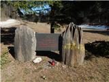 2
2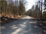 3
3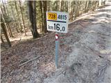 4
4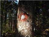 5
5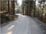 6
6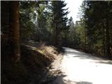 7
7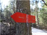 8
8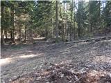 9
9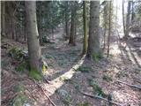 10
10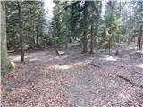 11
11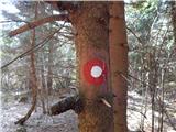 12
12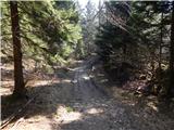 13
13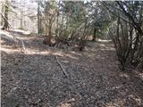 14
14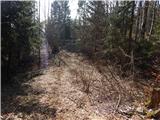 15
15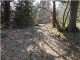 16
16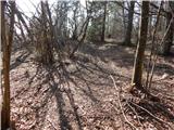 17
17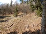 18
18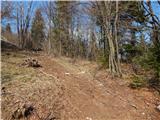 19
19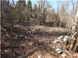 20
20 21
21 22
22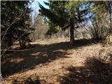 23
23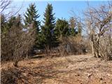 24
24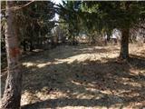 25
25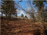 26
26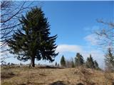 27
27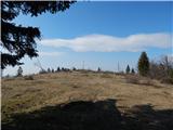 28
28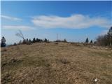 29
29 30
30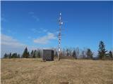 31
31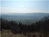 32
32
Discussion about the trip Brancljeva senožet - Županov vrh
To post a comment you must log in:
If you do not yet have a username, you must first
register.