Breg (Liški potok) - Sveti Jošt (below Lisca)
Starting point: Breg (Liški potok) (219 m)
| Latitude/Longitude: | 46,05140°N 15,24360°E |
| |
Walking time: 1 h 40 min
Difficulty: easy marked way
Elevation gain: 568 m
Elevation difference along the route: 575 m
Map:
Recommended equipment (summer):
Recommended equipment (winter): ice axe, crampons
Views: 169
 | 1 person like this post |
Access to starting point:
From the direction of Zasavje we drive towards Radeče, and then on the left bank of the river Sava, in the settlement Obrežje we leave the main road which continues over the bridge and continue on a side road in the direction of Lisca, Breg, and Loka. We continue driving through the settlements Loka pri Zidanem Mostu and Račica to the settlement Breg, where we turn left in the direction of Jurklošter and Lisca. We continue past a few more houses, and at the football field, we choose the right road, marked with signs for Lisca (left for Lovrenc), then drive approximately 350 meters to a marked parking lot, where the described path begins.
From the direction of Posavje we first drive to Boštanj, from where we head from the roundabout towards Sevnica, immediately after the bridge over the river Sava we go from the roundabout at the Lidl store "left" on the exit in the direction of Breg. We continue driving along the river Sava to the settlement Breg, where we turn sharply right in the direction of Jurklošter and Lisca. We continue past a few more houses, and at the football field, we choose the right road, marked with signs for Lisca (left for Lovrenc), then drive approximately 350 meters to a marked parking lot, where the described path begins.
Route description:
From the parking lot, we head onto a cart track that ascends to the left of the road, marked with signposts for Lisca via Razbor. After a short ascent, we leave the forest and veer slightly left from the cart track onto a footpath that initially runs parallel to the cart track, then turns more to the left. Upon reaching the edge of the forest, the path turns back to the right and soon rejoins the cart track, which we follow to an older homestead, bypassing it on the left and continuing along the marked path.
Next follows a steep ascent through the forest; higher up, the path flattens, offering occasional views of the surroundings, and leads us to the settlement of Razbor, where we notice the church of St. John the Baptist on the right side.
We continue left towards Lisca, following the blazes through the settlement and bypassing the nearby cemetery on the left side. We walk along a scenic asphalt road; after passing a chapel on the left, we veer slightly right from the asphalt road onto a parallel macadam path that leads to the houses in the settlement of Lisca, where we cross a narrower asphalt road. We continue following the signs for Lisca and ascend quite steeply across a meadow, from which a beautiful view of the village of Lisca and the surrounding hills opens up when looking back. Above the meadow, we cross a narrower asphalt road and enter the forest, where we continue a steep ascent for some time. Higher up, we reach a cart track where the path temporarily flattens; shortly after leaving it, we begin steeply ascending again. Further on, we arrive at a viewpoint with benches and a table, which is increasingly overgrown. The path then turns right and ascends diagonally along the slopes of the indistinct peak of Zlaški hrib. Higher up, we reach the ridge connecting Zlaški hrib with Lisca, where a path from the left, passing the church of St. Lovrenc, joins us. We continue straight and proceed straight at the nearby next crossing, where paths from the direction of Sevnica join from the right. Just a few steps beyond the crossing where we merge with paths from Sevnica, we arrive at the church of St. Jošt.
The starting point - Razbor 0:40, Razbor - sv. Jošt 1:00.
Description and pictures (except picture number 20, which is older) refer to the condition in May 2025.

Photos:
 1
1 2
2 3
3 4
4 5
5 6
6 7
7 8
8 9
9 10
10 11
11 12
12 13
13 14
14 15
15 16
16 17
17 18
18 19
19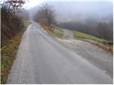 20
20 21
21 22
22 23
23 24
24 25
25 26
26 27
27 28
28 29
29 30
30 31
31 32
32 33
33 34
34 35
35
Discussion about the trip Breg (Liški potok) - Sveti Jošt (below Lisca)
To post a comment you must log in:
If you do not yet have a username, you must first
register.