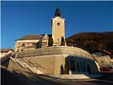
Čemšenik - Črni vrh (Čemšeniška planina)
Starting point: Čemšenik (670 m)
| Latitude/Longitude: | 46,18020°N 14,94510°E |
| |
Walking time: 1 h 30 min
Difficulty: easy marked way
Elevation gain: 534 m
Elevation difference along the route: 534 m
Map: Posavsko hribovje - zahodni del 1:50.000
Recommended equipment (summer):
Recommended equipment (winter):
Views: 40.681
 | 4 people like this post |
Access to starting point:
From the Ljubljana - Celje highway, take the Trojane exit. We then continue in the direction of Zagorje and the road takes us through the V Zideh tunnel, after which we arrive at the place where the road to the village of Šentgotard branches off to the left uphill. At the end of the village Šentgotard we come to an intersection, where we continue right in the direction of the village Čemšenik (left Prvine). The road then takes us through the village Dobrljevo, after which we arrive in Čemšenik, where we notice the mountain signposts for Čemšeniška planina by the road. Here we turn left steeply uphill and follow the road above the village, where we park on a small parking area by the road.
From Zagorje we drive through Kisovec towards Trojane. In the village Izlake we turn right (direction Čemšenik and Jesenovo) and follow the road to the intersection: left Čemšenik, right Jesenovo. Here we turn left and, when we notice the mountain signs for Čemšeniška planina by the road, we turn right steeply uphill and follow the road above the village, where we park on a small parking area by the road.
Route description:
From the church we continue towards the west, then from the nearby intersection we go right in the direction of bio jabolk. A steep ascent follows, at the end of the village at the water storage the asphalt ends. A little further, at the smaller intersection we go left; after a short ascent the signpost for Čemšeniška planina directs us right onto a marked footpath that ascends through the forest. The path then already after a few minutes crosses a cart track and a few steps further joins the forest road. We follow the moderately ascending road only briefly to the spot where the blazes direct us left onto a steep cart track. After a few metres of ascent on the cart track, we will notice a small spring on the left side of the path. The often quite muddy cart track brings us after a ten-minute ascent to a clearing, which we cross on a poorly visible path that is well visible on the other side. Here the path from Kisovec and Zagorje joins us from the right. We continue on the cart track, which makes two sharp turns and then on a smaller clearing turns into a footpath. The path ahead becomes quite steep and brings us, in a traversing ascent lasting approximately 30 minutes, to the spot where we join the path from Prvine. The path ahead runs along the edge of the steep meadows of Čemšeniška planina, from which beautiful views open up mainly towards Kum. A few minutes of walking along the edge of steep meadows follow, then we arrive at the spot where the cargo cableway crosses the mountain path. Here we carefully cross the cableway, taking care not to hit the steel cable with our head. On the other side of the cableway we already notice the mountain hut, which we reach in a few steps.
From the hut we continue ahead towards the east along the path, which first runs along the edge of steep meadows then goes into the forest. The path through the forest then ascends only slowly and brings us after 15 minutes of walking from the hut to the logbook box just a few steps below the summit.

Photos:
 1
1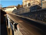 2
2 3
3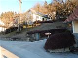 4
4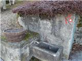 5
5 6
6 7
7 8
8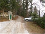 9
9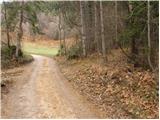 10
10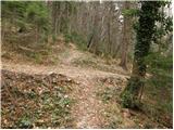 11
11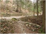 12
12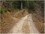 13
13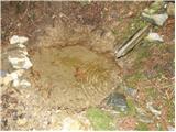 14
14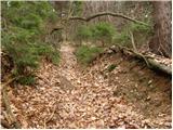 15
15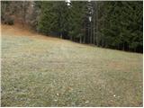 16
16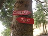 17
17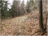 18
18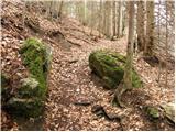 19
19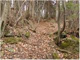 20
20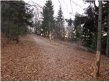 21
21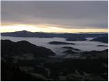 22
22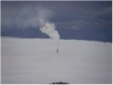 23
23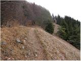 24
24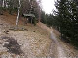 25
25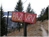 26
26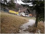 27
27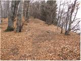 28
28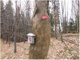 29
29 30
30
Discussion about the trip Čemšenik - Črni vrh (Čemšeniška planina)
|
| čemšeničan13. 06. 2010 |
Today I went along this path on the road leading to the church of St. Primož, when I reach the path that turns left towards Čem. plan., that's on picture 5, and further past the spring to the clearing 8.picture, soon above the spring I feel some greasy substance under my feet with a chemical smell, I continue and see that someone brought a septic tank truck to this clearing, emptied it at home and poured it straight onto the hiking trail, and also above the spring.
It was certainly a local who knows his area well, we cleaned wild dumps, we want to develop tourism in Čemšenik, show people the pristine nature of Čemšeniška planina, with such an act dear fellow citizens of Čemšenik certainly NOT.
Best regards and good luck.
|
|
|
|
| Lisica26. 03. 2011 |
Čemšeničan, I think the locals of Čemšenik don't care for 'tourism', as they directed me 2 villages back and to Prvine in the village (because I missed the little road to the top of the village). 
Today it was paradise up there for us 'čemažarje'. This path is nice and uncrowded, the path to the top takes a good hour. The stamp is in the hut and a bit further in the forest (at the wooden hut a few meters to the right along the path). This path is nice and uncrowded, the path to the top takes a good hour. The stamp is in the hut and a bit further in the forest (at the wooden hut a few meters to the right along the path).
Maybe someone could describe the path from Vransko or further to Zajčja koča?
|
|
|
|
| jprim26. 03. 2011 |
Čemažarje?
Are these wild garlic pickers? 
|
|
|
|
| rozka26. 03. 2011 |
Hi,
today we walked this path, starting from Prvine to Čemšeniška planina, continued past Črni vrh and further first along the ridge of Čemšeniška, then descent along the forest path, then we came to a wonderful meadow with a view of Krvavica. Here the path continues along the road for a while, then turns left into the forest again and after a short descent, the path to Zajčeva koča branches right, straight left directly to the top of Krvavica. I really liked the path, it's not strenuous but varied and now when everything is blooming, it's a real balm for the eyes
|
|
|
|
| čemšeničan27. 03. 2011 |
I forwarded Lisica to TD Čemšenik, but I think this person didn't mean anything intentional, that you went by car to Prvine. Most hikers to the planina choose the starting point at Prvine. For the holiday on 1st and 2nd May there are exceptionally many visitors from all over Slovenia who ask where the path or road to the planina goes. I write from personal experience as we live directly on the road a little before Čemšenik, but I will report this to PD Zagorje as well so that in the future this doesn't happen anymore. Many miss the road and drive even to the village Zaplanina all the way to the other end of the planina. Nice regards and good luck!
|
|
|
|
| krpan383. 07. 2011 |
Čemšeničan, we also ended up in Zaplanina today An additional sign would be very useful Otherwise it was a nice trip, if I ignore a bit of wind.
|
|
|
|
| pikec13. 07. 2011 |
For a family trip we also visited Čemšeniška planina
|
|
|
|
| malena6. 09. 2013 |
We also set off on 15.8.13 - not for the first time - to Čemšeniška planina. We went from the village Čemšenik (first picture of the parking lot opposite the water intake) and then followed the description. At the top, cold beer and a super platter. See you again.
|
|
|
|
| seinfeld19. 05. 2014 |
We were there on Saturday, May 10. I would like to warn that from the direction of Trojan the signs for Čemšeniška planina are not visible. You need to pay attention to the very steep asphalted road going left uphill, at the beginning of which there is a sign prohibiting trucks. Parking is possible a bit higher, opposite the signpost for the planina.
The path is steadily steep almost to the hut, with nice views to the south.
|
|
|
|
| Tbs13. 01. 2024 12:45:20 |
How about the parking at the starting point? Right in front of the church?
|
|
|
|
| bo_zl14. 01. 2024 18:57:56 |
I think you can park at the church, otherwise as written in the post above by sinfeld, in Čemšenik turn onto the narrow asphalt road between houses steeply uphill, the road loses asphalt paving, and there you can park, also at the roadside, enough space.
|
|
|
|
| Tbs15. 01. 2024 06:52:58 |
I understand, thanks. Probably there are some cars there anyway
|
|
|
|
| Tbs19. 01. 2024 17:47:25 |
Too much snow has fallen for tomorrow to go up there, right?
|
|
|
To post a comment you must log in:
If you do not yet have a username, you must first
register.