Parkirišče Kot - Planina Kot / Malga Coot
Starting point: Parkirišče Kot (1082 m)
| Latitude/Longitude: | 46,33183°N 13,42240°E |
| |
Walking time: 15 min
Difficulty: easy marked way
Elevation gain: 98 m
Elevation difference along the route: 98 m
Map: Julijske Alpe - zahodni del 1:50.000
Recommended equipment (summer):
Recommended equipment (winter):
Views: 254
 | 1 person like this post |
Access to starting point:
Through the border crossing at Rateče we drive through Trbiž / Tarvisio. If we drive on the highway, we leave it at the exit for Tablja / Pontebba. We continue driving on the old road in the direction of Videm / Udine. In the settlement Na Bili / Resiutta we turn left towards the valley of Rezija (Val Resia). Further on, we drive on a narrower asphalt road and follow the signs for the settlement Solbica / Stolvizza and then for the settlement Korito / Coritis. Along the narrow and occasionally steep road we arrive at the village of Korito. From the village of Korito we continue for approximately 3.5 km along an even slightly narrower road to the parking lot below the mountain pasture Kot / Malga Coot.
Access is also possible along a narrow and winding road through the border crossing Učja.
Route description:
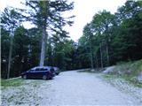
From the parking lot, we continue along the road that is closed to public traffic by a traffic sign. The stone-paved road ascends through the forest and after a few turns brings us to the beginning of Planina Kot. We continue along the ascending road that leads us past several information boards and brings us to the cottage on the mountain pasture.
Photos:
 1
1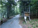 2
2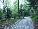 3
3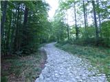 4
4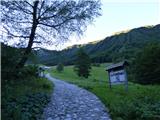 5
5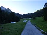 6
6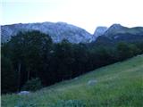 7
7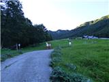 8
8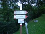 9
9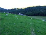 10
10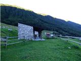 11
11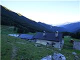 12
12
Discussion about the trip Parkirišče Kot - Planina Kot / Malga Coot
To post a comment you must log in:
If you do not yet have a username, you must first
register.