Črni Kal - Blegoš (by road, via hut)
Starting point: Črni Kal (1103 m)
| Latitude/Longitude: | 46,17240°N 14,12430°E |
| |
Route name: by road, via hut
Walking time: 1 h 30 min
Difficulty: easy marked way
Elevation gain: 459 m
Elevation difference along the route: 459 m
Map: Škofjeloško in Cerkljansko hribovje 1:50.000
Recommended equipment (summer):
Recommended equipment (winter): ice axe, crampons
Views: 191.944
 | 6 people like this post |
Access to starting point:
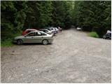
A) First, we drive to Škofja Loka, and then we continue driving towards Gorenja vas. Before we get to Gorenja vas, at the traffic-light intersection we turn right into Poljane nad Škofjo Loko, then we follow the signs for the settlement Javorje. The ascending road brings us higher into the mentioned village, after that at the next crossroads we follow the signs for Blegoš. Further, we drive on a narrower, but still asphalt road. After the settlement Gorenja Žetina the asphalt ends, and only a few minutes of a diagonal ascent separate us from Črni kal, where there is a larger parking lot and a crossroad of multiple roads.
B) From Žiri, Sovodenj or Horjul we drive to Gorenja vas, and then we continue driving towards Škofja Loka. A little after Gorenja vas, at the traffic-light intersection we turn left into Poljane nad Škofjo Loko, then we follow the signs for the settlement Javorje. The ascending road brings us higher into the mentioned village, after that at the next crossroads we follow the signs for Blegoš. Further, we drive on a narrower, but still asphalt road. After the settlement Gorenja Žetina the asphalt ends, and only a few minutes of a diagonal ascent separate us from Črni kal, where there is a larger parking lot and a crossroad of multiple roads.
C) From Železniki we drive towards Podbrdo, and then before the settlement Zali Log we turn left in the direction of Davča. At the crossroad a few hundred meters away, at the confluence of Davča and Muštrova grapa, we continue on the left road, which higher leads through the hamlet Potok, behind it, before we cross Matevžkova grapa, we continue sharply left, on the road on which we diagonally ascend to the parking lot on Črni kal.
D) From Petrovo Brdo or Sorica we descend to Podrošt, and then we continue driving towards Železniki. After the settlement Zali Log we turn right in the direction of Davča. At the crossroad a few hundred meters away, at the confluence of Davča and Muštrova grapa, we continue on the left road, which higher leads through the hamlet Potok, behind it, before we cross Matevžkova grapa, we continue sharply left, on the road on which we diagonally ascend to the parking lot on Črni kal.
Route description:
From the parking lot, we head onto the road, above which it is written "from here on we walk on foot". Right at the mentioned sign, the signs for Blegoš direct us to the right onto a wide footpath, along which in a few steps we ascend to a forest road. We follow the road to the right, and we walk along it for quite some time. After approximately half an hour of walking, we leave the road and continue the ascent on a marked footpath in the direction of the mountain hut Koča na Blegošu. The path soon approaches the road completely, then turns a little towards the left, where it starts to ascend steeper and steeper. Higher up, the path from the village Potok joins us from the right, and we continue straight on the path, which levels off somewhat, then over a grazing fence in a few minutes of additional walking brings us to the mountain hut Koča na Blegošu.
From the mountain hut, we continue on a gently sloping path, which crosses a panoramic grassy slope, after which the path goes into a short stretch of forest and ascends more steeply. After a few minutes of walking, the steepness eases and the path brings us out of the forest onto the summit unforested slopes of Blegoš. We then follow this increasingly panoramic path to the summit of Blegoš.

Photos:
 1
1 2
2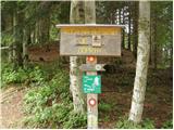 3
3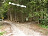 4
4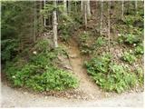 5
5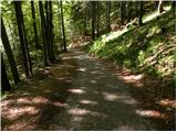 6
6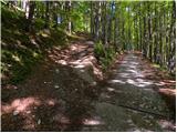 7
7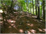 8
8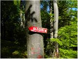 9
9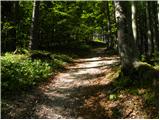 10
10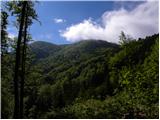 11
11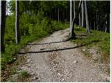 12
12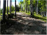 13
13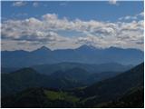 14
14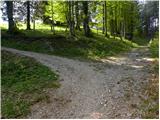 15
15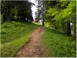 16
16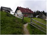 17
17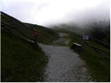 18
18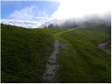 19
19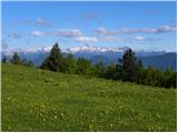 20
20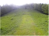 21
21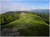 22
22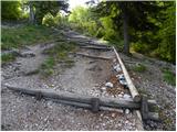 23
23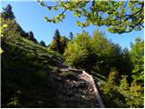 24
24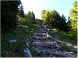 25
25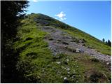 26
26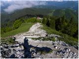 27
27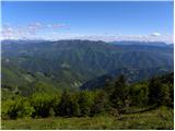 28
28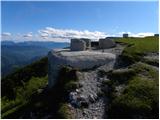 29
29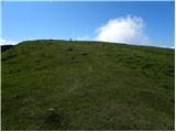 30
30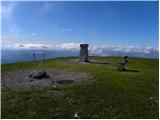 31
31 32
32
Discussion about the trip Črni Kal - Blegoš (by road, via hut)
|
| mt18. 10. 2006 |
MT-I went in the opposite direction, namely from the Č.K. hunting hut along the wide road and then right along the forest road towards the summit. From the summit I descended back towards the hunting hut with a stop at the hut on Blegoš. Wonderful effortless autumn excursion with beautiful views. Interesting to see the bunkers of the so-called Rupnik defense line.
|
|
|
|
| Damijan13. 05. 2007 |
Wonderful trip, most of the path is on a wide road, from the hut it's only about 10-15 minutes through grass to the top. Nice view, worth it!
|
|
|
|
| Lucy9. 04. 2011 |
I was also on Blegoš and I can tell you it's a great trip. You can go by road or steeply up. It's a walking mountain path that ascends gradually so it's suitable for everyone. The hut is nice and has a great location. On weekends it's very well visited but the view from the top is fantastic.
|
|
|
|
| Holcar214. 03. 2013 |
How much snow is there or will (fall) on Blegoš?
Is there enough for snowshoes or skis?
|
|
|
|
| isantl22. 04. 2015 |
Hello, I'm interested if it's possible to go from Prtovč to Ratitovec, then from Ratitovec to Blegoš, and back the same way, and how long this route takes time-wise. Regards
|
|
|
|
| serznoz23. 04. 2015 |
Prtovč is the main starting point for Ratitovec. To the summit about an hour and a half. The Selška valley separates the hills at around 400 m elevation, so a loop isn't sensible. But it makes sense to cross the valley by car. Then both hills can be summited in one day if you're fast enough and drive high enough under Blegoš. Check the map, it'll be clear.
|
|
|
|
| nusa23. 04. 2015 |
A few years ago I started from Črni Kal to Blegoš, continued to Porezen, descended to Petrovo Brdo, ascended to Soriška planina, then to Ratitovec and to Prtovč. That's about 10-12 hours of hiking.
|
|
|
|
| sirt123. 04. 2015 |
Shortest variant:
Zali log 522m -> Ratitovec 1667m -> Zali log 522m -> Blegoš 1562m <- Zali log 522m!
|
|
|
To post a comment you must log in:
If you do not yet have a username, you must first
register.