Daruvar - Petrov vrh above Daruvar
Starting point: Daruvar (175 m)
Walking time: 2 h 20 min
Difficulty: easy marked way
Elevation gain: 439 m
Elevation difference along the route: 500 m
Map:
Recommended equipment (summer):
Recommended equipment (winter):
Views: 187
 | 1 person like this post |
Access to starting point:
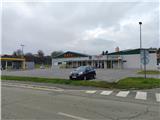
We leave the Zagreb-Slavonski Brod highway at the Novska, Jasenovac exit. We drive to Novska, from where we continue in the direction of Lipik, Pakrac. In Pakrac we go in the direction of Daruvar and then follow the signs for the center of the settlement; the railway station is the official beginning of the path, but for parking, it is better to turn right at the next intersection across the railway track to the gas station and the company KTC, where there is a parking lot by the street Krste Frankopana.
Route description:
From the gas station and market KTC we go east to the second crossing where we turn upwards into Vinogradska Street. When the road turns back to the east, we will notice the first blazes.
A little further from the first blazes, we come to a crossing with a stone crucifix. Here we go right among the vineyards, after some walking, we again reach an asphalt road, and we continue walking through the settlement Vinogradi towards the east.
After the last houses, we pass into the forest, the turn-off is poorly marked, many mountaineers leave their vehicle here and start the path a little higher (even if we continue on the asphalt road, we reach the destination, as it is the transport road for the mountain hut).
The path ahead is for some time gentle, then it starts moderately ascending. After a short ascent, we continue parallel with the road for some time, and when we get very close to the road, the path turns sharply left and begins descending for a while. Next follows approximately 10 minutes of descent, and we lose about 70 meters of altitude. When the descent ends, we reach a more interesting and demanding part of the path, the ascent to the cliff and viewpoint Vranjevina.
The path ahead turns to the south and ascends quite steeply to the upper part of the cliff, where constructed stairs assist us, though a steel cable would also be helpful, but unfortunately, there is none. At the top of the cliff, we are rewarded with a view to the north, and just beyond the viewpoint, there is an arranged resting place.
Next follows another steep part of the path, but higher up, the steepness decreases, and we return to an asphalt road, which we follow to the left.
We continue on the road for some time, and after a small saddle, we descend slightly again. Further on, we temporarily leave the road and return to it through the forest, then descend again, with blazes on this part being quite rare. By the lone pine at the end of the descent, we return into the forest.
Next follows some walking through low and dense forest, and later we cross the road once again and continue through the forest, but only for a short time. When we reach the road again, we walk along it to the mountain hut.
From the mountain hut, it is ten more minutes of ascent to the top. The path ahead becomes increasingly steep, and some climb to the summit also via the ski path.
The view from the peak is limited to the north and is increasingly overgrown by the forest. The inscription book is in the mountain hut.

Photos:
 1
1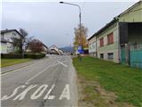 2
2 3
3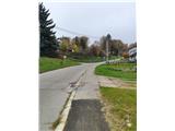 4
4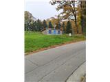 5
5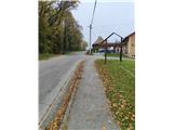 6
6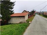 7
7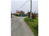 8
8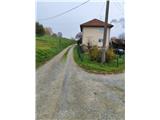 9
9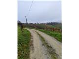 10
10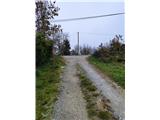 11
11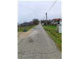 12
12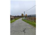 13
13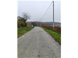 14
14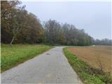 15
15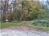 16
16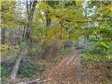 17
17 18
18 19
19 20
20 21
21 22
22 23
23 24
24 25
25 26
26 27
27 28
28 29
29 30
30 31
31 32
32 33
33 34
34 35
35 36
36 37
37 38
38 39
39 40
40 41
41 42
42 43
43 44
44 45
45 46
46 47
47 48
48 49
49 50
50 51
51 52
52 53
53 54
54 55
55 56
56 57
57 58
58 59
59 60
60 61
61 62
62 63
63 64
64 65
65
Discussion about the trip Daruvar - Petrov vrh above Daruvar
To post a comment you must log in:
If you do not yet have a username, you must first
register.