Delnice - Veliki Drgomalj
Starting point: Delnice (720 m)
Walking time: 1 h 15 min
Difficulty: easy marked way
Elevation gain: 434 m
Elevation difference along the route: 434 m
Map:
Recommended equipment (summer):
Recommended equipment (winter):
Views: 8.093
 | 3 people like this post |
Access to starting point:
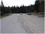
Over the border crossing Petrina we drive to Delnice, where behind the church (in the center of Delnice) we turn right and follow the road ahead in the direction of Drgomalj. The road along which we notice the blazes soon leads us to a large parking lot in front of the military barracks.
Route description:
From the parking lot, we continue on the right road, which in a gentle ascent passes military barracks and after 15 minutes of walking brings us to the next crossroad, where we continue on the left road in the direction towards Drgomalj. The road then starts ascending more steeply and quickly brings us to a spot where a marked footpath turns right onto a cart track (the turn-off is marked). We continue the ascent on the cart track, which ascends moderately and gradually becomes worse. After slightly less than an hour of walking, the cart track finally turns into a footpath, which then crosses several clearings. Next, the path leads us out of the forest, and in front of us, we see the peak, which we reach in a few steps.
Photos:
 1
1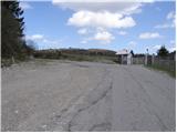 2
2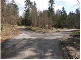 3
3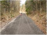 4
4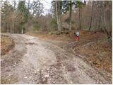 5
5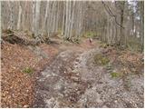 6
6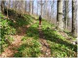 7
7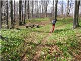 8
8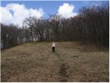 9
9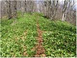 10
10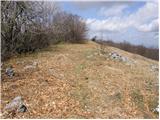 11
11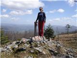 12
12
Discussion about the trip Delnice - Veliki Drgomalj
|
| lojzek1. 07. 2013 |
For STATEHOOD DAY we were on Veliki Drgomalj, beautiful. The trail is exceptionally easy, but that's exactly what we needed, peace, forest freshness, silence and at the end beautiful views of the hills in the distance.
IMPORTANT:
On the trail before the summit we found reading glasses and took them to PETEHOVAC. They can be picked up at the reception of the excursion home.

ŠIMI
|
|
|
To post a comment you must log in:
If you do not yet have a username, you must first
register.