Dobra / Neuhaus am Klausenbach - Castle Dobra / Burgruine Neuhaus am Klausenbach
Starting point: Dobra / Neuhaus am Klausenbach (318 m)
Starting point Lat/Lon: 46.86932°N 16.02926°E 
Time of walking: 10 min
Difficulty: easy marked way
Difficulty of skiing: no data
Altitude difference: 37 m
Altitude difference (by path): 37 m
Map:
Access to starting point:
We drive to Rogašovci, and then we continue driving in the direction of Kuzma. When we get to Sotina, we turn left in the direction of the settlement Strgarjevo / Kalch. After crossing the national border, we turn right and then drive to the settlement Dobra / Neuhaus am Klausenbach, where in the center of the settlement, we turn left towards the Catholic and Evangelical church. Next follows a short, quite steep ascent, and then we park in a parking lot at the edge of the forest.
Path description:
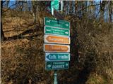
From the parking lot, we head left toward the Catholic church of St. Štefan (to the right is castle Tabor / Schloss Tabor and Neuhaus am Klausenbach) and bypass it on the upper side. Soon, signs for the castle ruins / Burgruine and the Catholic cemetery / Katholischer Friedhof direct us sharply right onto a narrower asphalt road, which leads us in a few minutes to the mentioned cemetery, where the footpath turns left. We continue on the macadam road through the forest, which first turns right and then begins to curve semicircularly toward the left. Higher up, we reach two newer cottages, where we turn left, and after a short set of stairs, we arrive at the interior of the ruins. From there, we can ascend steep stairs to a viewing platform, where a beautiful view opens up.
Description and pictures refer to conditions in January 2024.
Pictures:
 1
1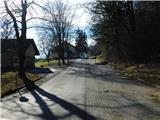 2
2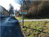 3
3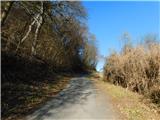 4
4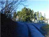 5
5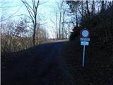 6
6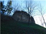 7
7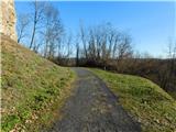 8
8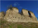 9
9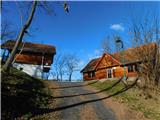 10
10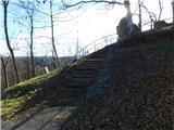 11
11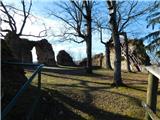 12
12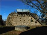 13
13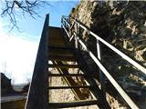 14
14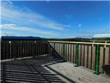 15
15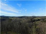 16
16