Dobra / Neuhaus am Klausenbach - Schloss Tabor in Neuhaus am Klausenbach (via Pfaffenriegel)
Starting point: Dobra / Neuhaus am Klausenbach (318 m)
Starting point Lat/Lon: 46.86932°N 16.02926°E 
Path name: via Pfaffenriegel
Time of walking: 40 min
Difficulty: easy marked way
Difficulty of skiing: no data
Altitude difference: 62 m
Altitude difference (by path): 80 m
Map:
Access to starting point:
We drive to Rogašovci, and then we continue driving in the direction of Kuzma. When we get to Sotina, we turn left in the direction of the settlement Strgarjevo / Kalch. After crossing the national border, we turn right and then drive to the settlement Dobra / Neuhaus am Klausenbach, where in the center of the settlement, we turn left towards the Catholic and Evangelical church. Next follows a short, quite steep ascent, and then we park in a parking lot at the edge of the forest.
Path description:
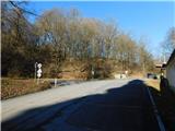
From the parking lot, we go right in the direction of castle Tabor / Schloss Tabor and Neuhaus am Klausenbach (left castle Dobra / Burgruine Neuhaus am Klausenbach) and bypass the nearby evangelical church on its upper left side. The path ahead leads us along an asphalt road, which a little further runs along the lower side of the evangelical cemetery, then guides us through a strip of forest. When we leave the forest, the path takes us past an orchard and a pasture, and upon reaching a marked crossroad, we turn left toward castle Tabor. The path ahead leads us past a few more houses and the fairytale forest Märchenwald Mühlgraben.
Further along, the path continues past occasional houses, and higher up, we arrive at castle Tabor.
Description and pictures refer to conditions in January 2024.
Pictures:
 1
1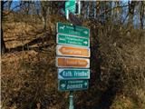 2
2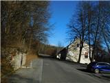 3
3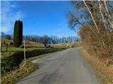 4
4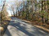 5
5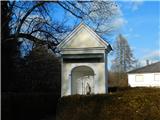 6
6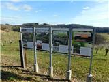 7
7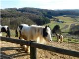 8
8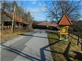 9
9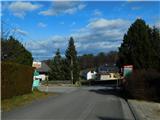 10
10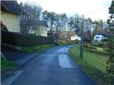 11
11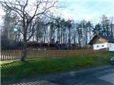 12
12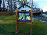 13
13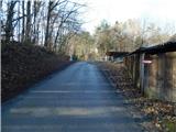 14
14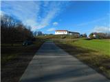 15
15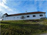 16
16