Dol pri Hrastniku - Klobuk
Starting point: Dol pri Hrastniku (313 m)
| Latitude/Longitude: | 46,14112°N 15,11592°E |
| |
Walking time: 2 h 10 min
Difficulty: easy marked way
Elevation gain: 577 m
Elevation difference along the route: 595 m
Map:
Recommended equipment (summer):
Recommended equipment (winter): ice axe, crampons
Views: 274
 | 1 person like this post |
Access to starting point:
From the road Hrastnik - Rimske Toplice we drive to the center of the settlement Dol pri Hrastniku, where by the parish church of St. Jakob and the NOB monument the described path begins. We park at one of the parking lots in the center of the settlement, or we can also park at a slightly larger parking lot by the cemetery, which is less than five minutes from the start of the described path.
Route description:
From the starting point, we head north, following signs for Kal (a path south leads to Gore), and bypass the church on the right side. We initially walk on a sidewalk along the road Trg borcev NOB, and later along Partizanska cesta. At the company Spectra 9 d.o.o., the sidewalk ends, and shortly after, we reach the path Srečno. We generally do not follow the signs for this path, as our route and the path Srečno coincide only briefly.
A little further, at the memorial of Slovenia’s independence, we turn right onto a side road, then follow Knafelc blazes (the path Srečno veers slightly more to the right here), ascending past individual houses. After the last house, we transition to a steep cart track that leads into the forest. In the forest, we turn right from the cart track onto a footpath that ascends quite steeply, and higher up, slightly bypasses a nearby homestead to the right. Upon leaving the forest, we cross an asphalt road leading toward the settlement Krištandol (turning left downhill allows a return to the starting point), then diagonally ascend a grassy slope, from which a first view opens toward Kum, the highest peak of Posavsko hribovje. When we re-enter the forest, we gradually move onto steeper slopes, ascending diagonally, requiring extra caution, especially in wet conditions. The steepness of the slope soon eases, but the path remains quite steep. Higher up, we reach a road leading toward the cottage Planinski dom na Kalu, the ski slope Rajska dolina, and some hamlets (here, too, turning left downhill allows a return to the starting point or to Hrastnik).
The path continues along an asphalt road, mostly ascending moderately. At the second left turn, a marked path from the settlement Marno joins from the right, passing through Krištandol (with signs for Gore and Kopitnik).
A little further, the road flattens and leads to a junction at a small saddle, where an NOB monument is located.
Here, we continue straight toward Kal and Mrzlica (left to Hrastnik via Blate, right to Ostri vrh, Baba, and Zavrate), descending lightly on the asphalt road at first, then ascending again after a chapel. At a nearby house, there is an inscription box for the NOB path. We continue along the road, which first turns right, then follows a long, scenic left turn. We proceed along the marked road, which has several crossroads, and after a stretch of forest, we arrive at the ski slope Rajska dolina. We cross the ski slope (while the ski slope is operating, passage is forbidden and dangerous; passage through the tunnel is also dangerous), and after the next NOB memorial, we reach a marked crossing.
We continue left in the direction of Hrastnik over Klobuk (straight to Hrastnik over Ravne, slightly right to Kal and Mrzlica) on a path that ascends for some time alongside the ski track, then turns right into the forest, where it mostly ascends diagonally. Higher up, the path flattens for a short time, then ascends more steeply and after a few minutes of further walking brings us to the scenic peak.
Dol pri Hrastniku - Mali Kal 1:10, Mali Kal - Klobuk 1:00.

Along the route: Mali Kal (760m)
Photos:
 1
1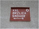 2
2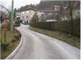 3
3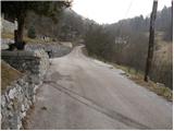 4
4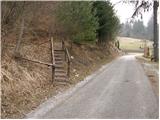 5
5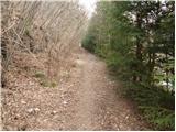 6
6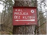 7
7 8
8 9
9 10
10 11
11 12
12 13
13 14
14 15
15 16
16 17
17 18
18 19
19 20
20 21
21 22
22 23
23 24
24 25
25 26
26 27
27 28
28 29
29 30
30 31
31 32
32 33
33 34
34 35
35 36
36 37
37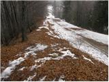 38
38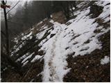 39
39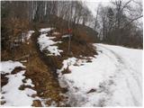 40
40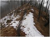 41
41 42
42
Discussion about the trip Dol pri Hrastniku - Klobuk
To post a comment you must log in:
If you do not yet have a username, you must first
register.