Dom v Kamniški Bistrici - Kamniški Dedec
Starting point: Dom v Kamniški Bistrici (601 m)
Starting point Lat/Lon: 46.3271°N 14.5893°E 
Time of walking: 2 h 45 min
Difficulty: partly demanding unmarked way
Difficulty of skiing: very demanding
Altitude difference: 982 m
Altitude difference (by path): 1000 m
Map: Kamniške in Savinjske Alpe 1:50.000
Access to starting point:
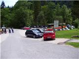
We drive to Kamnik and follow the road ahead towards the valley Kamniška Bistrica, where we park on a large parking lot near the mountain hut Dom v Kamniški Bistrici.
Path description:
From the parking lot in front of the mountain hut Dom v Kamniški Bistrici we continue on at first still asphalt road which after a short ascent quickly brings us into the forest. After few minutes of walking a signpost for saddle Kamniško sedlo point us to the right on a steep footpath which a little higher brings us to an interesting passage below an overhang cliffs. Still steep path then brings us to the bottom station of a cargo cableway, where we step on the road. We continue left and then already after few steps sharply right. Relatively steep forest path higher brings us to a cart track which we follow few ten meters to the right, and then blazes point us to the left, where after a steep initial ascent steepness decreases. Further, in a gentle diagonal ascent we cross relatively steep slopes, after which from the left path from higher starting point (Jermanca) joins.
Further, we need to pay attention, because the path we will soon brings us to the spot named V Klinu, where we leave the marked path which leads towards the saddle Kamniško sedlo (to here approx 1.5h). Here we continue right (straight Kamniško sedlo 2 hours - signpost) on an unmarked path which leads in Repov kot. We follow the mentioned path only about 100 meters.
When the path gets close to a riverbed of the stream (Sedelšček) we need to pay attention to sand landslip on the opposite side. There we cross a riverbed and on our right we find beaten footpath which starts rising in zig-zags on a steep forest terrain. We follow hunting footpath about 20 min. When we come to a crossing, we turn right and after few meters we are at the hunting cottage.
Behind the hunting cottage we turn left and then straight upwards. The path is steeply winding in zig-zags through the forest, until it flattens. We are on the ridge of Črni vrh. Ridge path brings us below a rocky wall of Kamniški Dedec. The path is winding among rocks and in few minutes we are on the summit.
The peak which has an inscription box is very panoramic on all sides: from Planjava, Brana, Krvavec, Vel. Planina, Zeleniške špice, itd.
Pictures:
 1
1 2
2 3
3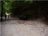 4
4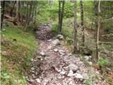 5
5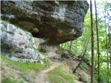 6
6 7
7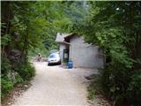 8
8 9
9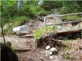 10
10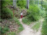 11
11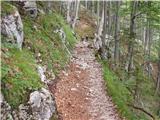 12
12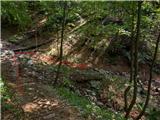 13
13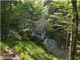 14
14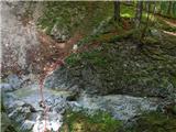 15
15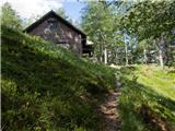 16
16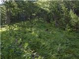 17
17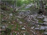 18
18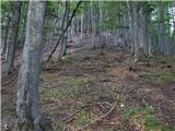 19
19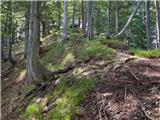 20
20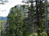 21
21