Dom v Kamniški Bistrici - Kamniški Dedec
Starting point: Dom v Kamniški Bistrici (601 m)
| Latitude/Longitude: | 46,32710°N 14,58930°E |
| |
Walking time: 2 h 45 min
Difficulty: partly demanding unmarked way
Elevation gain: 982 m
Elevation difference along the route: 1000 m
Map: Kamniške in Savinjske Alpe 1:50.000
Recommended equipment (summer):
Recommended equipment (winter): ice axe, crampons
Views: 63.644
 | 7 people like this post |
Access to starting point:
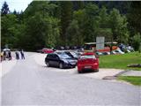
We drive to Kamnik and follow the road ahead towards the Kamniška Bistrica valley, where we park on the large parking lot near the mountain hut Dom v Kamniški Bistrici.
Route description:
From the parking lot in front of the mountain hut Dom v Kamniški Bistrici we continue on the initially still asphalted road, which after a short ascent quickly brings us into the forest. After a few minutes of walking the mountain signs for Kamniško sedlo direct us to the right onto a steep footpath, which a little higher brings us to an interesting passage below overhanging cliffs. The still steep path then brings us to the bottom station of the cargo cableway, where we step onto the road. We continue left and then already after a few steps sharply right. The relatively steep forest path brings us higher to a cart track, which we follow a few tens of meters to the right, then the blazes direct us to the left, where after a steep initial ascent the steepness decreases. Further in a gentle traverse ascent we cross relatively steep slopes, after which from the left the path from the higher starting point (Jermanca) joins us. There follows a few more minutes of walking and the path brings us to the junction V Klinu. The marked path towards Kamniško sedlo here turns left upwards (there are also signposts along the path), but we continue slightly right onto an unmarked path. At the beginning of this path there is a large sign »Pot ne vodi na K. sedlo«.
We continue in the direction of the path that does not lead to Kamniško sedlo; it soon turns left and brings us to the next, this time completely unmarked junction. Here we notice a few smaller cairns that direct us slightly right to the bed of the nearby torrent stream. We descend to the mentioned torrent and on the other side at the landslip we search for the start of the path, which continues right through the forest. The path ahead crosses a short exposed slope, then it starts to ascend in zigzags through the forest. Higher a transverse path branches off to the left, by which we can reach Repov kot, but we continue right on the still steep path, by which we quickly arrive at the nearby hunting cottage, from which a nice view opens onto Brana and Kamniško sedlo.
Behind the hunting cottage we continue on the well-visible and gradually steeper path, which ascends towards the south. Higher the path temporarily becomes less steep, then it turns slightly to the left, where it starts to ascend very steeply (especially when wet there is a great risk of slipping). The steepness then starts to decrease and the path, which still runs through the forest, brings us to the ridge of Črni vrh, where it turns left and flattens even more. A short descent follows, then the occasionally poorly visible path continues along the forest-covered ridge. After a few minutes of easy walking, the path starts to ascend more steeply again; it temporarily leaves the ridge to the right onto steep and slippery-dangerous slopes. After a shorter steep ascent we return to the ridge, which from here on is less vegetated and consequently more and more scenic. A moderate ascent follows along the mentioned ridge to the nearby rocky jump, where we can leave our poles if we have them with us, of course. The path ahead steeply ascends a narrow gully and just a few meters higher turns left, bringing us to the exposed slope surrounded by dwarf pines. With some hand assistance we ascend over the mentioned slope, which ends on the precipitous and panoramic summit.

Photos:
 1
1 2
2 3
3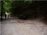 4
4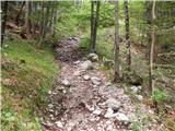 5
5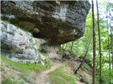 6
6 7
7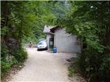 8
8 9
9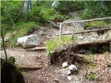 10
10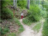 11
11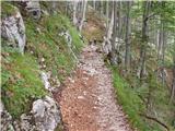 12
12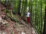 13
13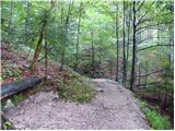 14
14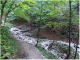 15
15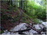 16
16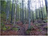 17
17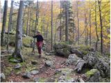 18
18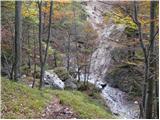 19
19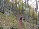 20
20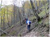 21
21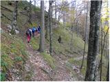 22
22 23
23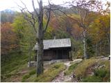 24
24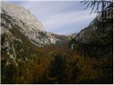 25
25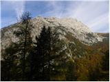 26
26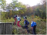 27
27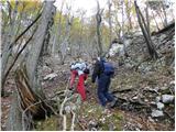 28
28 29
29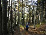 30
30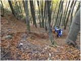 31
31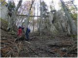 32
32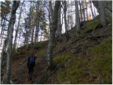 33
33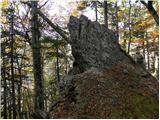 34
34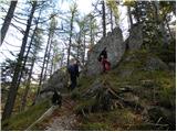 35
35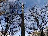 36
36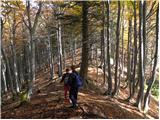 37
37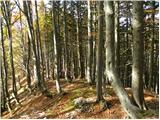 38
38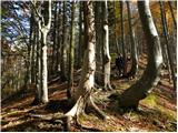 39
39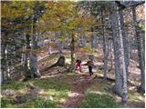 40
40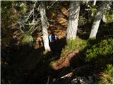 41
41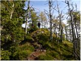 42
42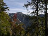 43
43 44
44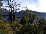 45
45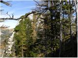 46
46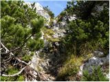 47
47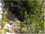 48
48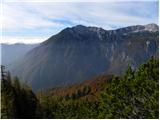 49
49 50
50 51
51 52
52
Discussion about the trip Dom v Kamniški Bistrici - Kamniški Dedec
|
| klavdipo13. 10. 2010 |
Is there a stamp on this summit too?
|
|
|
|
| Jany13. 10. 2010 |
Now I will decide more easily for the ascent. Nicely described and pictured. I always look at it when I go to the saddle.
|
|
|
|
| AnzeKozjek16. 05. 2013 |
Is the trail now good for ascent at this time? Thanks! Best regards
|
|
|
|
| _sandra_16. 05. 2013 |
Why wouldn't it be? 
|
|
|
|
| Janez Seliškar16. 05. 2013 |
The trail is always good for ascent. You just need to have equipment suitable for current conditions with you and use it as needed.
|
|
|
|
| tinky16. 05. 2013 |
Be careful not to miss the crossing in picture no. 19.
|
|
|
|
| AnzeKozjek17. 05. 2013 |
And what are the conditions now? If I'm not mistaken, the path goes more from the north side... is there possibly still some snow there above 1000m? Thanks!
Best regards =D
|
|
|
|
| Moyca17. 05. 2013 |
I was there on May 1st. No snow except some patches, which is not worth mentioning. Conditions were great. Žiga wasn't there, but there were two logbooks.
|
|
|
|
| Daaam18. 05. 2013 |
I can also confirm Sandra. I was up there today. Wonderful path, only above l.k you have to bite into the slope a bit I recommend!
|
|
|
|
| borutpovse29. 10. 2013 |
No water there anymore, shame, but wonderful view in good weather.
|
|
|
|
| strelec195410. 07. 2014 |
Probably the junction to Staničev vrh ?
|
|
|
|
| tinky10. 07. 2014 |
I hiked there once, and if memory serves me right, you end up back in Repov kot.
|
|
|
|
| franca10. 07. 2014 |
Yes, it leads to the gully, crosses it and joins the one that leads to Repov kot.
|
|
|
|
| B.Smart19. 09. 2014 |
On Wednesday I walked the path with a colleague and I must say the summit really fascinated me. Beautiful views worth all the steep sections overcome on the path. However, you need to be very careful at the junction between pictures 17 and 19. If you are even slightly less attentive, you will definitely miss the junction, as the cairns are placed only on a rock 10m to the right of the incoming path. We placed another one right at the path junction. On the way back we explored that left junction below the hunting hut and indeed reached the path to Repov kot. In between we also found some lingonberries In short, a beautiful trip and I highly recommend it.
|
|
|
|
| 75'er6. 10. 2014 |
Whoever uses Garmin, I warn that in AdriaTopo PRO and AdriaTopo XL maps Kamniški Dedec is incorrectly marked (shifted northeast to an unnamed peak between Kamniški Dedec and Staničev vrh). The correct position is at the Črni vrh marker, Črni vrh is west of the marked point.
|
|
|
|
| fpetel14. 11. 2016 |
We leave the path towards Kamniško sedlo at the spot where it briefly turns left at the sign Kamniško sedlo 2h. We go slightly right on an unmarked path and after about 200 meters continue on the right path across Sedelček - the left one goes through Repov kot valley. On the other side we immediately see a good hunting trail - before the hut, the path to the hut branches off. From the hut there is a super view and location. Behind the hut the steeper part begins.
|
|
|
|
| Enka17. 05. 2017 |
The logs "Path does not lead to K. Sedlo" at the V Klin junction are no longer there, so don't rely on them. Currently the path is quite trodden and can be followed, at junctions follow the instructions from the description and there shouldn't be problems. Otherwise it's quite knee-gripping with a slight touch of adrenaline towards the top. In dry conditions super ferrata, in wet I wouldn't go up.
|
|
|
|
| tcankar10. 04. 2018 |
Yesterday off-path over Mešenik to Kamniški Dedec. Some scrambling, otherwise pleasant solitude, only a chamois family comes to greet Descent on snow almost directly to the hunting hut. The snow is southern, compacted, unpredictable when running/fast walking downhill, as the leg occasionally sinks past the knee.
Special warning about ticks. I've never seen so many anywhere, in a few steps at least five were crawling on my legs - up to about 1000m. Given the high infection rate of ticks in this area with the meningitis virus, I recommend caution.
|
|
|
|
| iUnknown2. 05. 2018 |
How about access to the last 10 meters of elevation?
I've flown there a few times with a helicopter for remote guidance from the path to Srebrno sedlo and that rock - Kamniški Dedec - seemed quite inaccessible to me. Is there some rope there or did it just seem to me from the air that it's probably quite a climb?
|
|
|
|
| pohodnik384. 05. 2018 |
The last couple of meters are a bit steeper, you hold on to some roots or branches of scrub and you're up in a few steps 
|
|
|
|
| anak8. 12. 2018 |
Today after morning rain it was clear above Sedlo, but Dedec was barely peeking out of the sea of fog...
|
|
|
|
| klm25. 04. 2020 |
On Thursday 23.4.2020 at 16:13, my colleague Sebastjan Z. and I started from the bus stop before the turnoff to Jurj on Kamniški Dešec. At a conversational pace we ascended for 1.10h. At the top we met only a 4-member family who by accent wasn't from the Kamnik municipality (which of course doesn't bother me).
We descended also at a conversational pace, but at the lower station of the freight cableway we turned right off the established path and continued along the delivery track to the starting point. The entire tour took 2h. Views were nice, temperature optimal. That the not quite optimally cooled beer "fit like dad on mom" goes without saying.
|
|
|
|
| fpetel125. 04. 2020 |
What conversational times. From Jermanca it takes an hour fifteen, from K. Bistrica you have to run for something like that. 950 m ascent. Otherwise nice.
|
|
|
|
| CarpeDiem2478. 03. 2021 |
Hello! How is the snow in the summit area these days, if anyone has gone up there, please report!
|
|
|
|
| Bandzo8. 03. 2021 |
As much as I could see from the path to Kamniško sedlo, there is little snow, but the shady side is quite icy, so extreme caution to the summit section. Some snow was visible even there (see forum Kamniško sedlo).
Best,
Ben
|
|
|
|
| _Maša29. 04. 2021 08:48:01 |
Has anyone been to Dedec this week? What are the conditions towards the top? Lp
|
|
|
|
| bposl9. 04. 2021 16:31:26 |
From the hunting hut to the ridge there is snow. Possible without crampons, just slower, downhill is trickier. Otherwise bp, even at the top. Nice
|
|
|
|
| smatjaz18. 04. 2021 16:36:26 |
Was there this morning, from the hunting hut snow that has turned into ice, footprints are there, up it somehow went, down though mandatory at least crampons, also put on helmet due to risk of fall, below the hunting hut already southern exposure.
|
|
|
|
| ZorkoMojca23. 06. 2023 23:05:06 |
Was there yesterday, no snow left on the path.
|
|
|
|
| jasnicaž7. 04. 2025 21:43:34 |
plaNinaPirsMajcen, really wonderful video, I enjoyed watching it, thank you
|
|
|
|
| dleskovec8. 04. 2025 12:30:25 |
Beautifully done and interesting: and the "cute actress" added the icing on the cake. I wish you many more beautiful shots!!
|
|
|
|
| plaNinaPirsMajcen8. 04. 2025 13:50:43 |
dleskovec, thank you very much for the praise! The only actress in the video is me 😃 or rather the roe deer in one frame 😃
|
|
|
|
| Hribolazec819. 05. 2025 11:48:34 |
How is parking now in Kamniška Bistrica?
|
|
|
|
| Nehodimvhribe9. 05. 2025 12:23:44 |
You arrive and park
- In front of the hut there's parking
- For Kamniško sedlo there's parking (150m from the hut)
- for Kokrško sedlo there's parking (in Konc)
- at Jermanci I don't know, I've never been, but I know it's "open"
All free and no prohibitions
|
|
|
|
| asdf9. 05. 2025 17:45:20 |
At Jermanci driving is allowed to the bend at about 940 m altitude. There is a small parking lot for about five cars, more space by the meadow a bit lower. The quality of the road to Jermanc varies quite a bit (sometimes really bad). Last week it was relatively good.
|
|
|
To post a comment you must log in:
If you do not yet have a username, you must first
register.