Dom v Tamarju - Kotovo sedlo (via bivak)
Starting point: Dom v Tamarju (1108 m)
Starting point Lat/Lon: 46.476°N 13.7241°E 
Path name: via bivak
Time of walking: 3 h 15 min
Difficulty: partly demanding marked way
Difficulty of skiing: demanding
Altitude difference: 1026 m
Altitude difference (by path): 1026 m
Map: Kranjska Gora 1:30.000
Access to starting point:
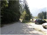
At first, we drive to Kranjska Gora, and then we continue driving towards Rateče. At the crossroad, where a road towards Rateče branches off to the right, straight the road continues towards Italy, we turn left in the direction of Planica. After a short ascent, we get to ski jumping hills in Planica, where there are some large parking lots.
Since the road towards Dom v Tamarju is closed for public traffic we have to park already in Planica, this extends the path for approximately 45 minutes.
Path description:
First, we walk to Dom v Tamarju, and from there we continue on a marked mountain path in the direction of Jalovec and Ponce (left Slemenova špica). The path ahead leads us through the forest, which quickly brings us to the next crossing, where the path on Ponce branches off to the right. We continue in the direction of Jalovec and we continue the ascent on the path which is for a short time still ascending gently through the forest. When we come out of the forest at first for some time we are ascending on extensive partly already overgrown gravel terrain, and then we gradually get on the scree, which continues towards Jalovec couloir. On the scree we ascend to a marked crossing, where we continue right in the direction of Jalovec (straight Jalovška škrbina and the path on Jalovec, which leads through the scree on a saddle Kotovo sedlo.
From the crossing ahead, the path passes on steep slopes, on which it starts ascending. Further, the path leads us through some little harder sections, where we have fixed safety gear for help. Higher, the path turns to the left and gradually flattens. The path ahead continues by a lane of dwarf pines, and we on the right side, about 100 meters away from the marked path we notice a bivouac below Kotovo sedlo, which is located below a bigger boulder (in fog we will hardly notice where the bivouac is located).
We continue on a moderately steep slope, on which we notice a large number of boulders and big rocks. Here from the left joins also the already mentioned path which runs on the scree, and we continue straight and after few minutes of additional ascent, we get to a saddle Kotovo sedlo.
Pictures:
 1
1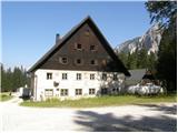 2
2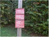 3
3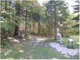 4
4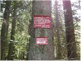 5
5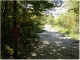 6
6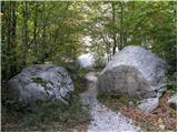 7
7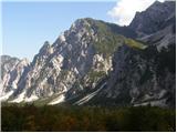 8
8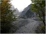 9
9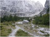 10
10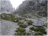 11
11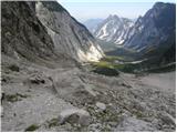 12
12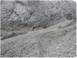 13
13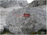 14
14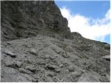 15
15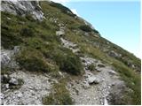 16
16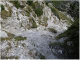 17
17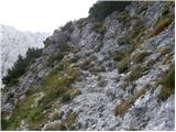 18
18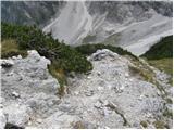 19
19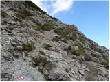 20
20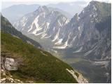 21
21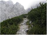 22
22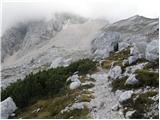 23
23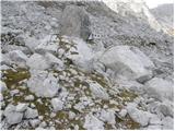 24
24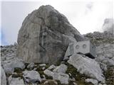 25
25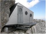 26
26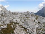 27
27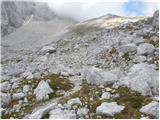 28
28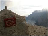 29
29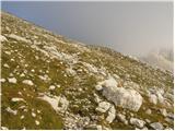 30
30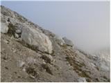 31
31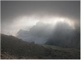 32
32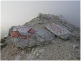 33
33